| Mesoscale Discussion 1102 | |
| < Previous MD | |

|
|
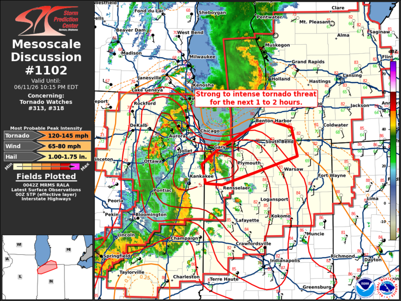
Mesoscale Discussion 1102 NWS Storm Prediction Center Norman OK 0744 PM CDT Thu Jun 11 2026 Areas affected...northwest Indiana Concerning...Tornado Watch 313...318... Valid 120044Z - 120215Z The severe weather threat for Tornado Watch 313, 318 continues. SUMMARY...A strong to intense tornado threat will exist for the next 1 to 2 hours. DISCUSSION...A cluster of supercells across northwest Indiana has a history of tornadoes including a likely strong tornado across Lake County within the past 15 minutes. The southernmost storm in this cluster across northern Newton County is exhibiting broad, strong rotation and is in a similarly favorable tornado environment featuring STP around 5. This supercell is expected to remain discrete/undisturbed and will likely pose a strong to potentially intense tornado threat across southern Porter, Laporte, and potentially St. Joseph county for the next 1 to 2 hours. ..Bentley.. 06/12/2026 ...Please see www.spc.noaa.gov for graphic product... ATTN...WFO...IWX...GRR...LOT... LAT...LON 41378757 41608723 41968653 42088615 41958565 41498554 41228647 41048715 41058749 41378757 MOST PROBABLE PEAK TORNADO INTENSITY...120-145 MPH MOST PROBABLE PEAK WIND GUST...65-80 MPH MOST PROBABLE PEAK HAIL SIZE...1.00-1.75 IN |
|
|
Top/All Mesoscale Discussions/Forecast Products/Home |
|
Source link