| Mesoscale Discussion 1063 | |
| < Previous MD | |

|
|
Mesoscale Discussion 1063
NWS Storm Prediction Center Norman OK
0743 AM CDT Wed Jun 10 2026
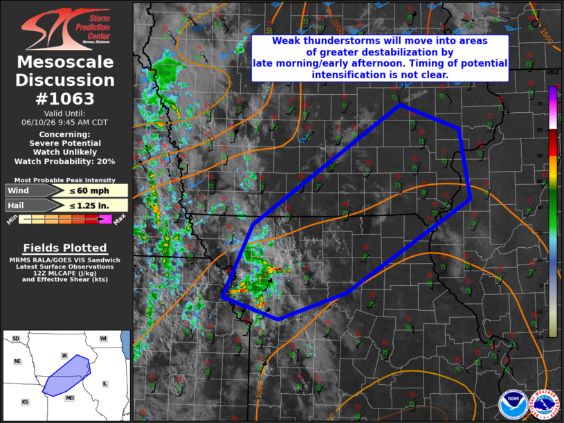
Areas affected...Northern Missouri into southeast Iowa
Concerning...Severe potential...Watch unlikely
Valid 101243Z - 101445Z
Probability of Watch Issuance...20 percent
SUMMARY...Weak convection will move into an increasingly unstable
environment by late morning/early afternoon. This activity will need
to be monitored. A watch is not likely in the near term, however.
DISCUSSION...Water vapor imagery shows a shortwave trough in the
lower Missouri Valley with additional lift provided by a weak MCV in
eastern Kansas. Weak convection has developed in response to these
features this morning. While this activity is expected to remain
weak in the short term, recent runs of the HRRR appear to capture
this weak cluster and intensify it sometime by late this morning
into early afternoon. Observational trends will need to be monitored
over the coming hours. A watch is not likely in the near term.
..Wendt/Guyer.. 06/10/2026
...Please see www.spc.noaa.gov for graphic product...
ATTN...WFO...LSX...DVN...DMX...EAX...
LAT...LON 39489509 40469459 42079199 41749095 40809078 39569294
39199413 39489509
MOST PROBABLE PEAK WIND GUST...UP TO 60 MPH
MOST PROBABLE PEAK HAIL SIZE...UP TO 1.25 IN
|
|
|
Top/All Mesoscale Discussions/Forecast Products/Home |
|
Source link