|
|
| Mesoscale Discussion 1063 | |
| < Previous MD | |

|
|
   Mesoscale Discussion 1063
   NWS Storm Prediction Center Norman OK
   0114 AM CDT Wed May 29 2024

   Areas affected...TX South Plains

   Concerning...Severe potential...Watch unlikely

   Valid 290614Z - 290745Z

   Probability of Watch Issuance...5 percent

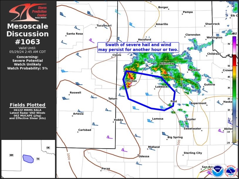
   SUMMARY...A narrow swath of severe hail and wind may persist through
   about 3 AM CDT before likely weakening. A watch is not expected.

   DISCUSSION...Long-lived supercell that produced multiple golf-ball
   size hail reports in the past hour across Roosevelt County, NM has
   evolved into a supercell bowing structure in the South Plains west
   of Lubbock. CAM guidance has handled this particular area of
   convection quite poorly, with successive runs of the HRRR
   initializing and then immediately weakening the cell within the
   first hour. MRMS MESH values have recently diminished to around 2
   inches as the bowing structure evolved which suggests the potential
   for significant severe hail is diminishing. Despite the likely
   elevated character, a swath of severe wind gusts may occur until the
   cell finally subsides, which was recently confirmed by a 62 mph gust
   at the Morton West TX Mesonet site. This appears likely to occur as
   it shifts away from the instability axis over eastern NM and
   relatively weaker deep-layer shear with eastern extent per
   time-series comparison of area VWP data.

   ..Grams/Thompson.. 05/29/2024

   ...Please see www.spc.noaa.gov for graphic product...

   ATTN...WFO...LUB...

   LAT...LON   34030273 33960224 33870165 33490122 33120127 33010155
               33060196 33310266 33820284 34030273
|
|
|
Top/All Mesoscale Discussions/Forecast Products/Home |
|


