| Mesoscale Discussion 313 | |
| < Previous MD | |
|
|
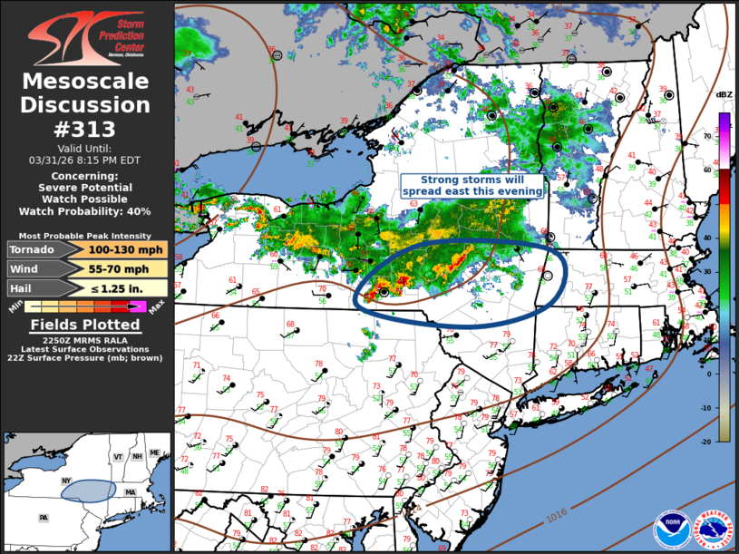
Mesoscale Discussion 0313 NWS Storm Prediction Center Norman OK 0552 PM CDT Tue Mar 31 2026 Areas affected...Southern New York into western Connecticut Concerning...Severe potential...Watch possible Valid 312252Z - 010015Z Probability of Watch Issuance...40 percent SUMMARY...Strong-severe thunderstorms will spread across the Hudson Valley into western Connecticut this evening. Severe thunderstorm watch is being considered. DISCUSSION...An elongated MCS has matured across portions of Upstate NY early this evening. Leading edge of this activity is spreading east and will soon advance across the Hudson Valley, aided in part by an expanding precip shield. While the downstream air mass is not particularly unstable, strong westerly flow will contribute to this MCS spreading toward western CT. Severe thunderstorm watch may be warranted downstream. ..Darrow/Guyer.. 03/31/2026 ...Please see www.spc.noaa.gov for graphic product... ATTN...WFO...ALY...BGM... LAT...LON 42807539 42737320 42087322 41797459 42077643 42807539 MOST PROBABLE PEAK TORNADO INTENSITY...100-130 MPH MOST PROBABLE PEAK WIND GUST...55-70 MPH MOST PROBABLE PEAK HAIL SIZE...UP TO 1.25 IN |
|
|
Top/All Mesoscale Discussions/Forecast Products/Home |
|
Source link