| Mesoscale Discussion 24 | |
| < Previous MD | |

|
|
Mesoscale Discussion 0024
NWS Storm Prediction Center Norman OK
1000 AM CST Sat Jan 17 2026
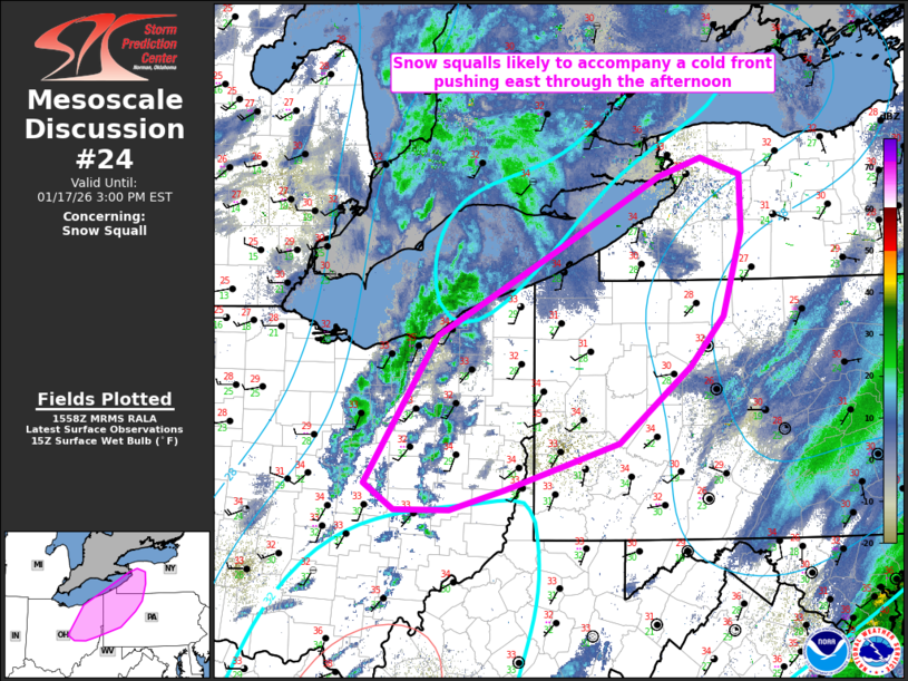
Areas affected...eastern OH and western PA/NY
Concerning...Snow Squall
Valid 171600Z - 172000Z
SUMMARY...Snow squalls are likely to accompany a cold front pushing
east across eastern Ohio into western portions of Pennsylvania and
New York through this afternoon.
DISCUSSION...Low-topped convection has recently increased along a
cold front progressing through north-central/northeast into central
Ohio. Both KLPR and KOSU sampled a visibility reduction to
quarter-mile with gusts of 30 and 31 kts respectively, and KMFD
recently dropped to quarter mile as well. The more organized portion
of the snow squalls will probably be confined closer to Lake Erie,
where stronger low-level convergence is anticipated. Steep low-level
lapse rates along/ahead of the front are the primary driver of a
favorable thermodynamic environment with SPC Mesoscale Analysis
estimates of a 2-4 Snow Squall Parameter. This is expected to shift
east with the front, favoring snow squall production throughout the
afternoon.
..Grams.. 01/17/2026
...Please see www.spc.noaa.gov for graphic product...
ATTN...WFO...BUF...CTP...PBZ...CLE...ILN...
LAT...LON 41518163 42288020 42907905 43077855 42927810 42427808
41677831 41237869 40577952 40168084 39988148 39978212
40218248 41518163
|
|
|
Top/All Mesoscale Discussions/Forecast Products/Home |
|
Source link