

7-Day Forecast — Cape Coral, FL
This Afternoon
83°F
Sunny
Friday
84°F
Sunny
Saturday
84°F
Sunny
Sunday
85°F
Sunny then Isolated Showers And Thunderstorms
Monday
84°F
Sunny
Tuesday
84°F
Sunny
Wednesday
84°F
Sunny then Isolated Rain Showers
Source: National Weather Service (api.weather.gov)
Cape Coral
Oct 22, 2026, 5:43 PM
82°F
Feels like 83°F
Scattered clouds
↑ 83° ↓ 81°
Wind
E 10 mph
Humidity
52%
Dew Point
63°F
Pressure
29.94 inHg
Rainfall
0.00 in
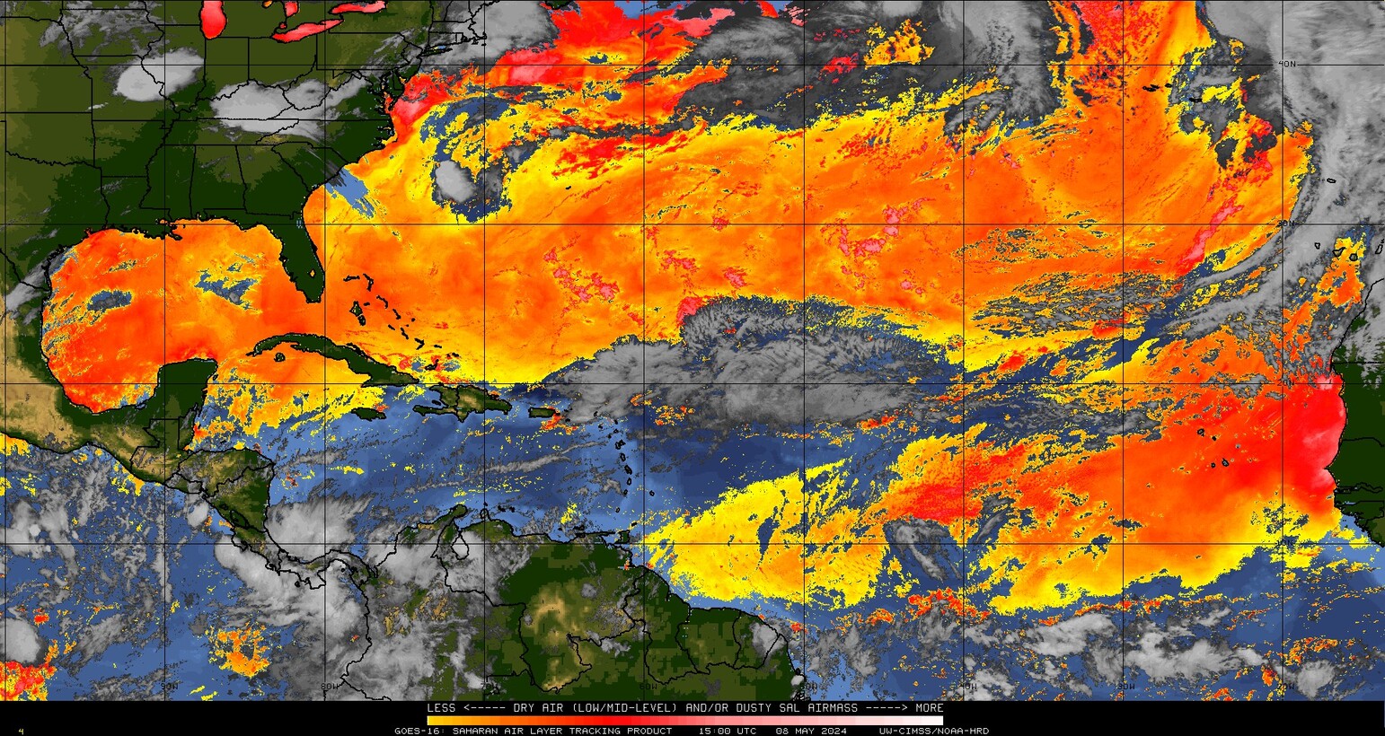
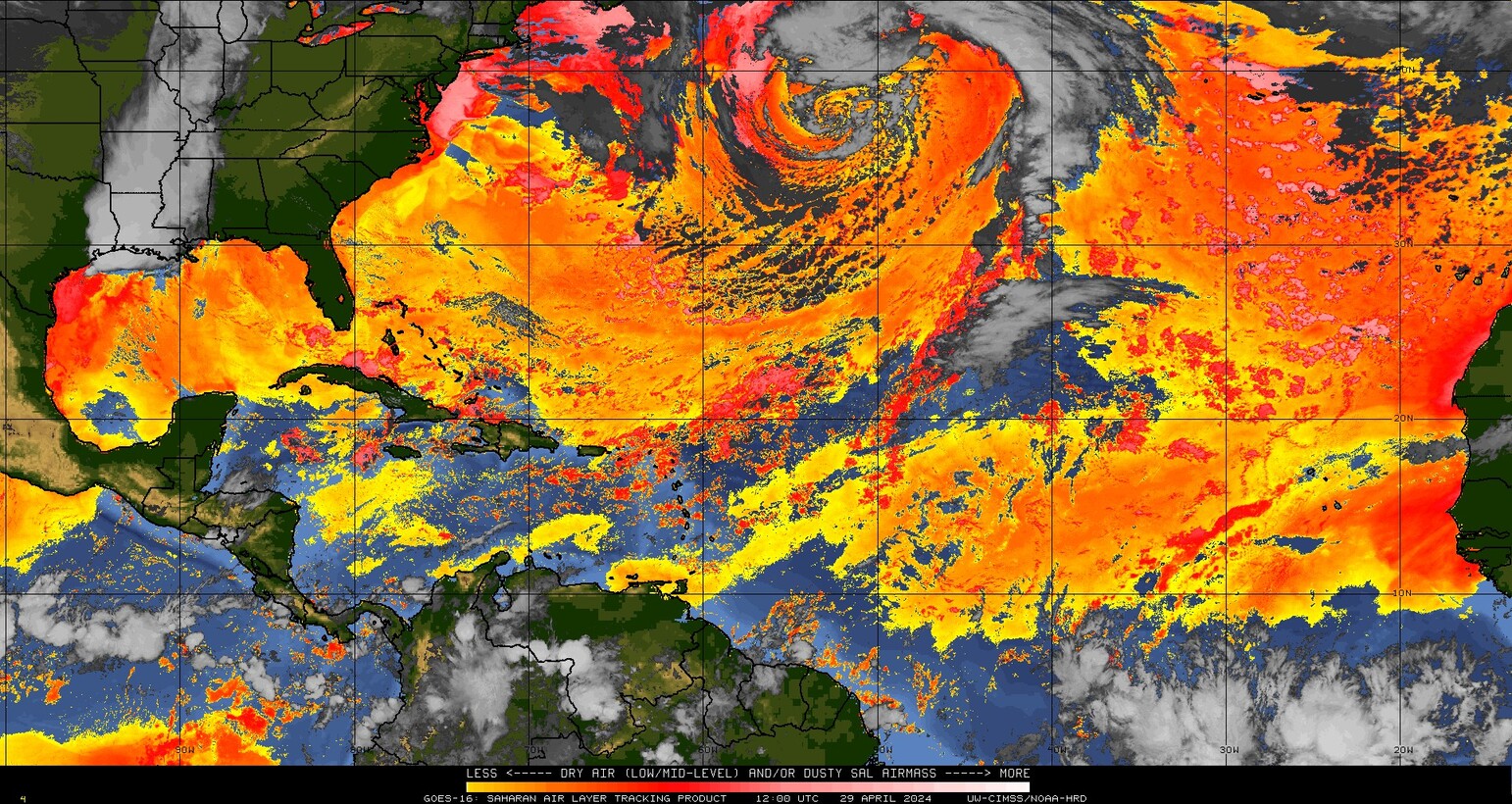

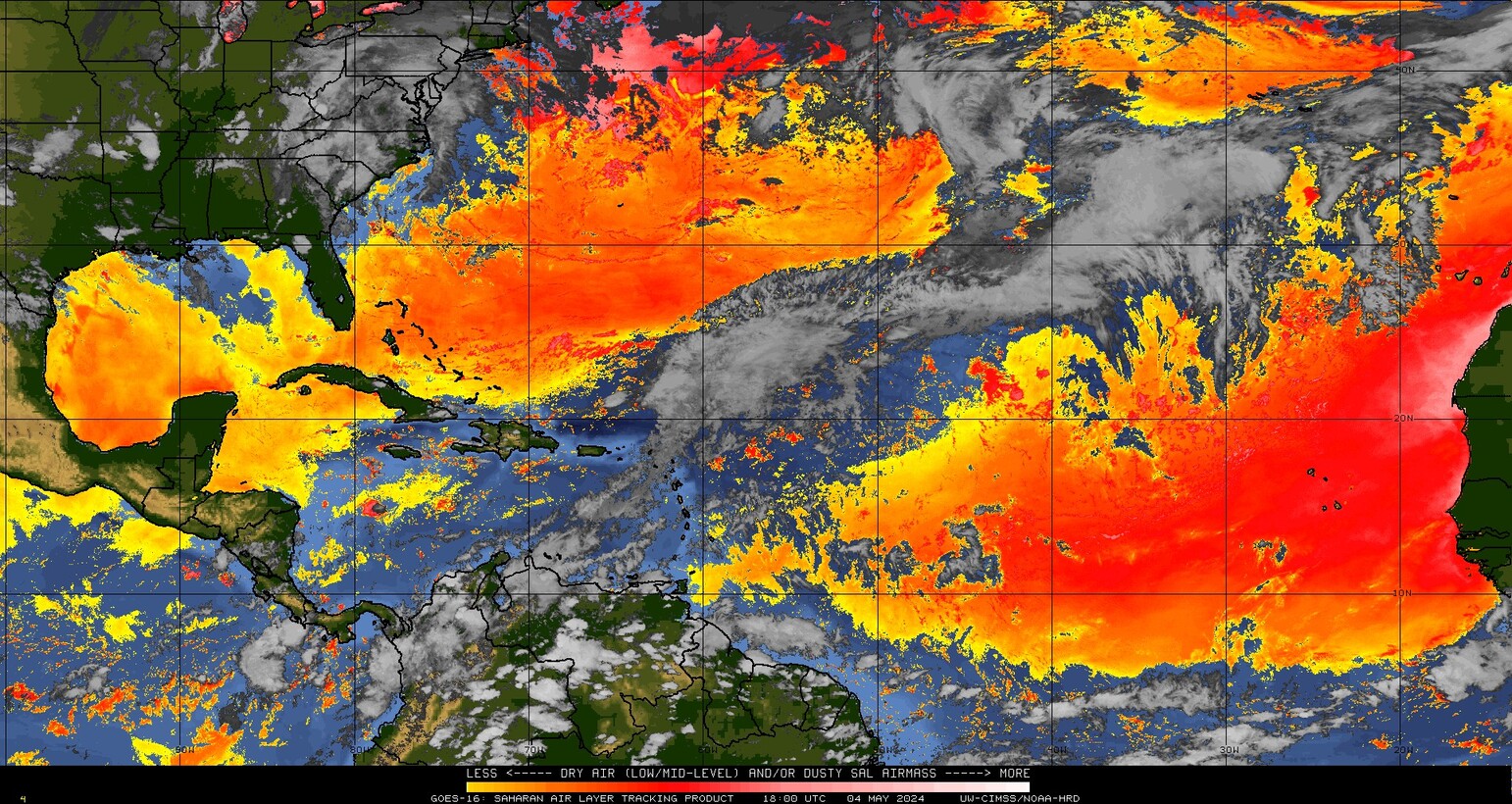
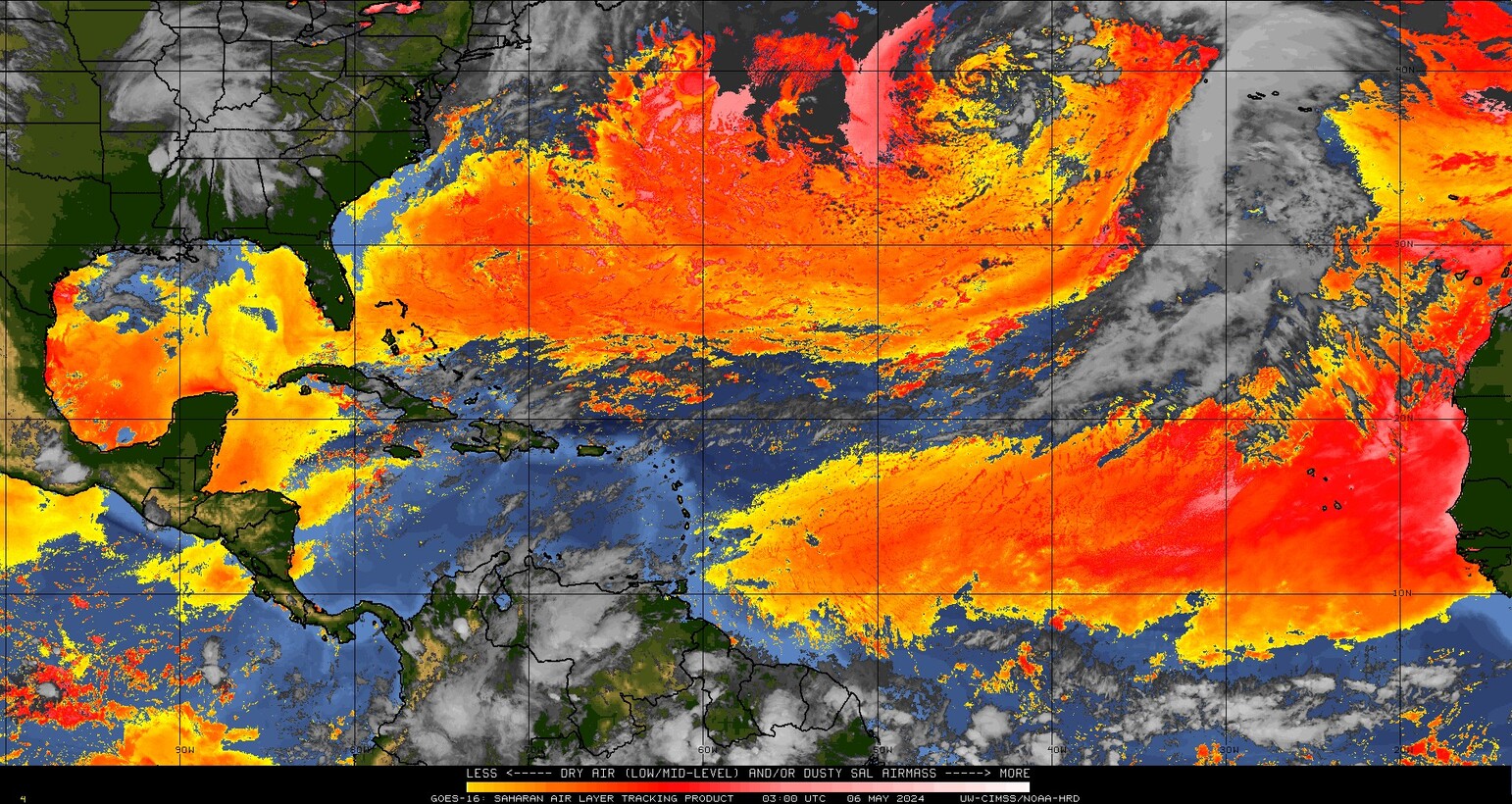
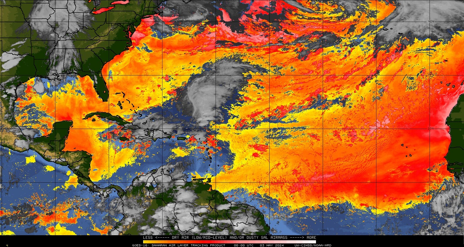

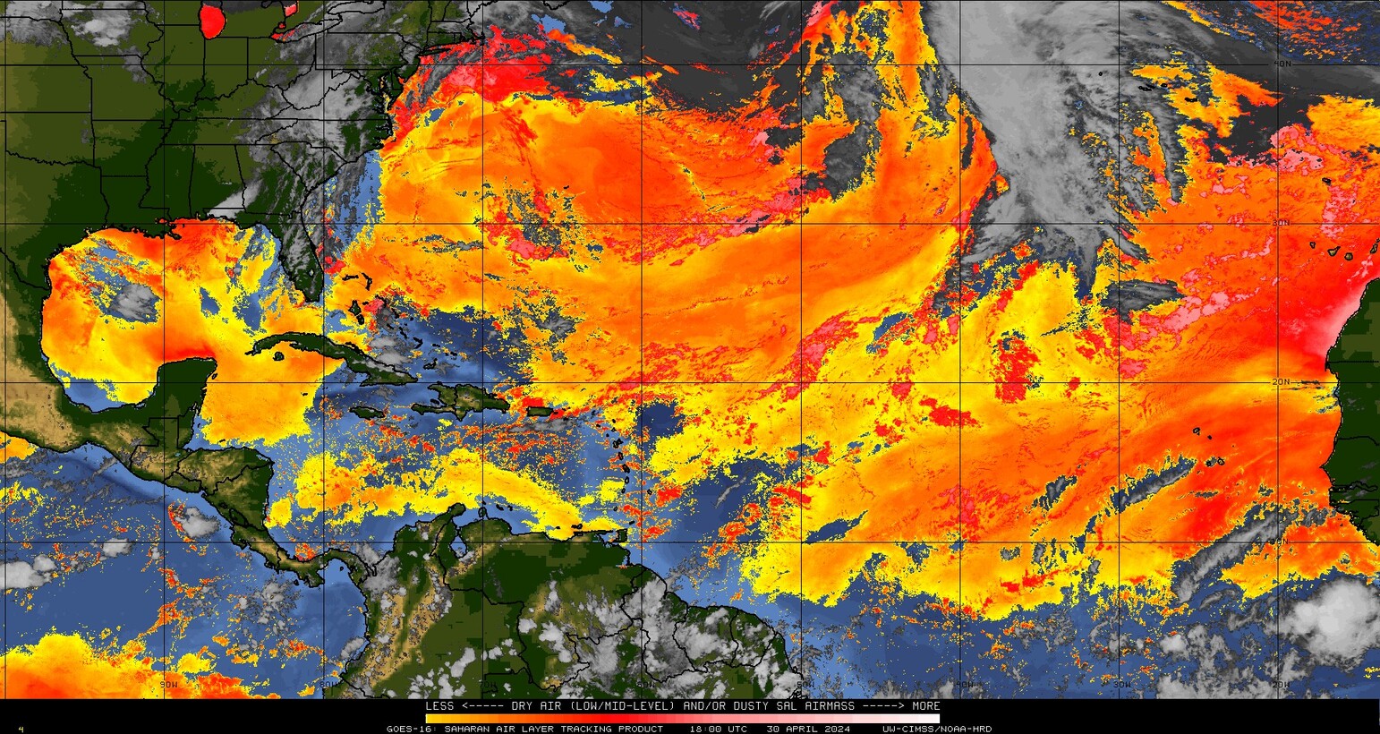
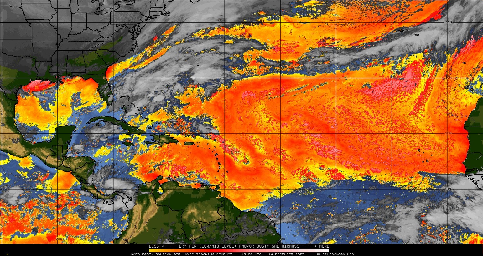
 NHC Atlantic
- Post-Tropical Cyclone Josephine Graphics Thursday, October 22, 2026 at 9:22 pmWind Speed Probabilities last updated Thu, 22 Oct 2026 21:22:57 GMT
- Post-Tropical Cyclone Josephine Forecast Discussion Number 5 Thursday, October 22, 2026 at 8:38 pmIssued at 500 PM AST Thu Oct 22 2026 000 WTNT45 KNHC 222038 TCDAT5 Post-Tropical Cyclone Josephine Discussion Number 5 NWS National Hurricane Center Miami FL AL102026 500 PM AST Thu Oct 22 2026 The convective cloud pattern of Josephine now resembles that of a warm frontal band, with little evidence of tropical-cyclone like curvature. […]
- Post-Tropical Cyclone Josephine Public Advisory Number 5 Thursday, October 22, 2026 at 8:37 pmIssued at 500 PM AST Thu Oct 22 2026 000 WTNT35 KNHC 222037 TCPAT5 BULLETIN Post-Tropical Cyclone Josephine Advisory Number 5 NWS National Hurricane Center Miami FL AL102026 500 PM AST Thu Oct 22 2026 ...JOSEPHINE BECOMES A POWERFUL EXTRATROPICAL LOW... SUMMARY OF 500 PM AST...2100 UTC...INFORMATION ---------------------------------------------- LOCATION...40.0N 65.8W ABOUT 235 MI...380 KM ESE […]
- Summary for Post-Tropical Cyclone Josephine (AT5/AL102026) Thursday, October 22, 2026 at 8:37 pm...JOSEPHINE BECOMES A POWERFUL EXTRATROPICAL LOW... As of 5:00 PM AST Thu Oct 22 the center of Josephine was located near 40.0, -65.8 with movement NE at 17 mph. The minimum central pressure was 988 mb with maximum sustained winds of about 65 mph.
- Post-Tropical Cyclone Josephine Wind Speed Probabilities Number 5 Thursday, October 22, 2026 at 8:37 pmIssued at 2100 UTC THU OCT 22 2026 000 FONT15 KNHC 222037 PWSAT5 POST-TROPICAL CYCLONE JOSEPHINE WIND SPEED PROBABILITIES NUMBER 5 NWS NATIONAL HURRICANE CENTER MIAMI FL AL102026 2100 UTC THU OCT 22 2026 AT 2100Z THE CENTER OF POST-TROPICAL CYCLONE JOSEPHINE WAS LOCATED NEAR LATITUDE 40.0 NORTH...LONGITUDE 65.8 WEST WITH MAXIMUM SUSTAINED WINDS NEAR […]
- Post-Tropical Cyclone Josephine Forecast Advisory Number 5 Thursday, October 22, 2026 at 8:37 pmIssued at 2100 UTC THU OCT 22 2026 000 WTNT25 KNHC 222037 TCMAT5 POST-TROPICAL CYCLONE JOSEPHINE FORECAST/ADVISORY NUMBER 5 NWS NATIONAL HURRICANE CENTER MIAMI FL AL102026 2100 UTC THU OCT 22 2026 POST-TROPICAL CYCLONE CENTER LOCATED NEAR 40.0N 65.8W AT 22/2100Z POSITION ACCURATE WITHIN 30 NM PRESENT MOVEMENT TOWARD THE NORTHEAST OR 55 DEGREES AT […]
- Atlantic Tropical Weather Outlook Thursday, October 22, 2026 at 5:27 pm000ABNT20 KNHC 221727TWOAT Tropical Weather OutlookNWS National Hurricane Center Miami FL200 PM EDT Thu Oct 22 2026For the North Atlantic...Caribbean Sea and the Gulf of America:Active Systems:The National Hurricane Center is issuing advisories on Subtropical Storm Josephine, located a couple hundred miles southeast of Nantucket Island, Massachusetts.Subtropical Central Atlantic:A trough of low pressure located several […]

I am text block. Click edit button to change this text. Lorem ipsum dolor sit amet, consectetur adipiscing elit. Ut elit tellus, luctus nec ullamcorper mattis, pulvinar dapibus leo.
I am text block. Click edit button to change this text. Lorem ipsum dolor sit amet, consectetur adipiscing elit. Ut elit tellus, luctus nec ullamcorper mattis, pulvinar dapibus leo.

000<>Summary for Post-Tropical Cyclone Josephine (AT5/AL102026)
ABNT20 KNHC 221727
TWOAT
Tropical Weather Outlook
NWS National Hurricane Center Miami FL
200 PM EDT Thu Oct 22 2026
For the North Atlantic...Caribbean Sea and the Gulf of America:
Active Systems:
The National Hurricane Center is issuing advisories on Subtropical
Storm Josephine, located a couple hundred miles southeast of
Nantucket Island, Massachusetts.
Subtropical Central Atlantic:
A trough of low pressure located several hundred miles to the
east-southeast of Bermuda is producing a large area of disorganized
showers and thunderstorms. Some development of this system is
possible through Friday while it moves slowly north-northeastward.
Upper-level winds are forecast to become too strong for further
development by the weekend.
* Formation chance through 48 hours...low...10 percent.
* Formation chance through 7 days...low...10 percent.
&&
Public Advisories on Josephine are issued under WMO header WTNT35
KNHC and under AWIPS header MIATCPAT5.
Forecast/Advisories on Josephine are issued under WMO header WTNT25
KNHC and under AWIPS header MIATCMAT5.
$$
Forecaster Beven
...JOSEPHINE BECOMES A POWERFUL EXTRATROPICAL LOW... As of 5:00 PM AST Thu Oct 22 the center of Josephine was located near 40.0, -65.8 with movement NE at 17 mph. The minimum central pressure was 988 mb with maximum sustained winds of about 65 mph.
<>Post-Tropical Cyclone Josephine Public Advisory Number 5Issued at 500 PM AST Thu Oct 22 2026<>Post-Tropical Cyclone Josephine Forecast Advisory Number 5000 WTNT35 KNHC 222037 TCPAT5 BULLETIN Post-Tropical Cyclone Josephine Advisory Number 5 NWS National Hurricane Center Miami FL AL102026 500 PM AST Thu Oct 22 2026 ...JOSEPHINE BECOMES A POWERFUL EXTRATROPICAL LOW... SUMMARY OF 500 PM AST...2100 UTC...INFORMATION ---------------------------------------------- LOCATION...40.0N 65.8W ABOUT 235 MI...380 KM ESE OF NANTUCKET MASSACHUSETTS ABOUT 335 MI...540 KM SSW OF HALIFAX NOVA SCOTIA MAXIMUM SUSTAINED WINDS...65 MPH...100 KM/H PRESENT MOVEMENT...NE OR 55 DEGREES AT 17 MPH...28 KM/H MINIMUM CENTRAL PRESSURE...988 MB...29.18 INCHES WATCHES AND WARNINGS -------------------- There are no coastal watches or warnings in effect. DISCUSSION AND OUTLOOK ---------------------- At 500 PM AST (2100 UTC), the center of Post-Tropical Cyclone Josephine was located near latitude 40.0 North, longitude 65.8 West. The post-tropical cyclone is moving toward the northeast near 17 mph (28 km/h), and this motion is expected to continue with a faster forward speed tonight. A gradual turn toward the east is forecast on Friday and into the weekend. On the forecast track, Josephine should move away from the United States and remain south of Nova Scotia and Newfoundland during the next couple of days. Maximum sustained winds are near 65 mph (100 km/h) with higher gusts. Strengthening is forecast through tonight, and Josephine is expected to become a powerful extratropical cyclone with hurricane-force winds tonight or early Friday. Winds of 40 mph (60 km/h) extend outward up to 415 miles (665 km) from the center. NOAA buoy 44001 located north of the center recently reported sustained winds of 49 mph (79 km/h) and a wind gust of 58 mph (94 km/h). The estimated minimum central pressure is 988 mb (29.18 inches). HAZARDS AFFECTING LAND ---------------------- WIND: Gale-force winds are possible in gusts along portions of the northeastern United States coast through this evening. See products issued by your local National Weather Service office for more details. COASTAL FLOODING: Minor to locally moderate coastal flooding is ongoing along portions of the U.S. Mid-Atlantic coast and will continue through the rest of the week around times of high tide. Please refer to products issued by your local National Weather Service forecast office for more information. SURF: Large swells generated by Josephine are affecting much of the eastern seaboard of the United States and portions of Atlantic Canada. These swells are likely to cause life-threatening surf and rip current conditions. Please consult products from your local weather office. A depiction of rip current risk for the United States can be found at: hurricanes.gov/graphics_at5.shtml?ripCurrents NEXT ADVISORY ------------- This is the last public advisory issued by the National Hurricane Center on this system. Additional information on this system can be found in High Seas Forecasts issued by the National Weather Service, under AWIPS header NFDHSFAT1, WMO header FZNT01 KWBC, and online at ocean.weather.gov/shtml/NFDHSFAT1.php $$ Forecaster Beven
Issued at 2100 UTC THU OCT 22 2026<>Post-Tropical Cyclone Josephine Forecast Discussion Number 5000 WTNT25 KNHC 222037 TCMAT5 POST-TROPICAL CYCLONE JOSEPHINE FORECAST/ADVISORY NUMBER 5 NWS NATIONAL HURRICANE CENTER MIAMI FL AL102026 2100 UTC THU OCT 22 2026 POST-TROPICAL CYCLONE CENTER LOCATED NEAR 40.0N 65.8W AT 22/2100Z POSITION ACCURATE WITHIN 30 NM PRESENT MOVEMENT TOWARD THE NORTHEAST OR 55 DEGREES AT 15 KT ESTIMATED MINIMUM CENTRAL PRESSURE 988 MB MAX SUSTAINED WINDS 55 KT WITH GUSTS TO 65 KT. 50 KT....... 0NE 0SE 100SW 110NW. 34 KT.......360NE 110SE 170SW 240NW. 4 M SEAS....210NE 240SE 540SW 240NW. WINDS AND SEAS VARY GREATLY IN EACH QUADRANT. RADII IN NAUTICAL MILES ARE THE LARGEST RADII EXPECTED ANYWHERE IN THAT QUADRANT. REPEAT...CENTER LOCATED NEAR 40.0N 65.8W AT 22/2100Z AT 22/1800Z CENTER WAS LOCATED NEAR 39.5N 66.8W FORECAST VALID 23/0600Z 41.3N 62.7W...POST-TROP/EXTRATROP MAX WIND 65 KT...GUSTS 80 KT. 64 KT... 0NE 0SE 60SW 60NW. 50 KT... 0NE 60SE 90SW 110NW. 34 KT...360NE 130SE 180SW 240NW. FORECAST VALID 23/1800Z 42.9N 58.6W...POST-TROP/EXTRATROP MAX WIND 60 KT...GUSTS 75 KT. 50 KT... 60NE 60SE 90SW 110NW. 34 KT...390NE 160SE 190SW 240NW. FORECAST VALID 24/0600Z 43.5N 55.9W...POST-TROP/EXTRATROP MAX WIND 55 KT...GUSTS 65 KT. 50 KT... 60NE 60SE 90SW 90NW. 34 KT...320NE 200SE 190SW 240NW. FORECAST VALID 24/1800Z 43.8N 52.6W...POST-TROP/EXTRATROP MAX WIND 50 KT...GUSTS 60 KT. 50 KT... 0NE 60SE 60SW 60NW. 34 KT...240NE 190SE 190SW 220NW. FORECAST VALID 25/0600Z 43.6N 48.0W...POST-TROP/EXTRATROP MAX WIND 45 KT...GUSTS 55 KT. 34 KT...150NE 180SE 180SW 200NW. FORECAST VALID 25/1800Z...DISSIPATED REQUEST FOR 3 HOURLY SHIP REPORTS WITHIN 300 MILES OF 40.0N 65.8W THIS IS THE LAST FORECAST/ADVISORY ISSUED BY THE NATIONAL HURRICANE CENTER ON THIS SYSTEM. ADDITIONAL INFORMATION ON THIS SYSTEM CAN BE FOUND IN HIGH SEAS FORECASTS ISSUED BY THE NATIONAL WEATHER SERVICE...UNDER AWIPS HEADER NFDHSFAT1 AND WMO HEADER FZNT01 KWBC. $$ FORECASTER BEVEN
Issued at 500 PM AST Thu Oct 22 2026<>Post-Tropical Cyclone Josephine Wind Speed Probabilities Number 5000 WTNT45 KNHC 222038 TCDAT5 Post-Tropical Cyclone Josephine Discussion Number 5 NWS National Hurricane Center Miami FL AL102026 500 PM AST Thu Oct 22 2026 The convective cloud pattern of Josephine now resembles that of a warm frontal band, with little evidence of tropical-cyclone like curvature. In addition, the circulation center is becoming elongated and cold-air clouds are increasing in the southern semicircle. Based on these developments and the earlier scatterometer pass showing a developing frontal boundary, Josephine has become an extratropical cyclone. The initial intensity is set at 55 kt, and this could be conservative. The initial motion is now faster toward the northeast or 055/15 kt. Josephine should move generally northeastward with some increase in forward speed tonight, followed by an eastward turn as it becomes well embedded in the mid-latitude westerlies. On the forecast track, the center of Josephine will move away from the New England states this evening and pass south of Nova Scotia and Newfoundland tonight and Saturday. The guidance is again tightly clustered, and the new forecast track is similar to the previous forecast. Josephine is expected to strengthen as an extratropical low tonight due to the influence of an amplifying mid- to upper-level trough over eastern Canada and the New England states, with winds reaching hurricane force. After tonight the global dynamical models are in good agreement that the cyclone should steadily weaken, and they forecast Josephine to dissipate by 72 h as it is absorbed by a new low pressure area developing to its northeast. The new intensity forecast is based mainly on the global models and again has only minor adjustments from the last forecast. The wind radii forecasts have also been revised based on the global model forecasts. This will be the last advisory on Josephine issued by the National Hurricane Center. Additional information on this system can be found in High Seas Forecasts issued by the National Weather Service, under AWIPS header NFDHSFAT1, WMO header FZNT01 KWBC, and online at ocean.weather.gov/shtml/NFDHSFAT1.php Please also see products from local National Weather Service offices and Environment Canada for more information regarding the effects of Josephine in coastal areas. FORECAST POSITIONS AND MAX WINDS INIT 22/2100Z 40.0N 65.8W 55 KT 65 MPH...POST-TROP/EXTRATROP 12H 23/0600Z 41.3N 62.7W 65 KT 75 MPH...POST-TROP/EXTRATROP 24H 23/1800Z 42.9N 58.6W 60 KT 70 MPH...POST-TROP/EXTRATROP 36H 24/0600Z 43.5N 55.9W 55 KT 65 MPH...POST-TROP/EXTRATROP 48H 24/1800Z 43.8N 52.6W 50 KT 60 MPH...POST-TROP/EXTRATROP 60H 25/0600Z 43.6N 48.0W 45 KT 50 MPH...POST-TROP/EXTRATROP 72H 25/1800Z...DISSIPATED $$ Forecaster Beven
Issued at 2100 UTC THU OCT 22 2026 000
FONT15 KNHC 222037
PWSAT5

POST-TROPICAL CYCLONE JOSEPHINE WIND SPEED PROBABILITIES NUMBER   5
NWS NATIONAL HURRICANE CENTER MIAMI FL       AL102026
2100 UTC THU OCT 22 2026

AT 2100Z THE CENTER OF POST-TROPICAL CYCLONE JOSEPHINE WAS LOCATED
NEAR LATITUDE 40.0 NORTH...LONGITUDE 65.8 WEST WITH MAXIMUM
SUSTAINED WINDS NEAR 55 KTS...65 MPH...100 KM/H.

Z INDICATES COORDINATED UNIVERSAL TIME (GREENWICH)
   ATLANTIC STANDARD TIME (AST)...SUBTRACT 4 HOURS FROM Z TIME
   EASTERN  DAYLIGHT TIME (EDT)...SUBTRACT 4 HOURS FROM Z TIME
   CENTRAL  DAYLIGHT TIME (CDT)...SUBTRACT 5 HOURS FROM Z TIME

WIND SPEED PROBABILITY TABLE FOR SPECIFIC LOCATIONS

CHANCES OF SUSTAINED (1-MINUTE AVERAGE) WIND SPEEDS OF AT LEAST
   ...34 KT (39 MPH... 63 KM/H)...
   ...50 KT (58 MPH... 93 KM/H)...
   ...64 KT (74 MPH...119 KM/H)...
FOR LOCATIONS AND TIME PERIODS DURING THE NEXT 5 DAYS

PROBABILITIES FOR LOCATIONS ARE GIVEN AS OP(CP) WHERE
    OP  IS THE PROBABILITY OF THE EVENT BEGINNING DURING
        AN INDIVIDUAL TIME PERIOD (ONSET PROBABILITY)
   (CP) IS THE PROBABILITY OF THE EVENT OCCURRING BETWEEN
        18Z THU AND THE FORECAST HOUR (CUMULATIVE PROBABILITY)

PROBABILITIES ARE GIVEN IN PERCENT
X INDICATES PROBABILITIES LESS THAN 1 PERCENT
PROBABILITIES FOR 34 KT AND 50 KT ARE SHOWN AT A GIVEN LOCATION WHEN
THE 5-DAY CUMULATIVE PROBABILITY IS AT LEAST 3 PERCENT.
PROBABILITIES FOR 34...50...64 KT SHOWN WHEN THE 5-DAY
64-KT CUMULATIVE PROBABILITY IS AT LEAST 1 PERCENT.


  - - - - WIND SPEED PROBABILITIES FOR SELECTED LOCATIONS - - - -

               FROM    FROM    FROM    FROM    FROM    FROM    FROM
  TIME       18Z THU 06Z FRI 18Z FRI 06Z SAT 18Z SAT 18Z SUN 18Z MON
PERIODS         TO      TO      TO      TO      TO      TO      TO
             06Z FRI 18Z FRI 06Z SAT 18Z SAT 18Z SUN 18Z MON 18Z TUE

FORECAST HOUR    (12)   (24)    (36)    (48)    (72)    (96)   (120)
- - - - - - - - - - - - - - - - - - - - - - - - - - - - - - - - - -
LOCATION       KT

HIBERNIA OILFD 34  X   X( X)   5( 5)   6(11)   3(14)   X(14)   X(14)

CAPE RACE NFLD 34  X  19(19)  28(47)   5(52)   X(52)   X(52)   X(52)

ILE ST PIERRE  34  X  48(48)  14(62)   1(63)   X(63)   X(63)   X(63)

BURGEO NFLD    34  X  23(23)  11(34)   1(35)   X(35)   X(35)   X(35)

PTX BASQUES    34  X  18(18)   8(26)   X(26)   X(26)   X(26)   X(26)

EDDY POINT NS  34 81   8(89)   X(89)   X(89)   X(89)   X(89)   X(89)

SYDNEY NS      34 35  31(66)   2(68)   X(68)   X(68)   X(68)   X(68)

SABLE ISLAND   34 99   X(99)   X(99)   X(99)   X(99)   X(99)   X(99)
SABLE ISLAND   50  X  52(52)   3(55)   X(55)   X(55)   X(55)   X(55)
SABLE ISLAND   64  X   4( 4)   X( 4)   X( 4)   X( 4)   X( 4)   X( 4)

HALIFAX NS     34 96   X(96)   X(96)   X(96)   X(96)   X(96)   X(96)

YARMOUTH NS    34 99   X(99)   X(99)   X(99)   X(99)   X(99)   X(99)

ST JOHN NB     34 19   X(19)   1(20)   X(20)   X(20)   X(20)   X(20)

EASTPORT ME    34  9   1(10)   X(10)   X(10)   X(10)   X(10)   X(10)

HYANNIS MA     34 26   X(26)   X(26)   X(26)   X(26)   X(26)   X(26)

NANTUCKET MA   34 97   X(97)   X(97)   X(97)   X(97)   X(97)   X(97)

$$
FORECASTER BEVEN
<>Post-Tropical Cyclone Josephine Graphics

Wind Speed Probabilities last updated Thu, 22 Oct 2026 21:22:57 GMT
