Headlines
- Today’s post shows how modeling is struggling to handle what may or may not happen in the Caribbean next week.
- At this point, we expect tropical development, but where that goes, at what intensity, and at what speed are all open questions we cannot currently answer.
Caribbean confidence levels low
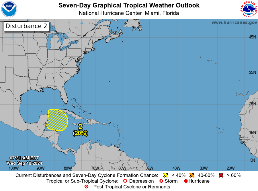
Rather than go into a post where I go back and forth on hypotheticals regarding potential Caribbean development next week, I want to go into how we should be thinking about this, sitting here on Wednesday, September 18th. First, the easy part: The National Hurricane Center has given the northwest Caribbean about a 20 percent chance of tropical development over the next week.
You may be asking why this seems so low. The NHC operates fairly conservatively, so expect these odds to probably increase as we get closer. After all, it’s not a given that we’re going to see tropical development in the northwest Caribbean. It’s a possibility.
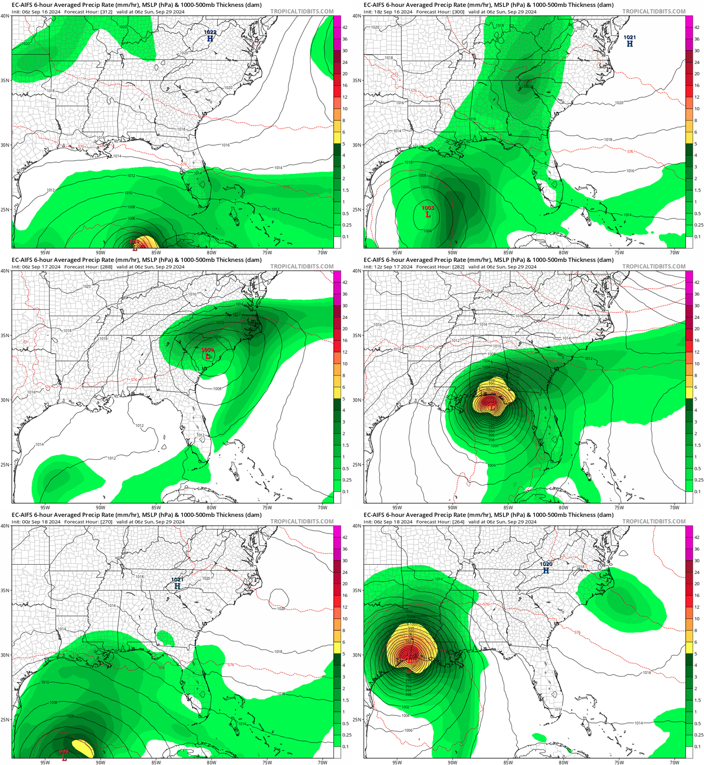
During Hurricane Beryl and again during Francine, we noted how good the European AI model and ICON model handled the storms. They were consistent on track and fairly consistent on the idea of intensity, particularly in the 5 days ahead of landfall, while other models were still generally bouncing around. So why can’t we just use those models and get a good idea of what may occur here? Well, here are the last 8 runs of the European AIFS model valid for next Sunday morning.

If you look at the GFS or ICON or whoever else you want, you would see a similar outcome. None of the operational modeling has any consistency or clue with respect to this system, short of “something might happen somewhere.” So when we tell you to ignore and disregard people posting single run deterministic models on social media saying “not a forecast, but check this out!” this is what we mean.
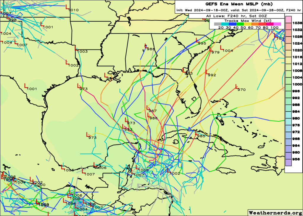
So the next thing you may ask is, “Matt, you’re a meteorologist. Isn’t it your job to cut through this and tell me what might happen?” And the answer is yes. However, I know my limits. When I look at GFS and European ensemble guidance, the traditional physics-based ensembles I see similar type outcomes with a wide berth of possibilities. Some go northwest, some go northeast, some don’t even develop it at all.

Finding signal in the noise is my job, and right now the only signal I maybe see is a propensity for the majority of model guidance to go north or northeast with this. And even that is sketchy at best. But it tells me Florida absolutely needs to watch this closely. And since we’re more than a week out from any impacts, that’s probably good enough.
The goal of a meteorologist this far in advance is not to get the call spot on. Anyone can try to do that, and periodically they’ll nail it while also likely delivering 65 other false alarms in the process. The goal of the meteorologist is to tell the audience what we know. We could dive deeper into the upper air pattern or things like that, but I feel we’re still a couple days away from getting too fancy with explaining how that impacts this outcome. But I’m not cherry picking model runs or data. I’m showing you examples of erratic deterministic output, which is all we have right now, and I’m showing you examples of slightly more stable though no less uncertain ensemble data. It’s a lot of noise, so don’t be panicked by individual cherry picked runs.
The bottom line right now? We have no idea what will form, exactly where it will form, and where it will go. But we are fairly confident that something is going to develop in the northwest Caribbean next week.
We’ll keep it simple today and leave it there.
Source link


