Headlines
- Milton made landfall near Siesta Key earlier this evening.
- Storm surge of 8 to 10 feet is likely to have occurred near Sarasota through Venice.
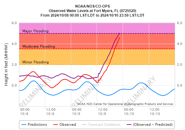
- Surge of 5 to 6 feet is causing major flooding in Fort Myers, Naples, Punta Gorda, and elsewhere down the coast.
- Tampa Bay was spared the worst case scenario surge.
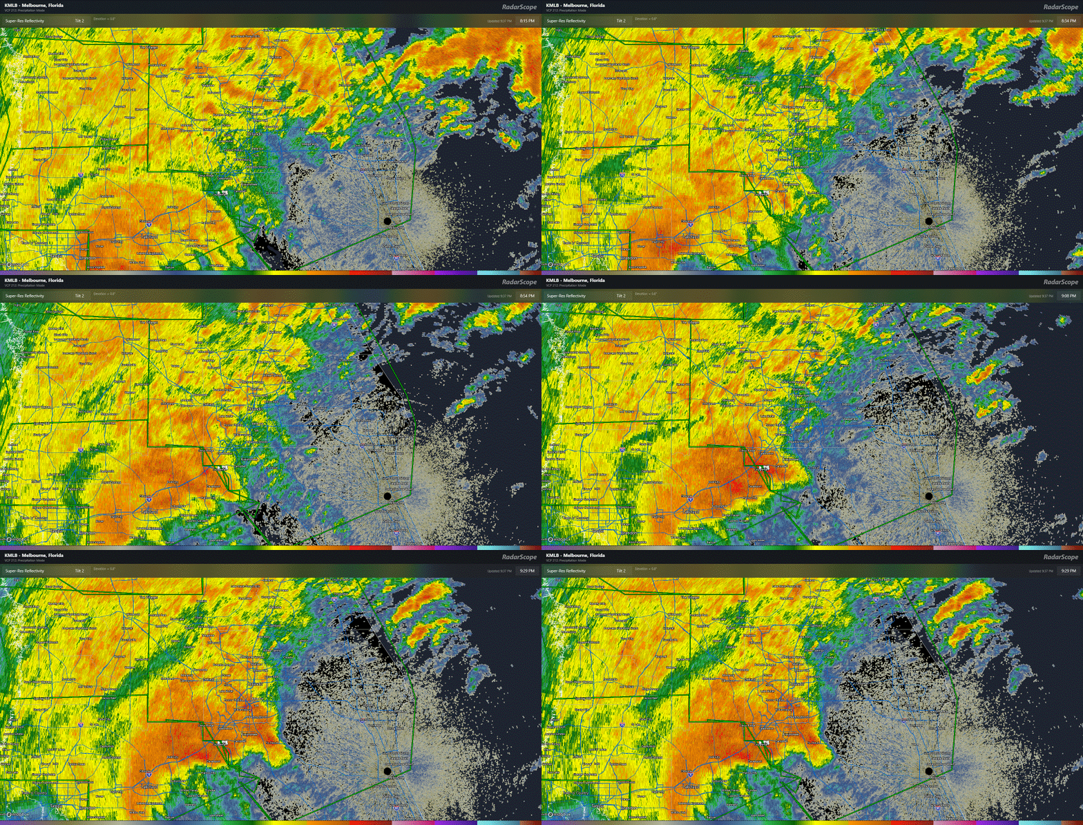
- But major to catastrophic flash flooding is now ongoing in the Tampa metro area, with torrential rain expanding north and east up I-4 toward Orlando.
- Over 1.5 million customers experiencing power outages now in Florida.
Hurricane Milton made landfall near Siesta Key this evening as a category 3 hurricane. An approximately 10 foot storm surge came ashore in Sarasota, while Tampa Bay ranged from negative surge (water being flushed out of the bay) in the upper part of the bay to about 2 feet in the lower part. Had Milton made landfall even 15 to 20 miles farther north, we’re talking about a 10 to 12 foot surge into Tampa Bay. That’s how close it came for Tampa…20 miles. Farther down the coast, about a 5 to 6 foot surge is ongoing in Fort Myers. There are videos from Venice floating around showing pretty terrible surge as well. So I presume daylight will bring a pretty rough scene in Sarasota, Venice, and Longboat Key, among other places.
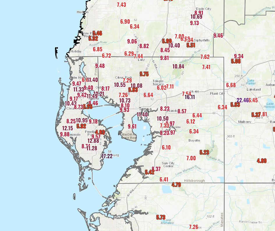
Relentless rain is pounding the Tampa metro area and now spreading north and east across the Florida Peninsula. Totals for today have been up to 17 inches in St. Petersburg and over 10 inches around much of Tampa.
There’s still a good deal more rain to come though hopefully the pace will slow somewhat. A flash flood emergency is in effect in Tampa. Catastrophic flooding is possible from the rainfall. This may not be the last flash flood emergency we see this evening, with torrential rain working northeast on I-4 toward Orlando and Deltona.
Several inches of rain will fall in a short time here, and severe flash flooding may occur. Thankfully, the tornado threat has pushed offshore for now, and though an isolated tornado can’t be ruled out there should not be the ridiculous pace we saw earlier today. The damage in eastern Florida from tornadoes is going to be more significant than we typically see in a tropical system. Why this storm went ballistic whereas other do not is a complex topic to get into but perhaps one we can touch on during the offseason.
Next update will be in the morning sometime. Wishing all the best in Florida.
Source link


