|
|
| Mesoscale Discussion 637 | |
| < Previous MD | |

|
|
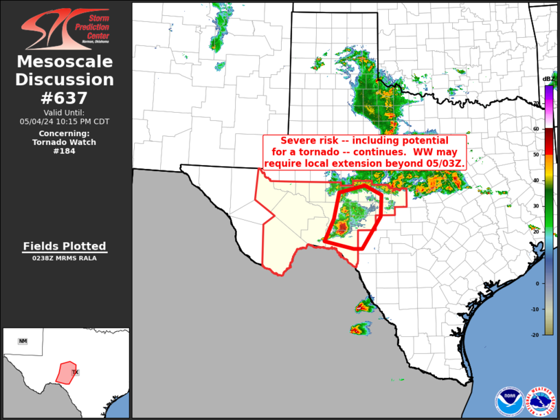
Mesoscale Discussion 0637 NWS Storm Prediction Center Norman OK 0940 PM CDT Sat May 04 2024 Areas affected...portions of the Edwards Plateau of Texas Concerning...Tornado Watch 184... Valid 050240Z - 050315Z The severe weather threat for Tornado Watch 184 continues. SUMMARY...Isolated severe risk continues across portions of the Edwards Plateau vicinity. Extension of WW 184 in time, beyond its scheduled 05/03Z expiration, may be needed for a portion of the area. DISCUSSION...Latest radar loop shows convection generally decreasing in intensity, though a lone storm moving eastward along the Crockett/Val Verde County line remains supercellular, with radar indications of a large -- though broad -- mesocyclone. Very large hail remains possible with this storm, along with locally damaging winds, and the evident rotation suggests at least some continued potential for a tornadic spin-up. While this storm will eventually move into Severe Thunderstorm Watch 185 if it maintains current trajectory/intensity, a local extension of WW 184 may be needed to cover short term severe risk. ..Goss.. 05/05/2024 ...Please see www.spc.noaa.gov for graphic product... ATTN...WFO...EWX...SJT...MAF... LAT...LON 29960178 30600148 31350132 31550047 31289992 30679994 29750056 29750084 29960178 |
|
|
Top/All Mesoscale Discussions/Forecast Products/Home |
|


