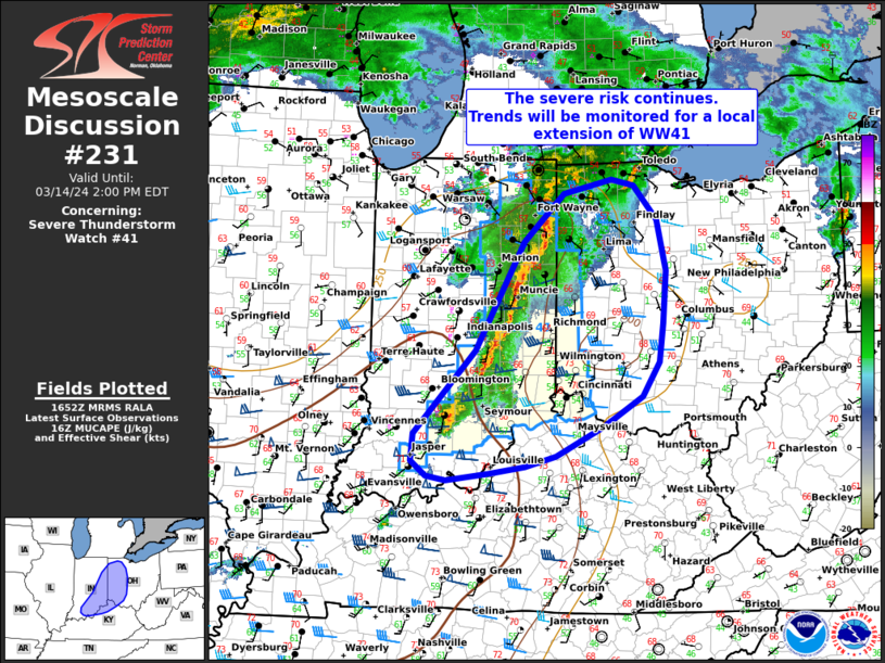
| Mesoscale Discussion 231 | |
| < Previous MD | |

|
|
Mesoscale Discussion 0231 NWS Storm Prediction Center Norman OK 0750 AM CDT Thu Mar 12 2026 Areas affected...Eastern GA into parts of SC and north FL Concerning...Tornado Watch 50... Valid 121250Z - 121415Z The severe weather threat for Tornado Watch 50 continues. SUMMARY...The wind-damage and brief tornado threat may continue eastward through the morning. DISCUSSION...Some decrease in convective vigor has been noted with the long-lived QLCS moving across parts of east GA and FL Panhandle. However, low-level rotation continues to occasionally be noted along portions of the line, especially across parts of east-central/southeast GA, where an evolution to more of a semi-discrete mode has occurred. Modest downstream destabilization and ascent attendant to an approaching mid/upper-level shortwave trough may help to sustain organized convection through the morning, with some wind-damage and brief-tornado threat spreading into parts of SC and southeast GA. Lightning activity has diminished with the southern portion of the line approaching north FL, but strong low-level flow may continue to support at least a localized damaging-wind threat through the morning. Parts of north FL will be monitored for an uptick in convective intensity later today, due to potential for somewhat stronger diurnal destabilization in this area. ..Dean.. 03/12/2026 ...Please see www.spc.noaa.gov for graphic product... ATTN...WFO...CHS...CAE...GSP...JAX...FFC...TAE... LAT...LON 31008300 32148218 33218250 34158217 34648181 34918155 34978097 34988070 34718042 34208035 33158061 31868113 30978156 30318181 29918236 29858281 29808330 29988375 30188368 30738320 31008300 MOST PROBABLE PEAK TORNADO INTENSITY...85-115 MPH MOST PROBABLE PEAK WIND GUST...55-70 MPH |
|
|
Top/All Mesoscale Discussions/Forecast Products/Home |
|
Source link


