|
|
| Mesoscale Discussion 2308 | |
| < Previous MD | |

|
|
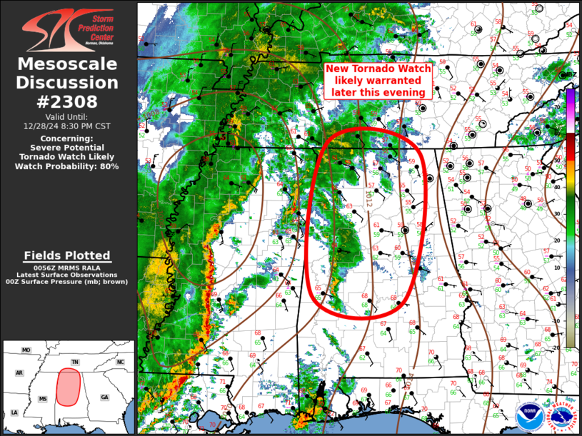
Mesoscale Discussion 2308 NWS Storm Prediction Center Norman OK 0659 PM CST Sat Dec 28 2024 Areas affected...Central/Northern Alabama into extreme southern Tennessee Concerning...Severe potential...Tornado Watch likely Valid 290059Z - 290230Z Probability of Watch Issuance...80 percent SUMMARY...Tornado watch will likely be warranted later this evening from central Alabama, northward, possibly into extreme southern Tennessee. DISCUSSION...LLJ continues to strengthen across MS into middle TN early this evening. Low-level warm advection is intense ahead of the primary squall line, and this is primarily responsible for scattered convection that is evolving along the MS/AL border. While the lead warm-advection storms are likely a bit elevated, surface dew points have risen into the lower 60s as far north as Jackson TN. With time lower 60s dew points will surge across the remainder of northern AL. While surface-based buoyancy will remain a bit weak across this region, intense shear will contribute to the longevity of upstream squall line, along with scattered warm advection storms. New tornado watch is likely warranted downstream. ..Darrow/Gleason.. 12/29/2024 ...Please see www.spc.noaa.gov for graphic product... ATTN...WFO...OHX...BMX...HUN... LAT...LON 32428817 35118787 34898591 32308630 32428817 |
|
|
Top/All Mesoscale Discussions/Forecast Products/Home |
|


