|
|
| Mesoscale Discussion 2305 | |
| < Previous MD | |

|
|
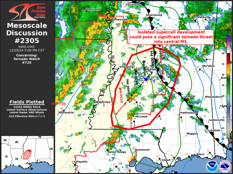
Mesoscale Discussion 2305 NWS Storm Prediction Center Norman OK 0356 PM CST Sat Dec 28 2024 Areas affected...portions of southeastern LA into central MS Concerning...Tornado Watch 720... Valid 282156Z - 282300Z The severe weather threat for Tornado Watch 720 continues. SUMMARY...Isolated supercell development across southern MS and southeastern LA could pose a significant tornado threat over the coming hours. However, displaced east from the strongest synoptic forcing, it remains unclear how persistent the threat may be until later this evening. DISCUSSION...Across the eastern edge of PDS Tornado Watch 720, an isolated supercell (with recent reports of a tornado) was observed over northeastern Franklin County MS. Additional discrete development has been noted farther south into southeastern LA, likely along a subtle confluence axis stretching into the northern Gulf of Mexico. This storm has slowly organized over the last several hours, coincident with the northward advection of a weak warm front. An unstable air mass with 1000-1500 J/kg of MLCAPE and strong low-level shear (300-400 m2/s2 ESRH JAN DGX VAD) is supportive of a continued severe threat. The strong low-level shear is also conditionally supportive of a strong and long-track tornado threat into central MS given the favorable storm mode. However, much of this activity is displaced farther east from the stronger synoptic forcing until later this evening. This could tend to make the threat somewhat intermittent until stronger forcing arrives. Thus, while the environment is favorable for a continued, and conditionally significant severe/tornado threat, there remains some uncertainty on the duration/longevity of the risk. ..Lyons.. 12/28/2024 ...Please see www.spc.noaa.gov for graphic product... ATTN...WFO...JAN...LIX... LAT...LON 31779096 31879096 32409067 32649053 32848993 32758961 32608931 32428926 31608957 31328986 31129006 31009060 31079101 31319106 31779096 |
|
|
Top/All Mesoscale Discussions/Forecast Products/Home |
|


