|
|
| Mesoscale Discussion 2296 | |
| < Previous MD | |

|
|
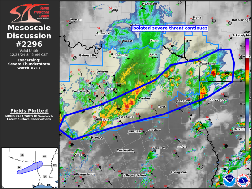
Mesoscale Discussion 2296 NWS Storm Prediction Center Norman OK 0738 AM CST Sat Dec 28 2024 Areas affected...North-central TX to the Ark-La-Tex Concerning...Severe Thunderstorm Watch 717... Valid 281338Z - 281445Z The severe weather threat for Severe Thunderstorm Watch 717 continues. SUMMARY...An isolated severe threat may persist into late morning, mainly within the southern portion of WW 717. DISCUSSION...Despite fairly extensive elevated convective development through daybreak, much of the activity has struggled to greatly intensify. Elevated MUCAPE appears most pronounced near the Ark-La-Tex, per the 12Z SHV sounding, but has supported only marginally severe activity thus far. Meanwhile, convection farther southwest in north-central to northeast TX has largely clustered and failed to sustain supercell structures despite adequate deep-layer shear. Convection may continue to struggle within WW 717. More prominent severe potential should develop though, to the south and east of this watch (see MCD 2294/WW 718 for forecast info in that region). ..Grams.. 12/28/2024 ...Please see www.spc.noaa.gov for graphic product... ATTN...WFO...LZK...SHV...FWD... LAT...LON 33819344 33819310 33489299 33009305 32629380 32209511 31889657 31549776 31809820 32139802 32449697 33089535 33459488 33589407 33819344 |
|
|
Top/All Mesoscale Discussions/Forecast Products/Home |
|


