|
|
| Mesoscale Discussion 2294 | |
| < Previous MD | |

|
|
   Mesoscale Discussion 2294
   NWS Storm Prediction Center Norman OK
   0625 AM CST Sat Dec 28 2024

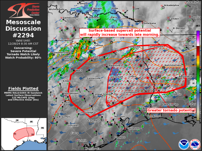
   Areas affected...parts of east TX to western LA

   Concerning...Severe potential...Tornado Watch likely

   Valid 281225Z - 281430Z

   Probability of Watch Issuance...80 percent

   SUMMARY...Surface-based supercell potential is expected to rapidly
   increase in the late morning to midday. A tornado watch will likely
   be needed by 14-15Z.

   DISCUSSION...The east TX to western LA warm-moist sector
   characterized by 66-71 F surface dew points has roughly reached a
   TPL to 20 S CRS to IER line as of 12Z. Pervasive cloud coverage will
   slow diabatic surface heating after sunrise, but the rich moisture
   profile will only need a few degrees of warming to yield a marked
   increase in surface-based convection. This will be favorably timed
   with strengthening large-scale ascent and flow fields ahead of a
   pronounced shortwave trough near central TX. 06Z ECMWF and recent
   HRRR guidance suggest scattered to widespread warm-moist sector
   thunderstorms will occur by midday. A strengthening kinematic
   profile should foster several to numerous supercells. Tornado
   potential will become more favorable with eastern extent in TX to
   LA, as hodographs enlarge midday into the afternoon.

   ..Grams/Edwards.. 12/28/2024

   ...Please see www.spc.noaa.gov for graphic product...

   ATTN...WFO...LCH...SHV...HGX...FWD...EWX...

   LAT...LON   30789744 31429734 32089652 32599457 32629384 32639289
               32189221 31419209 30989212 30759305 30769313 30689438
               29799642 30369727 30789744
|
|
|
Top/All Mesoscale Discussions/Forecast Products/Home |
|


