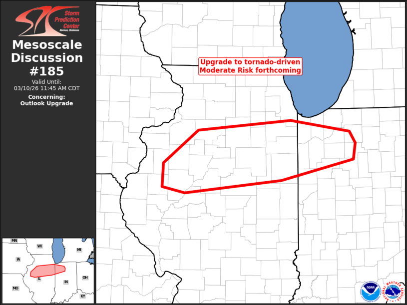
Mesoscale Discussion 0185 NWS Storm Prediction Center Norman OK 1042 PM CDT Fri Mar 14 2025 Areas affected...central and western Illinois...southeastern Missouri...and northeastern and central Arkansas Concerning...Tornado Watch 32...37... Valid 150342Z - 150445Z The severe weather threat for Tornado Watch 32, 37 continues. SUMMARY...Severe/isolated tornado risk to continue from central Illinois southwestward into central Arkansas. DISCUSSION...Latest radar loop shows that supercell storms that moved through the St. Louis area have evolved toward more of a damaging wind risk, as they have interacted with a drier low-level airmass east of the Mississippi River. With that said, damaging wind gusts remain likely, along with ongoing -- albeit somewhat lesser -- tornado potential. Farther south-southwestward along the convective band, more isolated/classic-looking supercells extend across southeastern Missouri, and particularly into northeastern and into central Arkansas. Specifically, strong rotation is noted within several storms in a zone from southeastern Reynolds/northwestern Wayne Counties in Missouri, southwestward to White County Arkansas. Along with risk for damaging winds and hail, greatest tornado risk appears to exist across this zone over the next couple of hours. Southern portions of WW 32 may be extended in time, beyond its scheduled 15/04Z expiration. ..Goss.. 03/15/2025 ...Please see www.spc.noaa.gov for graphic product... ATTN...WFO...IND...PAH...LOT...ILX...MEG...LSX...LZK...SGF... LAT...LON 34469245 35209241 37119092 38229085 39148980 40008987 40868924 40878765 39168756 38648840 37448972 34629127 34469245
Source link