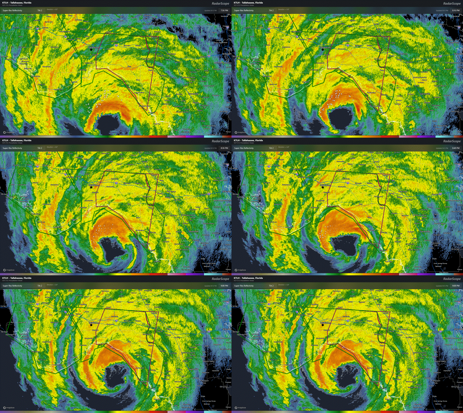
Hurricane Helene is about to make landfall by midnight, likely in Taylor County, FL, just south of Perry in the Big Bend as at least a 140 mph category 4 monster of a storm. There are too many superlatives to cover right now between the surge and wind and flooding and tornadoes. But suffice to say that Helene is en route to retirement in all likelihood.
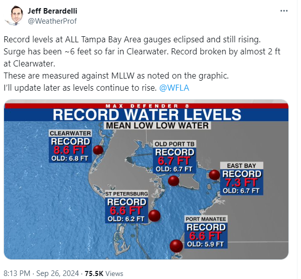
Historic water level values have all been met or broken in Tampa Bay.
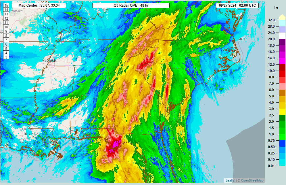
Widespread rain is causing flash flooding all over the Southeast that will worsen overnight.

Tornado Watches blanket much of the Southeast and numerous tornado warnings have occurred today. And an extreme wind warning is in effect just east of Tallahassee, the rarest of warnings reserved for only the mightiest of landfalling hurricanes. Helene joins that club shortly.
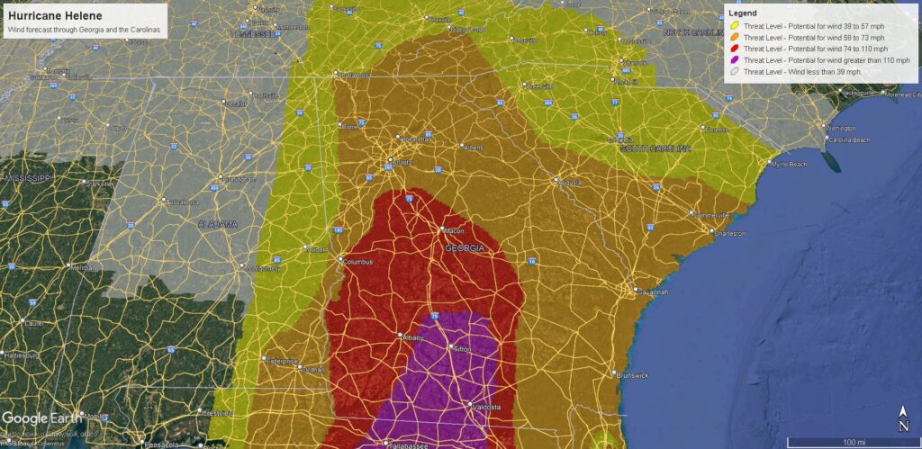
There have been no changes of note to the storm track, but the potential for stronger winds inland has expanded somewhat through the day today, and the wind risk map now looks like this:

This is likely to cause significant, long-duration power outages in Georgia and the Carolinas in addition to the anticipated widespread, severe, potentially catastrophic flash flooding. This includes the Atlanta metro. Charge your phones now if you have not already.
We’ll continue to watch this tonight and have a complete update later or in the morning.
Source link


