What’s changed since last night
- No meaningful change to the forecast intensity, track, or impacts into Florida.
- A slight nudge east in the track in North Georgia.
- Helene is now a category 2 storm
Larger storms tend to be a little more unruly in terms of how they organize. Helene meets that bill today. Reports of “concentric eyewalls” in the storm, almost as if the system is trying to figure out how large it wants to be.
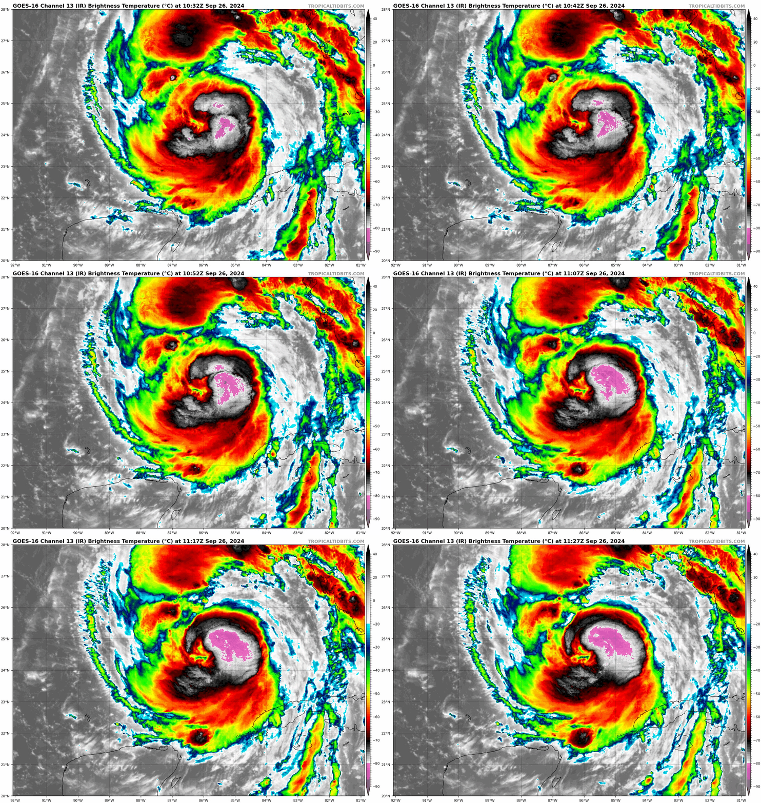
We’ve seen bursts of thunderstorms wax and wane near the center, but we’re currently in an uptick. Recent reports from NOAA flights into Helene suggest surface winds have increased to close to 100 mph. We’ll see what the new advisory shows just after I publish this. (Editor’s note: It has. Now a cat 2 with 100 mph winds). Basically, Helene continues to intensify, and there’s no reason to think the dire forecasts we and everyone else discussed yesterday have changed.
The surge forecast is basically unchanged from last night, with a 15 to 20 foot, unsurvivable peak surge in Apalachee Bay and the Big Bend.
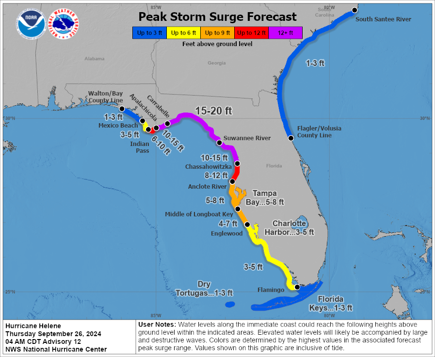
Tampa Bay continues to see a 5 to 8 foot surge, which will be some of the worst surge experienced in modern times there.
The track of Helene is virtually unchanged as well. The most likely landfall point is between Apalachicola and Steinhatchee right now. There remains at least some risk that wobbling of the track could force it closer to Cedar Key in an extreme scenario. I would not rule that out, but I would be absolutely preparing for the worst between Apalachicola and Homosassa and for very bad outcomes south of there to Tampa Bay. Landfall should occur late this evening.
A Tornado Watch is in effect for most of the Florida Peninsula today.
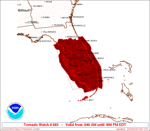
That watch goes til 8 PM ET, and additional watches could be required to the north later today. Isolated tornadoes seem to already be a bit of a threat and this should escalate some through the day and into tonight.
The heavy rainfall threat continues to look very, very bad for both areas near landfall and interior locations in the Appalachians in North Carolina, Upstate South Carolina, and North Georgia.
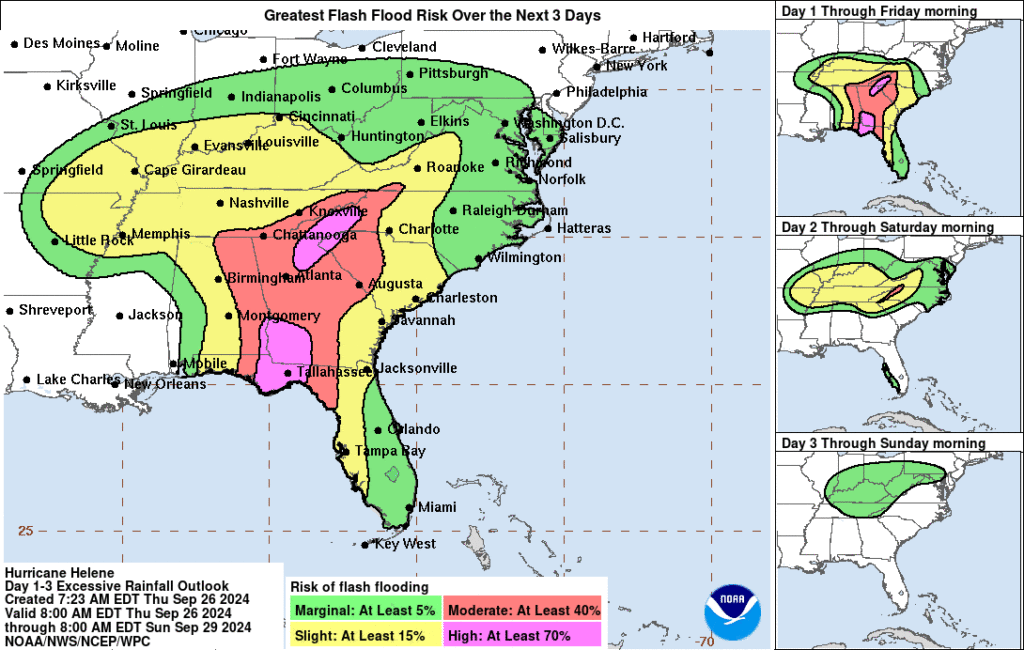
After heavy rain yesterday, we continue to see the risk for 10 to 16 inches of additional rainfall with the storm today, tonight, and early Friday before things slowly ease up a little tomorrow. Catastrophic interior flooding, especially in that high risk area northeast of Atlanta remains a high likelihood.
Real quick tangent here. One of the reasons Helene is going to be such a monster storm as it comes inland is because it’s essentially “phasing” with a massive upper cutoff low over the mid-South. A cutoff low is a storm system in the upper atmosphere that has essentially cut itself off from the jet stream. When this happens, the system tends to just meander around until something changes to kick it out. In this situation, you can see the animation below with the big upper low north of Memphis, and then Helene surging in on the right side of the image.
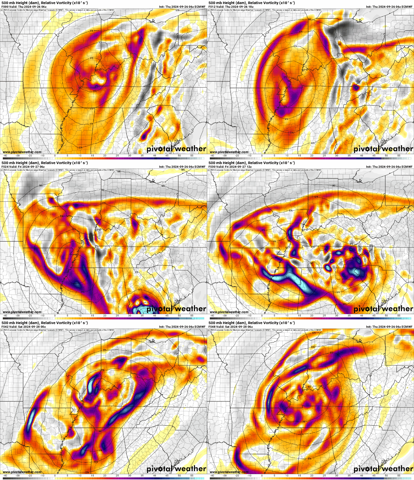
This complex merger is something we don’t usually think of with a hurricane. Hurricane Sandy was a good example of this happening with tropical systems and showed why its winds and size caused so much damage despite “not technically being a hurricane” when it hit New Jersey in 2012. The whole process extends the life cycle of the winds of the hurricane and it’s why tropical storm warnings extend so far inland. The rain element is related as well. With Helene being pulled northeast, then suddenly hooking back northwest “into” the upper low, it will continue to produce rain on the windward side of the Appalachians, leading to additional rain tomorrow and further flooding.
Anyway, that explains some of what’s going on behind the scenes with Helene after it moves inland. We’ll update this post with any notable changes throughout the day.
Source link


