| Mesoscale Discussion 377 | |
| < Previous MD | |

|
|
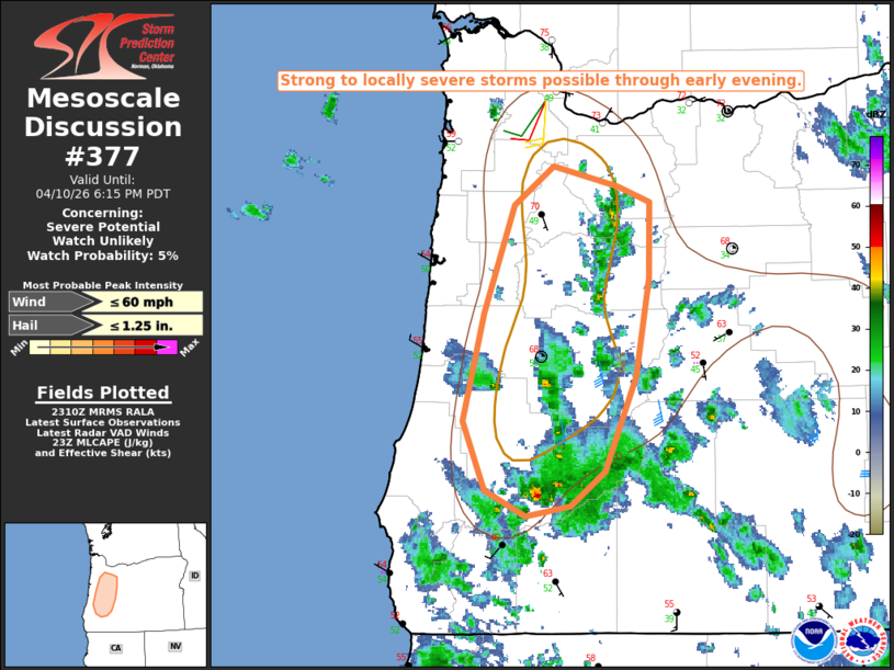
   Mesoscale Discussion 0377
   NWS Storm Prediction Center Norman OK
   0613 PM CDT Fri Apr 10 2026

   Areas affected...Parts of western OR

   Concerning...Severe potential...Watch unlikely

   Valid 102313Z - 110115Z

   Probability of Watch Issuance...5 percent

   SUMMARY...Strong to locally severe storms are possible through early
   evening.

   DISCUSSION...Convection has gradually increased across parts of
   western OR this afternoon, within a region of ascent to the north of
   a mid/upper-level shortwave trough moving across parts of northern
   CA and vicinity. Filtered diurnal heating beneath cold temperatures
   aloft (around -20C at 500 mb) has allowed MLCAPE to rise to
   near/above 500 J/kg, sufficient for sporadic strong updrafts. Modest
   midlevel southerly flow is supporting effective shear of 25-35 kt,
   marginally supportive of at least transient updraft organization.

   As storms move northward across the Willamette Valley and adjacent
   higher terrain areas, small to marginally severe hail and locally
   gusty winds will be possible through the remainder of the afternoon
   into the early evening.

   ..Dean/Thompson.. 04/10/2026

   ...Please see www.spc.noaa.gov for graphic product...

   ATTN...WFO...MFR...PQR...

   LAT...LON   42992354 43482374 44222355 44982325 45242287 45102226
               45002194 44462196 43782209 43132239 42892271 42822314
               42992354

   MOST PROBABLE PEAK WIND GUST...UP TO 60 MPH
   MOST PROBABLE PEAK HAIL SIZE...UP TO 1.25 IN
|
|
|
Top/All Mesoscale Discussions/Forecast Products/Home |
|
Source link