| Mesoscale Discussion 226 | |
| < Previous MD | |

|
|
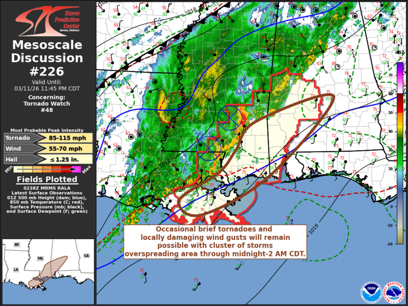
Mesoscale Discussion 0226 NWS Storm Prediction Center Norman OK 0939 PM CDT Wed Mar 11 2026 Areas affected...parts of southeastern Louisiana and Mississippi and southwestern Alabama Concerning...Tornado Watch 48... Valid 120239Z - 120445Z The severe weather threat for Tornado Watch 48 continues. SUMMARY...Occasional brief tornadoes and locally damaging wind gusts will remain possible with a cluster of storms overspreading the region through midnight-2 AM CDT. DISCUSSION...The organized convective system, with at least a couple of embedded meso beta scale lower/mid-tropospheric cyclonic circulations and occasionally intensifying meso gamma scale cyclonic circulations closer to the surface, is generally being maintained. This is likely being supported by inflow of boundary-layer based CAPE up to around 1000 J/kg, within a narrow corridor of better low-level moisture return roughly aligned with a 30-35 kt southwesterly 850 mb jet nosing inland of the Gulf coast. It appears that this corridor of destabilization and enlarged low-level hodographs will persist and develop east-northeastward across southeastern Mississippi through southwestern Alabama into the 05-07Z time frame, with the eastward progression of the mid-level short wave across Louisiana. As long as this continues, occasional brief tornadoes and locally damaging wind gusts will remain possible. ..Kerr.. 03/12/2026 ...Please see www.spc.noaa.gov for graphic product... ATTN...WFO...BMX...MOB...JAN...LIX... LAT...LON 31048942 31798881 32418644 30388840 29389041 29749105 30478989 31048942 MOST PROBABLE PEAK TORNADO INTENSITY...85-115 MPH MOST PROBABLE PEAK WIND GUST...55-70 MPH MOST PROBABLE PEAK HAIL SIZE...UP TO 1.25 IN |
|
|
Top/All Mesoscale Discussions/Forecast Products/Home |
|
Source link