| Mesoscale Discussion 169 | |
| < Previous MD | |

|
|
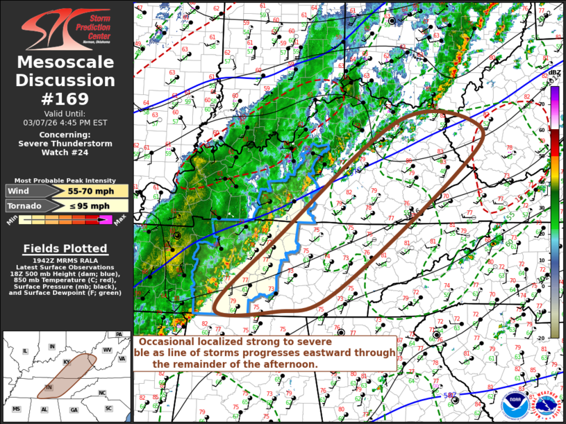
Mesoscale Discussion 0169 NWS Storm Prediction Center Norman OK 0144 PM CST Sat Mar 07 2026 Areas affected...part of eastern Kentucky...middle and eastern Tennessee...southwestern West Virginia Concerning...Severe Thunderstorm Watch 24... Valid 071944Z - 072145Z The severe weather threat for Severe Thunderstorm Watch 24 continues. SUMMARY...At least some risk for occasional locally strong to severe wind gusts probably will persist with a squall line overspreading the region through the remainder of the afternoon. It is not clear that an additional severe weather watch is needed, but trends will continue to be monitored. DISCUSSION...The pre-frontal squall line has undergone fluctuations in intensity, but, to this point, has remained modest in strength, with peak surface gusts mostly below severe limits. Downstream, across the Cumberland Plateau vicinity, surface dew points have decreased with continuing insolation and relatively deep boundary-layer mixing. However, it does appear that at least a narrow corridor of low-level moistening and destabilization may be maintained immediately ahead of the squall line as it progresses eastward through the remainder of the afternoon. While it is not clear that this will be accompanied by an appreciable further increase in cold pool strength and severe wind gust potential, at least some risk for occasional locally strong to severe wind gusts probably will persist. ..Kerr.. 03/07/2026 ...Please see www.spc.noaa.gov for graphic product... ATTN...WFO...RLX...MRX...JKL...ILN...LMK...OHX...HUN... LAT...LON 38408357 38258183 37418241 35388501 35078622 35098754 36348622 38408357 MOST PROBABLE PEAK TORNADO INTENSITY...UP TO 95 MPH MOST PROBABLE PEAK WIND GUST...55-70 MPH |
|
|
Top/All Mesoscale Discussions/Forecast Products/Home |
|
Source link