| Mesoscale Discussion 114 | |
| < Previous MD | |

|
|
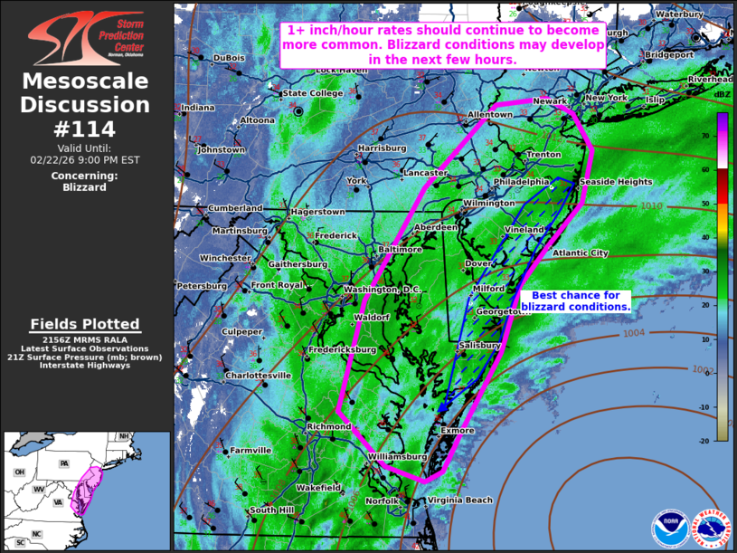
   Mesoscale Discussion 0114
   NWS Storm Prediction Center Norman OK
   0358 PM CST Sun Feb 22 2026

   Areas affected...portions of extreme eastern Pennsylvania...much of
   New Jersey...Delaware...eastern Maryland...and far eastern Virginia

   Concerning...Blizzard

   Valid 222158Z - 230200Z

   SUMMARY...Moderate to heavy snow should continue into the evening.
   1+ inch/hour rates remain possible in spots. Blizzard conditions may
   begin within the next few hours.

   DISCUSSION...21Z mesoanalysis indicates that the surface low,
   located east of the Delaware coastline, has strengthened to 998 mb,
   with surface observations along the coast showing northeasterly
   surface gusts approaching 20 kts in spots. 700 mb WAA and
   frontogenesis continues to intensify along the DE/NJ coastline, and
   should strengthen further with surface low intensification. 1+
   inch/hr snowfall rates are likely underway, and should only become
   more common with time. Furthermore, surface low intensification will
   result in increased gradient flow along the Mid Atlantic coastline,
   where blizzard conditions will be possible. The current thinking is
   that blizzard conditions will most likely develop in the next few
   hours.

   ..Squitieri.. 02/22/2026

   ...Please see www.spc.noaa.gov for graphic product...

   ATTN...WFO...OKX...PHI...AKQ...CTP...LWX...

   LAT...LON   37767705 38847675 39947600 40767509 40817445 40667412
               40307388 39797402 39377445 39007480 38357504 37597553
               37197577 37097599 37247648 37767705
|
|
|
Top/All Mesoscale Discussions/Forecast Products/Home |
|
Source link