Headlines
- Rafael (mostly) did what it was supposed to do in the Gulf, although it’s unclear if there was a “winner” among the models.
- A tropical wave has an increasing potential to develop in the Caribbean later this week.
- This system may pose a threat to Central America either through development into a storm or through a slow-moving heavy rainmaker.
- It bears close watching between the Yucatan and Nicaragua.
Rafael’s demise
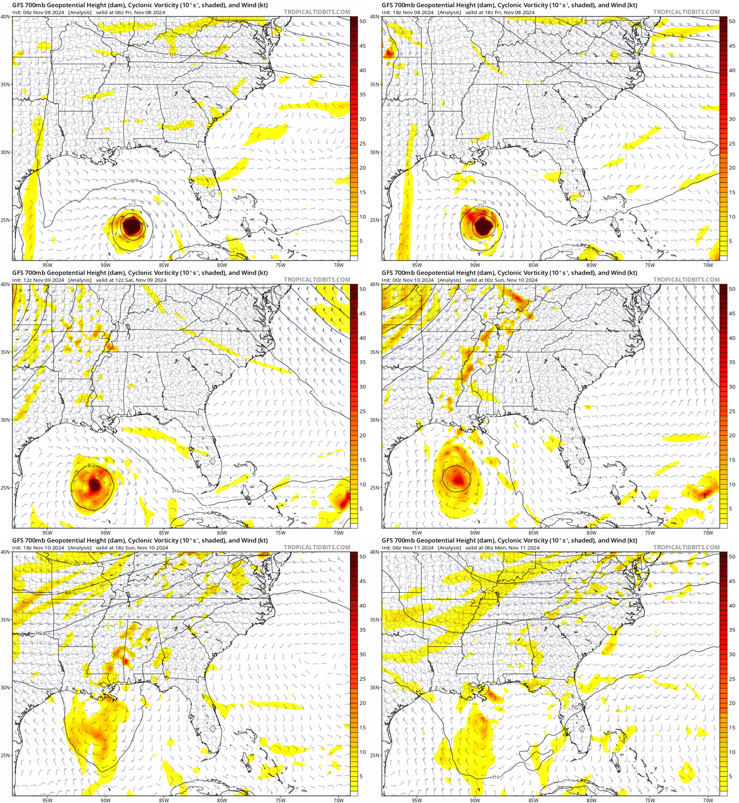
Mostly as expected, Rafael succumbed to wind shear and dry air over the Gulf of Mexico this weekend. Just to tie a ribbon on this whole thing, remember, model guidance was sort of split on taking Rafael southward into the Bay of Campeche or north into Louisiana. The majority of guidance shifted toward the Bay of Campeche track late last week, and the official forecasts all generally pointed toward that happening. Interestingly, when you look at the initialization of the models since Friday, you can see the mid-level signature of Rafael kind of shear apart with some going north and some going south.

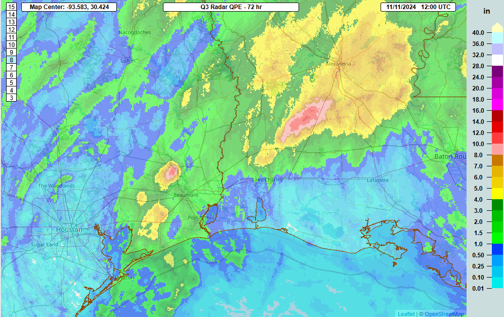
That said, there was likely some element of Rafael’s moisture that got picked up by a cold front in the Deep South this weekend. Heavy rain and flooding occurred in Louisiana, especially between Alexandria and Lake Charles, with radar estimates in excess of 12 inches since Friday morning.

Heavy rainfall in excess of 4 inches also occurred in eastern Louisiana and even southwest Mississippi. All in all, it was a substantial autumn rain event, perhaps aided a little by Rafael.
Potential trouble brewing for Central America
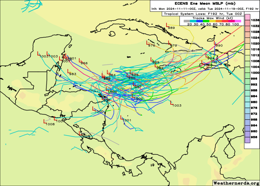
With Rafael now just a remnant in the Gulf, our attention will focus back to the Caribbean, where we should see a tropical disturbance in about 4 or 5 days or less drifting into the western part of the Sea. The NHC assigns about 40 percent develop odds, and a slow moving system could cause some problems in Central America. Models are divergent on exactly where, what, and when. But in general, a system tracking toward Honduras or Nicaragua seems plausible. Upper level steering currents look to be generally weak. This means that whatever does or does not develop is likely to remain slowly moving in this area.
This means that a couple unideal solutions are on the table right now, ranging from a potentially strengthening system to a slow-moving hefty rainmaker. Neither option usually leads to good outcomes in Central America, so unfortunately this will bear very close watching for those areas between the Yucatan and Nicaragua. For the Gulf, at least initially it appears that high pressure should exert control and effectively close off the area to anything from the Caribbean. So it is not likely to be a concern. But for folks in Central America, watch this one closely.
Source link


