Snowpack has been running well above average this winter across the Colorado River watershed. It’s a rare bright spot after 23 years of grinding megadrought brought the driest conditions in 1,200 years to the basin that supplies 40 million people in Arizona, California, Colorado, Nevada, New Mexico, Utah, Wyoming, and Mexico.
Should the generous rains and mountain snows continue into spring, they would head off a deeper water crisis, including perhaps an unprecedented loss of hydropower generation from severely depleted Lake Powell and Lake Mead. As of August 2022, chances that such a loss of generation, known as a “minimum power pool,” could happen by late 2023 had risen to an alarming 30%, according to calculations released by the U.S. Bureau of Reclamation.
Autumn and early winter moisture has now pushed those odds back below 10% as of the January update from the bureau. The lake level by December was almost three feet higher than had been projected in August.
Yet although the moisture is welcome, some experts and advocates worry it could further delay the hard work that managers of the watershed must do to keep it healthy and make its service more inclusive as the climate grows hotter and more parched.
“As soon as water supplies increase, people tend to stop paying attention,” said Kathy Jacobs, director of the University of Arizona’s Center for Climate Adaptation Science and Solutions, in an interview. “I hope people realize that even one year of good flows doesn’t mean we have a trend in that direction. We really need a long-term solution.”


Climate change and development collide
More than ever, breakneck population growth and agricultural demands across the Southwest are butting up against the imperatives of a changing climate.
Experts agree that the century-old agreement that governs management of the Colorado River basin needs to be overhauled to fairly apportion the shrinking water resources. Conservation measures have brought some relief: Notably, Las Vegas has aggressively cut water usage even as its population has boomed. But such solutions are just a Band-Aid, experts say, and the region needs to take a hard look at persistent problems, such as a thirsty agriculture sector and the history of shortchanging Indigenous tribes of needed resources.
As shown dramatically in Figure 2 below, the margins of error that once buffered Colorado River usage ran out around the turn of the century, making it much harder to adapt to climate change.


By June 2022, the outlook had grown so dire that the U.S. Department of the Interior ordered the seven states of the Colorado River basin to come up with a plan by August (a deadline later extended to Jan. 31) for cutting 2 to 4 million acre-feet of water use per year, or about 15-30% of current use.
After months of wrangling, six of the basin’s seven states had come up with a joint framework, submitted to the Bureau of Reclamation on Jan. 30. However, California put forth a competing proposal on Jan. 31.
“The difference is in timing,” observed writer John Fleck, who directs the University of New Mexico’s Water Resources Program, in a blog post on Feb. 1. “California’s cuts don’t kick in until later – essentially a gamble on good hydrology once again helping us avoid conflict by letting us use more water in the short term.”
There’s at least one sign of modest progress, according to Fleck: “despite big disagreements about how to approach this, we have unanimity among all seven states that very deep cuts in Lower Basin water use [Arizona, California, and Nevada] are needed.”
The most recent federal guidelines for Colorado River drought management, released in 2007 and updated in 2019, have fallen woefully short of events. An especially stark depletion of the two main reservoirs since 2020 was triggered in part by an unusual three-year La Niña event now winding up.
The lack of a full-basin agreement by the January deadline now increases the odds that the federal government will proceed with its own mandated cuts while working to expedite updates of its drought management guidelines, which expire in 2025.
Megadrought strikes the West
As recently as 1999, Lakes Powell and Mead were nearly full. A number of years since then have been painfully dry, as the region has been suffering through a long-term megadrought similar to others that have occurred every few centuries. Even if this latest megadrought were to end immediately, rising temperatures will continue to sap the region’s water supplies.
During a megadrought, natural factors – such as persistent La Niña conditions, which tend to shunt moisture-bearing systems north of the Colorado River Basin – conspire to limit precipitation. But climate change is playing a role, too, by worsening the impacts of the current megadrought on water supply and ecosystems. Recent studies of tree-ring data estimated that regional soil moisture has dipped to its lowest level since at least the year 800. The latest research showed that rising temperatures fueled by climate change are responsible for about half the current megadrought’s impact on soil moisture.
Another analysis found that the natural flow of the Colorado is decreasing by around 9% for each degree Celsius of warming, mainly because of reduced snowpack. Going forward, warming is likely to be more important than precipitation change in shaping long-term water supply over the Colorado Basin. Climate models suggest that total precipitation may increase this century over the Upper Colorado Basin while holding steady or dropping slightly in the Lower Basin.
As more and more water evaporates from reservoirs, rivers, and the landscape as the climate warms, the system’s overall water supply appears set to decline over the long term even as wet periods come and go.


In April 2022, storage in 60-year-old Lake Powell fell to 22% of capacity, and in July, 85-year-old Lake Mead dropped to 23% of capacity – in both cases the lowest levels observed since the reservoirs were built. Together, they represent only about a year’s worth of backup storage for the Colorado Basin, compared to the four years available when both are at capacity.
If Lake Powell and Lake Mead end up having to reduce their output of hydropower, utilities may turn to more natural gas to generate electricity, which in turn could boost emissions of heat-trapping pollution and worsen climate change.


Century-old compact ignored “inconvenient science”
As they navigate these planning tracks, policymakers must stay within the confines of the century-old Colorado River Compact. Its assumptions about regional water supply were too blithe even in the 1920s and are now fatally flawed.
The compact divvied up most of the Colorado River’s water between two groups: the drier, rapidly growing states of the Lower Basin and the wetter, slower-growing Upper Basin (Colorado, New Mexico, Utah, and Wyoming), which has yet to use all its share. A small fraction is allocated to Mexico.
“The states, especially California and Arizona, had come to depend on really big allotments that were only possible because we ignored the laws of physics and didn’t account for evaporation and system losses,” Fleck warned in a September 2022 symposium.
Fleck and former Colorado River District manager Eric Kuhn laid out in devastating detail how the agreement went awry in their book “Science Be Dammed: How Ignoring Inconvenient Science Drained the Colorado River,” and in a series of writings and presentations on the compact’s centennial in 2022.
The compact was devised by policymakers eager to develop the region. They drew on overly optimistic estimates of river flow based on gauge data from 1900 to 1920 –a period now recognized as one of the wettest in the last 1,400 years. More or less ignored at the time but much closer to the long-term reality were parallel analyses from U.S. Geological Survey scientist Eugene Clyde (E.C.) LaRue, which relied on limited data and proxies from the drier decades of the late 1880s. His work suggested that a truly representative average flow would be at least 10% lower.
The chief benchmark for assessing the upper-lower split is the Colorado’s flow as measured at Lees Ferry, a few miles south of the Utah-Arizona border just downstream from Glen Canyon Dam (see Figure 5).


The compact originally assumed that the flow at Lees Ferry would average 16.4 million acre-feet per year on a decadal basis. Most of the water years over the last century have fallen short of that estimate. The actual annual average at Less Ferry from 1906 to 2018 was 14.8 million acre-feet.
The compact also hinged on a serious underestimate of the 1.5 million acre-feet lost through evaporation and transit each year. A warming climate will increase loss from evaporation.
Moreover, the water rights of Native Americans were given mere lip service in the original compact: It had only a single sentence noting that the agreement should not be construed as affecting U.S. obligations to tribes. Subsequent court cases led to allocations to 22 tribes of roughly 3.2 million acre-feet of diversion rights, or nearly a quarter of the basin’s typical annual supply. Additional claims by 12 of those tribes have yet to be resolved.
Tribal nations have struggled to secure a place at the policy table and to put into place the infrastructure needed to fully use the water they’ve been allocated, some of which is being used outside the tribes.
“We should not have to remind you — but we will again — that as our trustee, you must protect our rights, our assets, and people in addition to any action you take on behalf of the system,” read a letter sent in August from 14 tribal nations to the Department of the Interior.


On January 5, 2023, President Joe Biden signed legislation allowing the Colorado River Indian Tribes Reservation to lease water to users outside its reservation boundaries.
“The rich soil along the riverbanks has sustained our people for millennia,” said Amelia Flores, elected leader of the reservation and its members from Mohave, Chemehuevi, Hopi, and Navajo tribes, in congressional testimony last year.
Flores said the increased flexibility from the new legislation would allow the tribes to use their senior water rights to help other struggling users during times of drought, while also helping the tribe to expand preserves for native plants and endangered fish along the river.
Two sides of the conservation coin: urban and rural
Some of the Colorado River basin’s urban areas have stepped up to the water-conservation plate in impressive fashion. Despite the Las Vegas Strip and its infamous fountains-in-the-desert scenery, Las Vegas’s aggressive moves have led to a 26% drop in water usage since 2002, even with the arrival of more than 750,000 new residents.
A citywide ban on ornamental (“non-functional”) grass alongside roads, highways, and buildings – the nation’s first such law, passed in 2021 and effective in 2027 – should save an additional 9.5 billion gallons per year, or almost 10% of southern Nevada’s current usage.


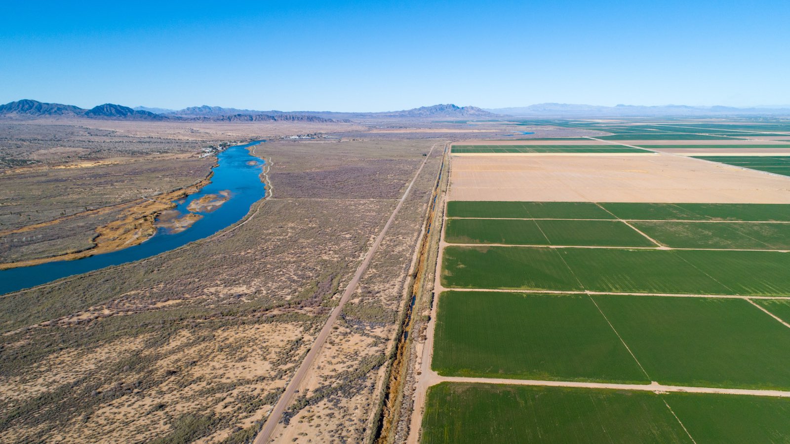
Then there’s agriculture, which accounts for some 70% of the nation’s Colorado River water use. Despite water-saving practices deployed at some of the region’s farms and ranches, there’s no overall mechanism to push the array of crops grown from water gulpers to water sippers.
One new type of incentive is emerging from last year’s Inflation Reduction Act: direct federal payments to Lower Basin farmers who agree to relinquish parts of their water allocations over periods of up to three years.
Nongovernmental organizations are also pitching in. The Nature Conservancy has launched several partnership projects with agriculture, ranging from setting up water banks to cultivating markets for water-efficient crops.
“Most of the farmers we work with see the problem,” said Taylor Hawes, who directs the conservancy’s Colorado River Program. “They see what’s coming, they want to be part of the solution, they want to adapt, and they are implementers.
“I’m also seeing a faction of farmers who are pointing fingers, saying ‘It’s not our problem, we’re senior rights holders, you’re trying to take our water.’ That’s unfortunate.”
Can the Colorado River Compact be saved?
For all its flaws and inequities, the compact has managed to keep water conflicts among states and sectors from flaring into endless mutinies and lawsuits. It seems unlikely it will be wholly abandoned, given the lack of an obvious alternative, the wildly varying interests, and the complex array of treaties, regulations, and other mechanisms collectively dubbed the Law of the River, which for decades has translated the compact into practice.
Hawes is among those who see the 1922 compact as salvageable.
“To build a whole new system from scratch would be a Herculean feat,” Hawes told Yale Climate Connections. “We don’t have to throw the compact out to build a new structure, a new legal framework that allows us to adapt to this new reality.”
For example, rather than simply lowering the compact’s unrealistically large fixed allocations, Hawes and some other water experts prefer dynamic, percentage-based allocations that could flex from year to year as needed.
“We need to be able to divvy the water based on reality, and we need to build recovery of the system into that allocation, too,” Hawes said.
Kuhn and Jacobs put forth their own vision for a revamped agreement in the anthology “Cornerstone at the Confluence: Navigating the Colorado River Compact’s Next Century”, released in November by the University of Arizona Press.
Along with percentage-based allocations, Kuhn and Jacobs call for a wholesale shift toward a system that takes into account climate change as well as a host of other environmental and equity issues – or, as they put it, “a management regime that is responsive to the Colorado River system as a non-stationary system.”
Jeff Masters contributed to this post. Website visitors can comment on “Eye on the Storm” posts (see comments policy below). Sign up to receive notices of new postings here.
Source link