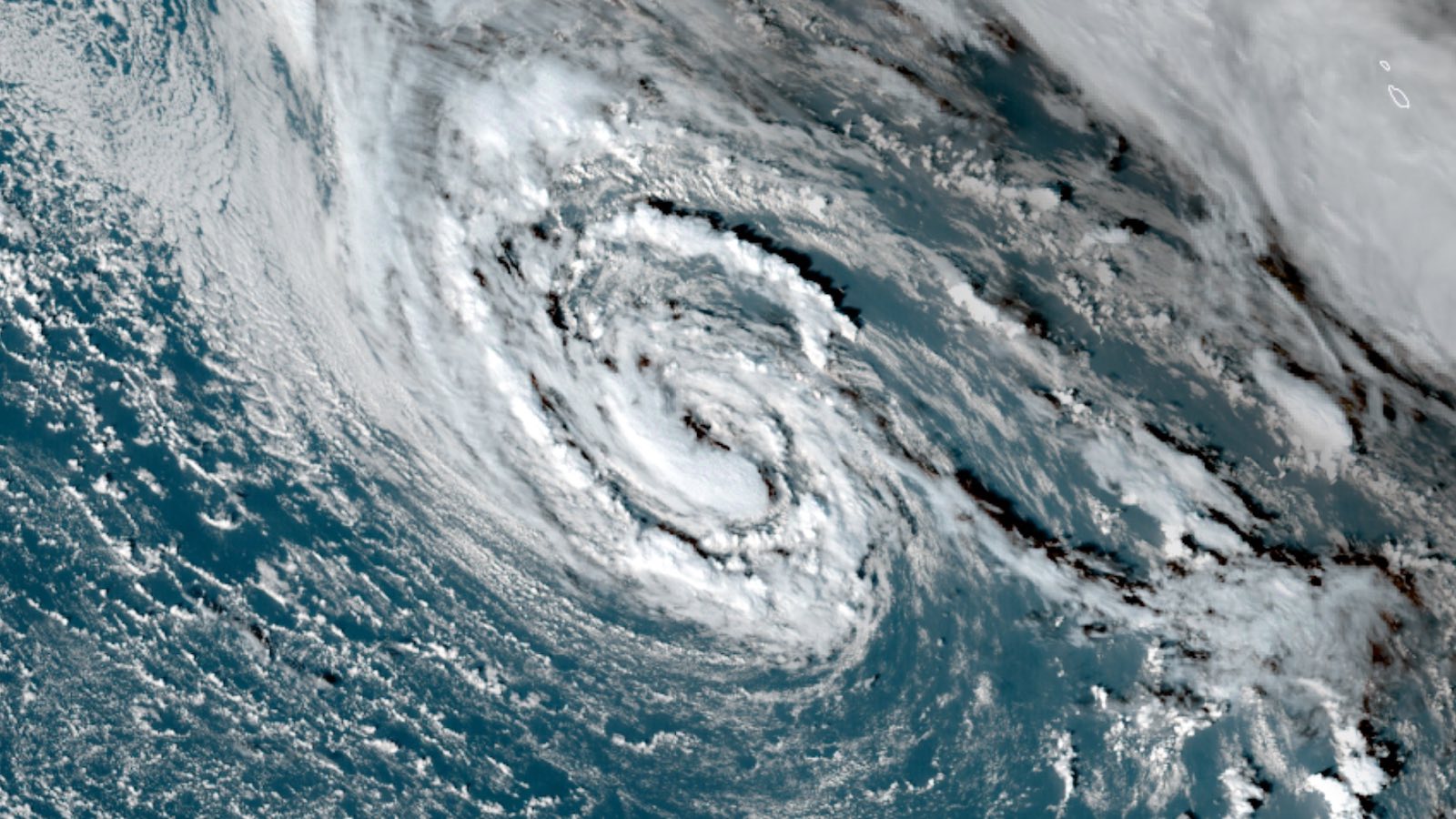
Former Subtropical Storm Wanda went tropical on Monday, November 1, as it was redesignated by the National Hurricane Center (NHC) as Tropical Storm Wanda. The name change at 5 p.m. EDT Monday wasn’t based on Wanda’s latitude—the storm remained poleward of 35 degrees latitude north, well away from the tropics—but instead based on its structure.
During the day on Monday, as Wanda moved away from the upper low that had assisted its evolution as a subtropical storm, Wanda gradually took on the characteristics of a warm-core cyclone, with a smaller and more sharply defined wind core.
Wanda’s status as a symmetric warm-core cyclone (a.k.a., a tropical storm) was supported by Florida State University analysis of GFS model output on Tuesday. Satellite images also revealed a healthy, symmetric cyclone, with multiple bands of thunderstorms arcing around its center. Thunderstorms late Tuesday were increasing and intensifying near Wanda’s center, and Wanda could strengthen slightly by Wednesday, as predicted by NHC.
With Wanda the last on the Atlantic’s official list of names for 2021, the storm’s evolution is a fitting bookend. The Atlantic season began with Subtropical Storm Ana, which developed as a subtropical storm northeast of Bermuda on May 22 and became a tropical storm on May 23.
Forecast for Wanda
As of 5 p.m. EDT Tuesday, Wanda’s top sustained winds were at 50 mph. Sea surface temperatures are running 1-2°C warmer than average for this time of year throughout most of the North Atlantic north of the tropics, helping to give Wanda a boost, as will a moist surrounding atmosphere (mid-level relative humidity of around 60-65%). Wind shear is predicted to remain moderately strong, at 10-20 mph, over the next couple of days.
Water temperatures of 22-24°C (72-75°F) are unusually low for a tropical cyclone, but the air aloft is so cold that warm-core-type dynamics are still being supported.
Light steering currents will allow Wanda to wander across the Atlantic west and northwest of the Azores throughout the week, with no dramatic change in intensity expected. By late week, Wanda will be moving over cooler waters and will encounter stronger wind shear and drier air, so a weakening trend may begin then. Eventually, Wanda will merge with an approaching frontal system.
Wanda could move over or near the northwestern-most Azores islands over the weekend as a tropical or post-tropical storm, as suggested by the 12Z Tuesday runs of the GFS and ECMWF models.
Elsewhere in the Atlantic, there were no other systems of potential interest for tropical development as of midday Tuesday. The Atlantic hurricane season doesn’t end until November 30, however, and recent years have seen significant hurricanes develop in the Caribbean in November, including Category 4 Hurricanes Eta and Iota (2020) and Category 3 Hurricane Otto (2016).
Website visitors can comment on “Eye on the Storm” posts. Comments are generally open for 30 days from date posted. Sign up to receive email announcements of new postings here. Twitter: @DrJeffMasters and @bhensonweather
Source link


