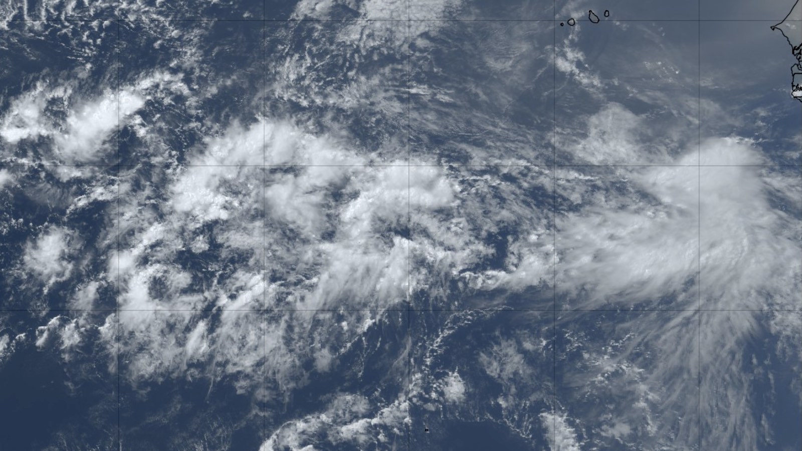
The islands of the Caribbean may experience their first named storm of 2022 next week, when a developing disturbance in the central Atlantic passes though the Lesser Antilles. On Friday afternoon, June 24, a tropical wave in the eastern Atlantic near 8°N, 30°W, designated 94L by the National Hurricane Center, was headed west at 15-20 mph. This position close to the equator will slow development of 94L, as it won’t be able to leverage the Earth’s spin much to help get itself spinning. However, the system otherwise had unusually favorable conditions for development for June, with sea surface temperatures near 28 degrees Celsius (82°F), light wind shear of 5-10 knots, and a moist atmosphere with a mid-level relative humidity of 70%.
The system looked moderately organized on satellite images on Friday afternoon, with a decent-sized area of heavy thunderstorms featuring a little bit of spin at mid-levels of the atmosphere. Disturbed weather is also evident to the east of 94L (see image at top), along the intertropical convergence zone near longitude 20°W.
June is unusually early to see a system like 94L in the main development region (MDR) for hurricanes (between the coast of Africa and Central America, including the Caribbean). Wind shear is typically much too high, ocean temperatures usually marginal, and often too much dry air to the north. However, 94L is so far south that it is dodging the dry air of the Saharan Air Layer to its north, and wind shear has uncharacteristically taken a holiday from the region.
The European and GFS models, and a number of their ensemble members, have 94L developing into a tropical storm by early next week. Steering currents favor a west to west-northwesterly track, with the Friday morning runs of the GFS and European models predicting 94L will enter the Windward Islands of the Lesser Antilles on Tuesday, June 28, or Wednesday, June 29, as a tropical depression or weak tropical storm. In a 2 p.m. EDT Friday Tropical Weather Outlook, NHC gave 94L two-day and five-day odds of formation of 20% and 60%, respectively. The first hurricane hunter mission into 94L is scheduled for Monday afternoon.
The next name on the Atlantic list of storms is Bonnie, a name that is one of the most recycled names on the rotating list of storms: Seven previous incarnations of Bonnie have appeared, beginning in 1980.
Across the 172 years of Atlantic hurricane records kept by NOAA, only four tropical storms have been known to develop in the MDR during June: an unnamed 1933 storm, Ana (1979), Bret (2017), and Elsa (2021). Ana and Bret reached the Antilles as tropical storms and dissipated shortly thereafter. Elsa strengthened into a Category 1 hurricane as it crossed the Windward Islands (becoming the first hurricane to strike Barbados at any time of year since Janet in 1955). It went on to cross the Caribbean and strike Cuba and Florida as a tropical storm, causing an estimated $1 billion in damage along its prolonged path. The 1933 system was the strongest of this small group, striking Trinidad and northeastern Venezuela as a Category 1 on July 2 and making landfalls in western Cuba and northeastern Mexico as a Category 2 hurricane.
The eastern Caribbean is notoriously hostile to early-season development, in large part because of the strong vertical wind shear and sinking motion that often prevail there during June and July. However, models are projecting considerably less shear than usual, as both easterly low-level trade winds and westerly upper-level winds are predicted to be weaker than usual.
Early-season storms in MDR: a likely harbinger of an active season
94L is growing organized early in the season in the main development region for hurricanes (between the coast of Africa and Central America, including the Caribbean). A named storm forming in this region in June or July is typically a harbinger of an active season, as it shows the atmosphere and ocean are conducive for activity.
Last year, Hurricane Elsa became a tropical storm on July 1 in the main development region, at 48.8°W, making it the second named storm on record to form so early in the season east of 50°W. The year 2021 turned out to be exceptionally active, with an extraordinary 21 named storms (third highest on record), seven hurricanes, four major hurricanes, and an accumulated cyclone energy (ACE) of 145. Those numbers compare with the 1991-2020 averages for an entire season of 14.4 named storms, 7.2 hurricanes, 3.2 major hurricanes, and an ACE index of 123.
The most easterly-forming June named storm on record was a 1933 system that became a tropical storm on June 25 at 45.2°W (thanks go to Brian McNoldy for this stat). That year was among the busiest seasons on record, with 20 named storms, 11 hurricanes, six major hurricanes, and the highest accumulated cyclone energy (ACE) on record: 259.
Website visitors can comment on “Eye on the Storm” posts. Please read our Comments Policy prior to posting. Comments are generally open for 30 days from date posted. Sign up to receive email announcements of new postings here. Twitter: @DrJeffMasters and @bhensonweather
Source link


