Typhoon Doksuri battered the northern Philippines for over 24 hours, with its eye passing directly over several small islands just north of the main Philippine island of Luzon. The powerful storm is now on its way to China, where landfall is expected on Thursday afternoon U.S. Eastern time.
On Tuesday, when Doksuri was at category 3 strength, it stalled for approximately six hours with its eye just off the coast of northwestern Luzon Island, subjecting a considerable portion of the coast to extreme eyewall winds and waves for an extended period. Rainfall has been especially heavy in northwestern Luzon, where the circulation around the south side of Doksuri, which is called Egan in the Philippines, pushed strong, moisture-laden winds against high terrain. As a result, Doksuri has caused extensive flooding, and heavy rains persisted across northwest Luzon into Wednesday evening.
In Laoag City, the capital city of the Ilocos Norte province, the 36-hour rainfall total of 461 millimeters (18.15 inches) through 8 p.m. Wednesday local time was close to the long-term average for the entire month of July. Stranded residents in the city’s submerged villages of Lusong, Zamboanga, Cavit, and Gabu were appealing for help to be rescued on social media. The Associated Press reported at least two flooding-related deaths from the Philippines, and it will be some time before damage in the hardest-hit areas is fully understood.
Forecast for Doksuri
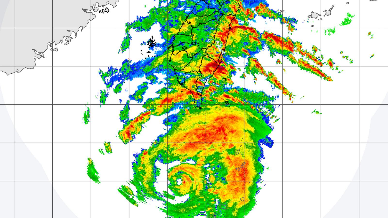
Doksuri’s stall along the coast of the Philippines weakened the typhoon from a category 4 storm with 140 mph winds to a category 2 with 110 mph over the 24 hours ending at 8 a.m. EDT Wednesday. As Doksuri begins to accelerate northwestward over still-warm waters, it is expected to pass around 100 miles off the coast of southwestern Taiwan, where the typhoon’s expansive circulation will bring gale-force winds. Widespread torrential rains are expected across Taiwan, with totals possibly exceeding 500 millimeters (20 inches) across mountainous areas.
The Joint Typhoon Warning Center predicts that Doksuri will remain a large and powerful typhoon with sustained winds of 100-115 mph as it heads northwest toward an expected landfall in China on Thursday afternoon (U.S. EDT) near Xiamen City. Since typhoons approaching this portion of the Chinese coast are typically weakened by encounters with the Philippines and/or Taiwan, landfalls by intense storms are uncommon. According to NOAA’s historical hurricane tracks website, only three category 2 or stronger storms are recorded to have hit near Xiamen City. The most recent of these was category 2 Typhoon Meranti of 2016 (100 mph sustained winds at landfall).
East Asia also needs to watch tropical disturbance 91W, currently located about 1,000 miles east of the southern Philippines. The GFS and European model and their ensembles have consistently been predicting that 91W will develop into a typhoon by late this week and potentially threaten Japan’s Ryukyu Islands and China early next week. Such a path could also enhance southwest monsoonal flow across the Philippines and Taiwan, bringing them yet more rainfall.
In the Atlantic: just one disturbance to watch
A tropical wave that emerged from the coast of Africa on Tuesday is predicted to speed west to west-northwest across the tropical Atlantic at 15-20 mph during the week. By Monday, July 31, the wave is expected to be several hundred miles northeast of the Leeward Islands, and there is some support for development around that time from a number of members of the GFS and European model ensembles, as well as the 6Z Wednesday operational version of the GFS model. In its 8 a.m. EDT Wednesday Tropical Weather Outlook, the National Hurricane Center gave the disturbance two-day and seven-day odds of development of 0% and 30%, respectively.
Tropical disturbance 95L moved through the Lesser Antilles Islands on Tuesday afternoon, bringing heavy rain showers and gusty winds. The disturbance has grown very disorganized over the central Caribbean, and the National Hurricane Center is no longer giving the disturbance a chance to develop.
Likewise, a weak area of low pressure a few hundred miles east of the Bahamas that was being monitored yesterday for development has also grown disorganized and is no longer being mentioned in the National Hurricane Center’s Tropical Weather Outlook.
Website visitors can comment on “Eye on the Storm” posts (see comments policy below). Sign up to receive notices of new postings here.
Source link