Click on the data points in the hurricane tracker map cone to retrieve current storm information and forecasts. The OFCL model is the official National Hurricane Center storm model. Press play to activate the storm tracker, radar, and satellite map. Use the LAYERS button in the lower right corner to adjust the storm map settings. Click on the links below to follow storm updates in the storm weather feed blogs. The feeds are retrieved automatically during hurricane updates from the NHC and are included in the these locations.
| Hurricane Models - Refer to Map. The OFCL is the official National Hurricane Center model. | |||
|---|---|---|---|
Hurricane Future Forecast
Press play to put future forecast in motion.
Tropical Cyclone Genesis and Formation Probability


Latest Tropical Weather Blog Posts
Hurricane Blogs from The Eyewall and Tropical Tidbits.
NHC YouTube Video Updates
Latest NHC YouTube Updates.
Tropical Weather Outlook Graphics


Tropical Weather Outlook Text
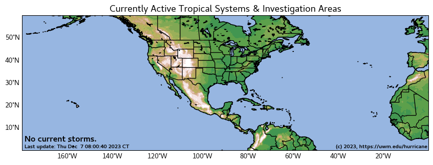
000
ABNT20 KNHC 302304
TWOAT

Tropical Weather Outlook
NWS National Hurricane Center Miami FL
700 PM EST Sun Nov 30 2025

For the North Atlantic...Caribbean Sea and the Gulf of America:

Tropical cyclone formation is not expected during the next 7 days.

This is the last regularly scheduled Tropical Weather Outlook of the
2025 Atlantic Hurricane Season. Routine issuance of the Tropical
Weather Outlook will resume on May 15, 2026. During the off-season,
Special Tropical Weather Outlooks will be issued as conditions
warrant.

$$
Forecaster Bucci