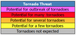
Tornado Impact Map
HTI graphics are issued by local Weather Forecast Offices (WFOs) when tropical cyclone (i.e. hurricane or tropical storm) wind watches and warnings, and/or storm surge watches and warnings, are in effect for at least part of their land area of responsibility. For detailed information, click the colored polygons on the map.

To view more hurricane impacts, view this link

