Note: I am presently traveling and unable to record video discussions for TD19. I will be able to create videos this weekend, if necessary.
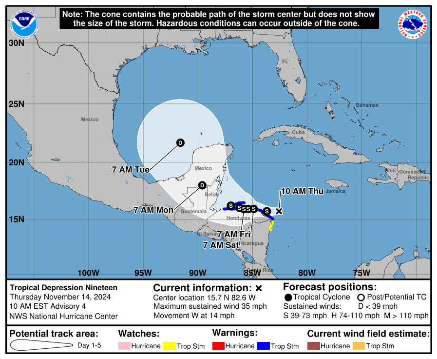
Tropical Depression 19 (#TD19) continues to gradually organize, but has not yet formed an inner core. Aircraft reconnaissance is finding a broad wind field with max surface winds around 35 mph. The storm center is located just east of #Honduras. A belt of somewhat dry low to mid-level air is wrapping into the NE quadrant, disrupting core convection a bit.
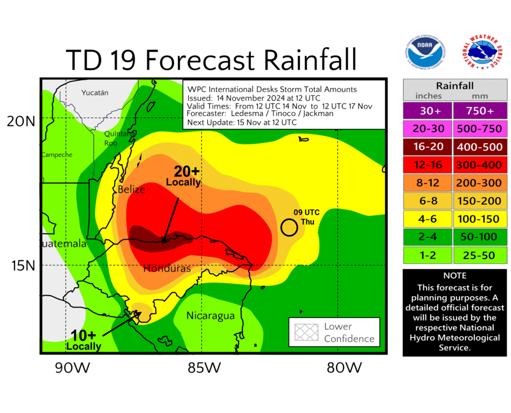
Due to where TD19’s vorticity ultimately coalesced, its westward track will carry it rather close to or over Honduras in the near future. The storm will also slow down considerably due to weakening steering currents as a ridge builds over the Gulf of Mexico. This will lead to potentially extreme flooding risk for portions of Honduras through the weekend. Hoping everyone stays safe in that region.
On Sunday or Monday, TD19 is expected to accelerate again northwestward around the western side of the ridge over the Gulf of Mexico, likely moving into #Belize and then crossing the #Yucatan Peninsula. The intensity of TD19 is highly dependent on just how much it interacts with the land mass from now through the weekend. Any track deviation farther over water could result in a stronger storm approaching Belize.
The currently anticipated land interaction over the next 4 days is now expected to weaken TD19 considerably prior to entering the Gulf of Mexico. Some models now suggest the storm could dissipate entirely, but at 4-5 days out, there is still uncertainty in this portion of the storm’s life cycle. TD19 or its remnants would likely turn north and northeastward across the gulf. Any potential impacts to the north or eastern gulf coast remain uncertain, but recent trends have been good news. Folks in the region should continue to monitor the forecast over the next few days just in case.
Basic HTML is allowed.
Source link


![Tropical Tidbits — [Thursday] Tropical Depression 19 Forms in the Western Caribbean](https://capeweather.com/wp-content/uploads/2024/11/Tropical-Tidbits-—-Thursday-Tropical-Depression-19-Forms-in-the.png)

