Tropical storm warnings are up for portions of Cuba, southern Florida, and the northwestern Bahamas as a large, rainy tropical disturbance over the southeastern Gulf of Mexico plows northeastward towards Florida. Designated Potential Tropical Cyclone One (PTC 1) by the National Hurricane Center (NHC), the disturbance has grown more organized over the past day, and is likely to become Tropical Storm Alex by Saturday.
A hurricane hunter aircraft investigating PTC 1 on Friday morning found a large area of heavy rains that were poorly organized, with a weak surface circulation center near the northeastern tip of Mexico’s Yucatan Peninsula. At 11 a.m. EDT Friday, PTC 1 was headed northeast at 5 mph with top winds of 40 mph and a central pressure of 1002 mb.
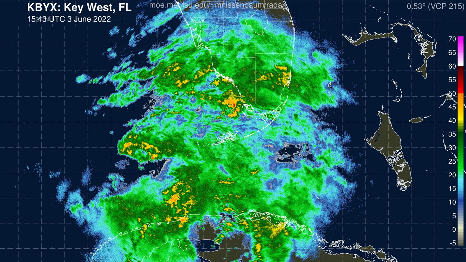
PTC 1 began spreading strong rain squalls through southern Florida on Friday morning, with Key West recording sustained winds of 29 mph, gusting to 38 mph, at 6:53 a.m. EDT. Radar-estimated precipitation from the Key West radar as of 12 p.m. EDT Friday showed that much of South Florida and western Cuba had received 1-3 inches of rain, with isolated amounts of five inches.


Forecast for PTC 1
The disturbance had marginal conditions for development Friday afternoon, with high wind shear of 20-25 knots, ocean waters of 27 degrees Celsius (81°F), and an atmosphere with a mid-level relative humidity of 60%. Satellite images on Friday afternoon showed that PTC 1 had a modest area of heavy thunderstorms entirely to the east of a poorly-defined low-level surface circulation near the northeastern tip of Mexico’s Yucatan Peninsula. Strong upper-level winds out of the west were keeping any heavy thunderstorms from forming on the west side of the center.
Wind shear is predicted to remain high for the next four days, and PTC 1 is unlikely to undergo rapid intensification during its lifetime. The odds of development appear to be greater after the system crosses over the Florida Peninsula and enters the waters off the Southeast U.S. coast on Sunday, when the National Hurricane Center is predicting it will reach its peak intensity, with 50 mph winds.


Heavy rains from PTC 1 will be its main threat, with two-day rainfall amounts of five-plus inches expected over portions of Mexico, Cuba, South Florida, and the western Bahamas by Sunday, June 5. Because of dry air to the northwest of the system, a sharp cutoff point for the heavy rains is expected over central Florida. Minor coastal flooding from a storm surge of 1-3 feet will also accompany the landfall of PTC 1 in coastal southwestern Florida and the Keys.
Isolated tornadoes Friday evening and early Saturday are also a concern over extreme South Florida, primarily in southern Miami-Dade and Monroe Counties, which NOAA’s Storm Prediction Center has placed in its “Slight Risk” area for severe weather (level two on a scale of one to five, with five being the highest risk). Historically, tornadoes associated with tropical cyclones are weak, with about 90% rated EF0 or EF1, but the threat is higher when the tornadoes occur during the dark of night, when people are sleeping.
In its 8 a.m. EDT Friday Tropical Weather Outlook, NHC gave PTC 1 two-day and five-day odds of formation of 90%.
Bob Henson contributed to this post.
Website visitors can comment on “Eye on the Storm” posts (see below). Please read our Comments Policy prior to posting. (See all EOTS posts here. Sign up to receive notices of new postings here.)
Source link