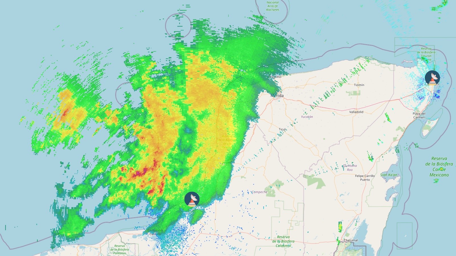
There was little change to the status of Tropical Storm Karl in the southern Gulf of Mexico’s Bay of Campeche on Thursday morning, and the storm is expected to make landfall in Mexico early Saturday morning, with heavy rains being the main threat.
At 11 a.m. EDT Thursday, October 8, Karl was about 245 miles north of Coalzacoaltos, Mexico, with top sustained winds of 50 mph. Satellite images showed that the low-level center of Karl was almost exposed to view, with all of the storm’s heavy thunderstorms located to the southeast of the center. This configuration was the result of strong upper-level winds out of the northwest, which were creating a high 20 knots of wind shear over Karl.
The wind shear is predicted to remain moderate to high over the next two days, as a ridge of high-pressure forces Karl to the south at about 5 mph. The high shear, in combination with a dry atmosphere with a mid-level relative humidity of 55%, is expected to prevent any significant strengthening of Karl before landfall occurs in Mexico on the south-central coast of the Gulf of Mexico early Saturday morning. Heavy rains will be the main threat from Karl, with widespread amounts of 3 – 7 inches predicted near the landfall location. Fortunately, the portion of Mexico where Karl’s heaviest rains will be falling have dry soils, with moderate drought in some areas.
Hurricane Julia’s death toll at 76, with 52 missing
The rains from Hurricane Julia finally ended on Tuesday over Central America after the category 1 hurricane made landfall in Nicaragua on Saturday, October 8. Satellite estimates from NOAA’s Climate Prediction Center indicated that Julia dropped widespread rainfall amounts of 4 – 8 inches across much of Nicaragua, northern Honduras, northern Guatemala, eastern El Salvador, Trinidad and Tobago, and coastal regions of Panama, Costa Rica, Colombia, and Venezuela.
Julia is being blamed for at least 76 deaths across the Caribbean and Central America, all from heavy rains causing landslides and flooding. Most of those fatalities occurred in Venezuela, where a landslide in Las Tejerias on Saturday (two days after Julia passed through far northern Venezuela as a tropical depression) killed 43 and left 50 missing. Julia’s rains killed 14 in Guatemala and 10 in El Salvador, and also caused fatalities in Trinidad and Tobago, Nicaragua, Panama, Honduras, and Mexico.
Julia’s remnants continued to linger on Thursday near the Pacific coast of Mexico, but the National Hurricane Center (NHC) gave near-zero odds of any redevelopment in its 8 a.m. EDT Thursday Tropical Weather Outlook.
A disturbance in the eastern Atlantic to watch
A tropical wave located a few hundred miles south of the Cabo Verde Islands off the coast of Africa was moving west to west-northwest at 5-10 mph on Thursday morning. Satellite images showed that the wave was poorly organized, with modest heavy thunderstorm activity with a bit of spin. Conditions were favorable for development, with warm waters near 28 degrees Celsius (82°F), moderate wind shear of 10-20 knots, and a moist atmosphere. The wave has only weak model support for development, and models do not show the wave threatening any land areas in the coming week.
In its 8 a.m. EDT Thursday Tropical Weather Outlook, NHC gave the wave 2-day and 5-day odds of development of 0% and 20%, respectively. The next name on the Atlantic list of storms is Lisa.
Bob Henson contributed to this post. Website visitors can comment on “Eye on the Storm” posts (see comments policy below). Sign up to receive notices of new postings here.
Source link