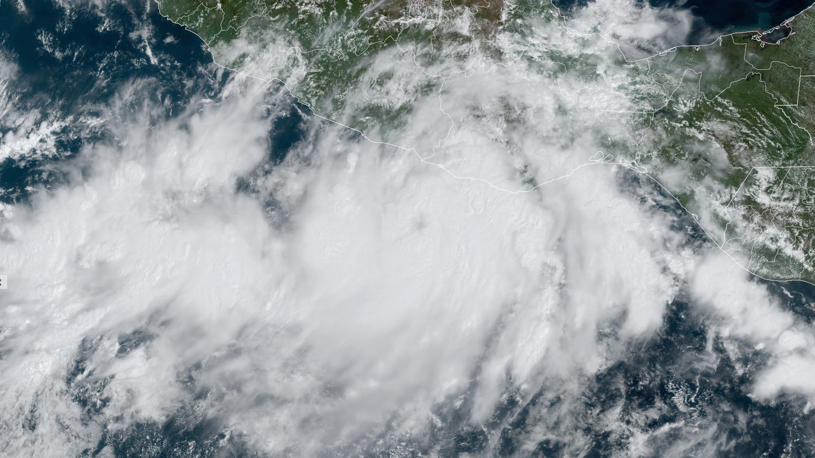
A potentially devastating hurricane heading for Mexico has spun up in the Pacific. As of 11 a.m. EDT Monday, Tropical Storm John was quickly gaining strength about 105 miles south of Punta Maldonado, which is located on Mexico’s south coast near the border of Guerrero and Oaxaca states about 80 miles east-southeast of Acapulco. John was drifting north at just 3 mph (4.8 kmh).
#John is clearly keen to reach the limit of its environment and has stepped on the gas. Vortical hot towers are now wrapping to solidify further the already established low-level and mid-level cores, and it's likely a dangerous hurricane is on the approach to Southern Mexico. pic.twitter.com/vM6YHdr3ZC
— Kacper (@KacperWx) September 23, 2024
John was packing top sustained winds of 70 mph (113 kmh) on Monday morning, a mere 12 hours after it was still officially a tropical depression with 30-mph (48 kmh) winds. The storm has thus already more than met the definition of rapid intensification. Conditions are nearly ideal for rapid strengthening, possibly all the way up until an expected landfall on Tuesday. Sea surface temperatures ahead of John are 30-31 degrees Celsius (86-88°F); wind shear will be light, dropping to around five knots; and John is embedded in a moist atmosphere with a mid-level relative humidity around 70%. The oceanic heat beneath John’s path will be fairly limited, as John is already close to the coast and over shallow water, but this should pose little impediment for John given the extremely supportive conditions overall. John is predicted to continue slowly northeast, making landfall on Tuesday afternoon or evening along the western Oaxacan coast.
There are ominous precedents for extremely rapid intensification just off the Mexican coast, including Hurricane Patricia (2015) and Hurricane Otis (2023). Patricia rocketed from tropical storm to Category 5 strength in 24 hours, spinning up the strongest sustained tropical-cyclone winds on record globally (estimated at 215 mph), then weakened just before landfall and struck a sparsely populated area. Otis vaulted from official tropical-storm to Cat 5 strength even more quickly than Patricia – in just 12 hours – and made a catastrophic direct hit on Acapulco at close to peak strength, replacing Patricia as the Pacific’s strongest landfalling hurricane on record and becoming Mexico’s costliest hurricane on record.


There are no large cities ahead of John, but its rapid strengthening and slow movement could lead to truly dangerous rainfall totals – possibly exceeding 30 inches (760 mm) locally, with widespread 10-20 inch (250-500 mm) totals – that could produce catastrophic flooding and mudslides. A substantial storm surge is possible just east of where John comes ashore.
We help millions of people understand climate change and what to do about it. Help us reach even more people like you.
Source link


