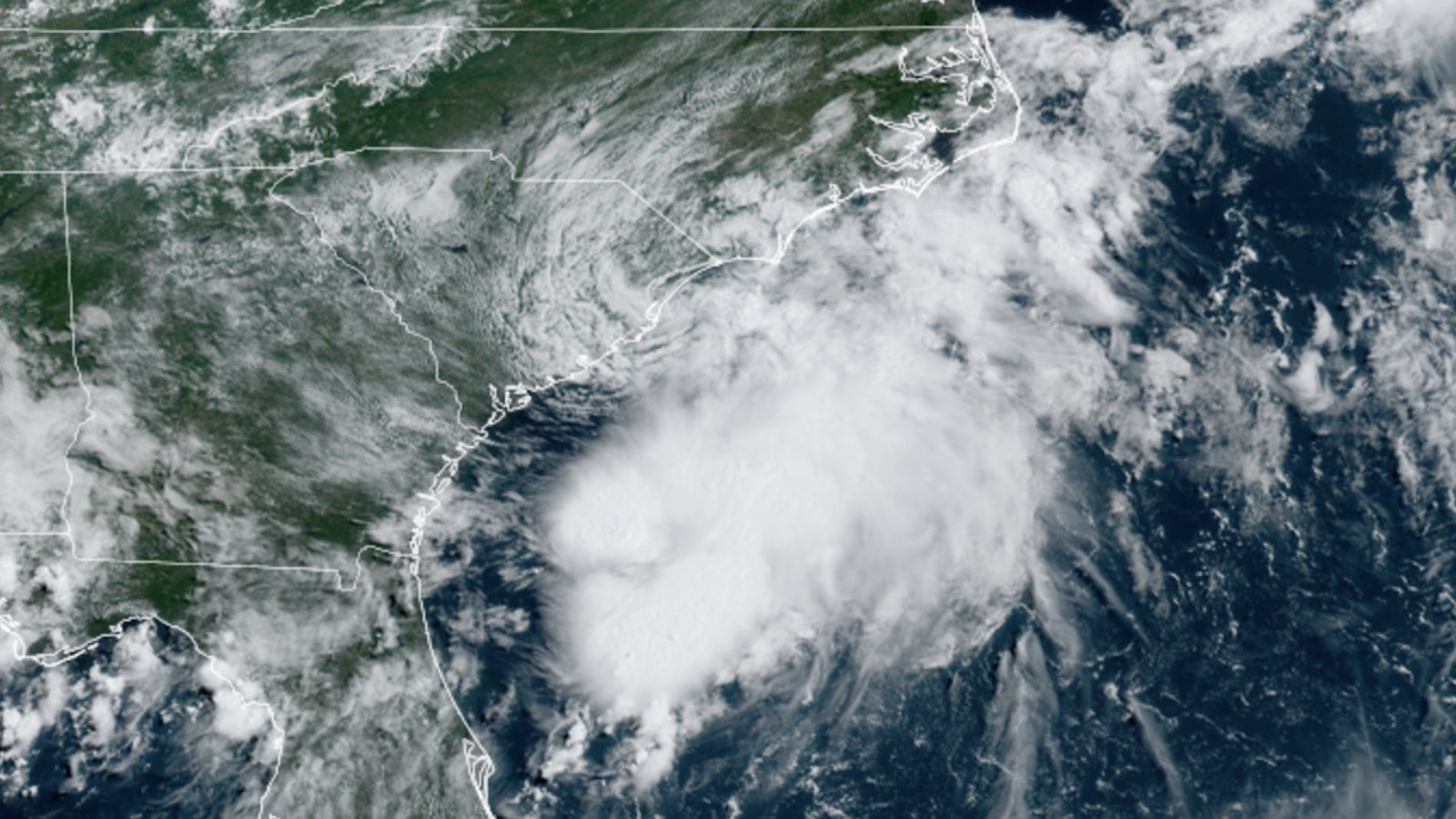
In a surprise to forecasters, Tropical Storm Colin developed at 5 a.m. EDT Saturday from a persistent trough of low pressure along the coast of South Carolina. The initial location of the storm was just inland, so Colin can be considered to be the first U.S. landfalling named storm of 2022. Over the period 1991-2020, the average appearance of the season’s third named storm was August 3, so 2022 now is running more than a month ahead of average.
As of 11 a.m. EDT Saturday, Colin was five miles west of Myrtle Beach, South Carolina, heading northeast at 7 mph with top winds of 40 mph and a central pressure of 1012 mb. Radar imagery showed Colin bringing intermittent heavy rains to the coasts of South Carolina and North Carolina, but most of the storm’s rains were over water.
Satellite images also showed that Colin’s heavy thunderstorms were primarily over the ocean, away from land, since strong upper-level winds out of the northwest were creating about 20 knots of wind shear. The atmospheric and oceanic conditions around Colin will allow for only a brief life as it moves northeast to east-northeast along the coast: a cold front will begin to affect Colin by Saturday night, with wind shear increasing to a very high 30 knots by Sunday night, and sea surface temperatures of 25.5 degrees Celsius (78°F). The main threat of the storm will be isolated flooding from one to two inches of heavy rains, with isolated amounts of four inches.
This is the third tropical storm named Colin, a name introduced in 2010 after the retirement of 2004’s devastating Category 4 Hurricane Charley.
Bonnie makes landfall near the Costa Rica/Nicaragua border
Tropical Storm Bonnie made landfall just before 11 p.m. EDT Friday near the Costa Rica/Nicaragua border with top winds of 50 mph. At the time of landfall, an Air Force hurricane hunter aircraft found Bonnie had formed an eyewall and was well on its way to becoming a hurricane, so it is fortunate that the storm took so long to get organized.
Passage over the relatively flat terrain of Nicaragua allowed Bonnie to retain its structure, and it emerged into the eastern Pacific around 11 a.m. EDT Saturday as a tropical storm with 40 mph winds. Bonnie is the first storm to cross from the Atlantic into the Pacific and maintain its identity as a named storm since Hurricane Otto in November 2016. Bonnie is expected to strengthen into a category 1 hurricane by Tuesday and trace a path roughly parallel to the Pacific coast of Mexico.
Tropical wave just west of Lesser Antilles poses little threat
A tropical wave that moved through the Lesser Antilles Islands on Friday into the eastern Caribbean was moving west-northwest at 10-15 mph. Satellite images showed the wave to be quite disorganized and headed into an area of high wind shear that will make development unlikely. In an 8 a.m. EDT Saturday tropical weather outlook, the National Hurricane Center gave the wave 2-day and 5-day odds of development of 10%.
Website visitors can comment on “Eye on the Storm” posts. Comments are generally open for 30 days from date posted. Sign up to receive email announcements of new postings here. Twitter: @DrJeffMasters and @bhensonweather
Source link