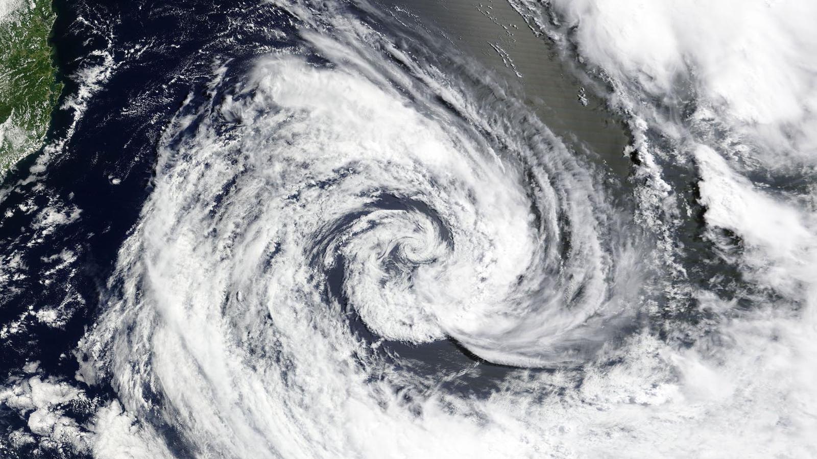
The only ocean basin on Earth that does not regularly see tropical cyclones develop is the South Atlantic, but it had a rare tropical storm form on Sunday night. Tropical Depression 01Q was designated by the Brazilian Navy Hydrographic Center at 7 a.m. EST Sunday and by 7 p.m., it had been upgraded to Tropical Storm Akará, with top sustained winds estimated at 40 mph and a central pressure of 1,000 millibars. NOAA’s Office of Satellite and Product Operations was also tracking Akará and assigning Dvorak intensity ratings.
Although one or two subtropical storms typically form each year in the South Atlantic, Akará is the region’s first officially recognized tropical storm that has been named since Iba in 2019 and only the third one there since Anita in 2010.
On those few occasions when tropical cyclones do form in the South Atlantic, they are typically located within a few hundred miles of the coast of Brazil. Such was the case with Akará, which was centered about 300 miles southeast of São Paolo as of 7 p.m. EST Sunday. Satellite imagery on Monday showed a well-organized but partially exposed low-level circulation. The images showed that the storm had lost nearly all of its heavy thunderstorm activity near the center, and the storm had taken on a more subtropical appearance, with the heaviest thunderstorms concentrated in a band well removed from the center.
Akará is predicted to remain at minimal strength through Tuesday and gradually weaken and lose its tropical characteristics as it heads south toward cooler waters, remaining well offshore.
Sea surface temperatures in the vicinity of Akará on Monday were around 0.5 degrees Celsius warmer than average, at around 26 degrees Celsius (79°F), or what’s typically considered to be the minimum threshold for tropical development. Unusually warm water has been covering most of the North and South Atlantic for months now. In fact, readings in the eastern tropical Atlantic are at record-warm levels for mid-February — already up to values more typical of early summer.
South Atlantic tropical cyclones: a 21st-century acknowledgment
Until the 2000s, it was widely thought that full-fledged tropical cyclones did not form in the South Atlantic. Although waters can be sufficiently warm, there is often too much wind shear, and tropical waves that can serve as seedlings for tropical cyclones do not stream regularly off the coast of southern Africa as they do from northern Africa. For these reasons, the South Atlantic was not canvassed by reconnaissance flights, and satellite imagery was not monitored closely for tropical development.
In 2004, expectations were upended when a nontropical system off the coast of Brazil gradually transitioned into a tropical cyclone and then turned back westward. The system came to be known as Hurricane Catarina, as it made landfall in the Santa Catarina province of Brazil as a Category 1 equivalent on March 27, 2004. More than 38,000 structures were damaged, and another 1,468 collapsed, with three people killed and 185 others injured.
After Catarina, forecasters and researchers began to pay closer attention to the South Atlantic, reviewing older satellite images and other evidence of past activity. Research released in 2012 found that 63 subtropical cyclones had formed between 1957 and 2012, or about one subtropical cyclone every year. In the eight years from 2015 through 2023, there were 13 more subtropical storms, as well as Tropical Storm Iba in 2019 and short-lived Tropical Storm 01Q in 2021 (which was recognized by NOAA but not named by the Brazilian Navy).
The first list of names for subtropical and tropical cyclones in the South Atlantic appeared in 2011. Originally including 10 names, the ongoing multiyear list was expanded to 15 names in 2018, and 32 more names were added in 2022. Akará is the first of these 32 new names to be used.
It’s tough to ascertain whether subtropical storms are actually occurring more often over time in the South Atlantic, are being identified and named more frequently, or both. In addition, because records prior to this century are so sparse across the region, it’s difficult to tell whether human-induced climate change has played any role in the increased number of tropical and subtropical cyclones being detected there. The waters over which Catarina formed in 2004 were actually slightly cooler than average for the time of year, according to an analysis by Ron McTaggart-Cowen and Lance Bosart of the University at Albany, SUNY.
One interesting recent case is Subtropical Storm Raoni of 2021, which evolved from a potent nontropical storm off the coast of far southern Brazil near the border with Uruguay. According to a 2022 study led by Michelle Simões Reboita of the Federal University of Itajubá, Brazil, this cyclone shared some meteorological DNA with some of the North Atlantic’s most intense storms on record, including the infamous “Perfect Storm” of October 1991. The key feature in common was a warm core tucked (or “secluded”) within a classic frontal structure, one that’s more akin to a winter storm than a hurricane. This is the first time such a structure has been identified in the South Atlantic, according to the study authors.
Source link


