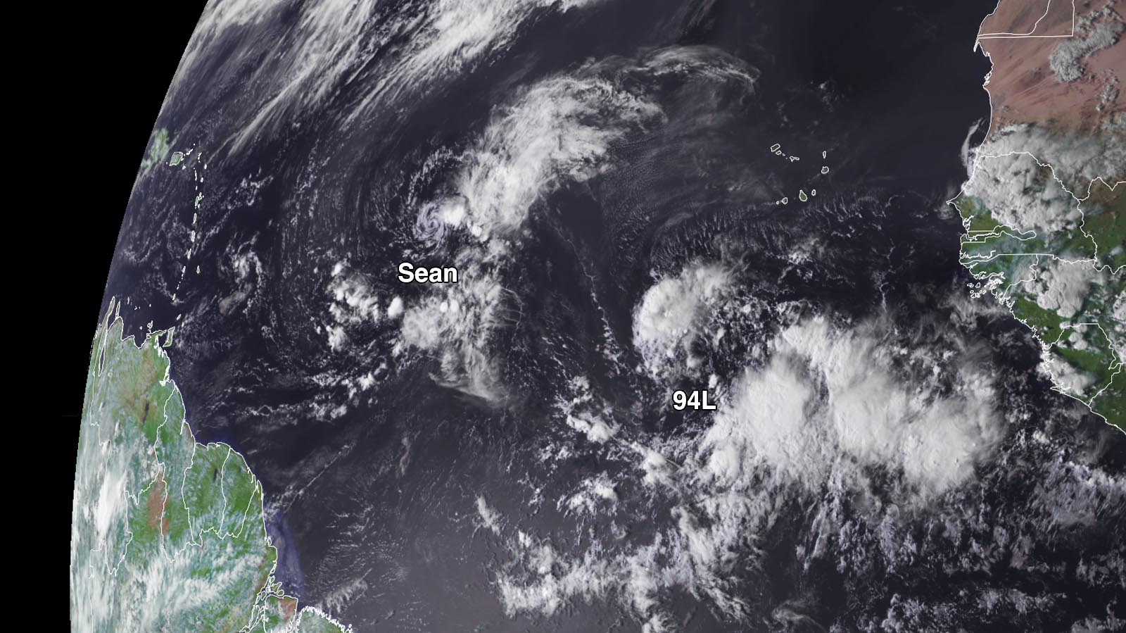
Tropical Storm Sean was on its last legs Friday as an unremarkable Atlantic system, but a new disturbance will need to be watched much more closely. This system, dubbed Invest 94L by the National Hurricane Center, shows signs of marching across the Main Development Region and possibly reaching the Lesser Antilles as a tropical depression or named storm late in the week, which would be a rare occurrence for so late in hurricane season.
Satellite images on Friday afternoon showed that the new system was located several hundred miles south-southwest of the Cabo Verde Islands. The disturbance had only a limited amount of heavy thunderstorms but an impressive amount of spin. Surface pressures are on the high side, at or above 1010 millibars. What’s noteworthy is that 94L is located quite close to the equator, near latitude 9 degrees north, and a powerful upper ridge will be developing across the subtropical Atlantic. These factors will give 94L a higher chance of reaching the Lesser Antilles than was the case for multiple other systems in the deep tropical Atlantic.
An unusually moist atmosphere will be swaddling 94L for the next few days, with midlevel relative humidity in the 70 to 80% range, though some dry air to the north could intrude into the system. Wind shear is predicted to remain light (5-10 knots). Moreover, like this year’s other systems in the Main Development Region, 94L will also draw on unusually warm sea surface temperatures for this time of year, 29-30 degrees Celsius (84-86 degrees Fahrenheit). Together, this looks like an unusually supportive set of conditions to nurture a tropical cyclone.
It will likely take 94L several days to organize, assuming it does, and it’s still possible that a closed circulation will never take shape. In its Tropical Weather Outlook issued at 2 p.m. EDT Friday, the National Hurricane Center gave 94L two- and seven-day odds of development of 20% and 80%. Forecast models are inconclusive guides when a system is this early in its development, and there have been stark differences among the leading long-range models and their ensembles on whether 94L will develop into a substantial tropical cyclone. If 94L does manage to organize, it could be a tropical depression by Monday or Tuesday and would have a chance at gaining strength through the week as it moves west. Any impacts on the Lesser Antilles would be late in the week, with the 12Z Friday operational run of the European model predicting that 94L would move through the Lesser Antilles on Friday, October 20. The GFS model and its ensemble members generally have been predicting that 94L will recurve to the north before reaching the Lesser Antilles, though. The next name on the Atlantic list is Tammy.

Only a few hurricanes have made it from the Main Development Region into the Lesser Antilles this late in any year, as shown in Figure 1. Sea surface temperatures in the region are typically marginal for supporting hurricanes by mid-October, and midlatitude jet-stream winds are often dipping further south, adding wind shear and hauling storms out to sea. While nearly all of the hurricanes shown in Figure 1 moved with an east-to-west component, one of them — Lenny — was famous for its contrary behavior. Nicknamed “Wrong-Way Lenny” for its west-to-east track, Lenny passed just south of St. Croix in the U.S. Virgin Islands on November 15, 1999, as a high-end Category 4 storm (see bright purple line at top left) with top sustained winds of 155 mph.
Sean muddles along in the remote tropical Atlantic
Tropical Storm Sean remained a highly sheared storm on Friday afternoon, with pulses of ragged convection bubbling well to the east of its low-level center. As of 11 a.m. EDT Friday, Sean’s top sustained winds were at minimal tropical-storm strength, 40 mph. Sean was located in the central tropical Atlantic about 1,180 miles west of the Cabo Verde Islands, moving west-northwest at 12 mph. Forecast models show that wind shear will continue to plague Sean, driving increasingly dry air into the system. Sean is predicted to degrade into a post-tropical low on Sunday.
Jeff Masters contributed to this post.
Website visitors can comment on “Eye on the Storm” posts (see comments policy below). Sign up to receive notices of new postings here.
Source link


