With the upcoming new moon on Wednesday, October 6, and the moon near perigee (its closest approach to the Earth), much of the southeast U.S. coast will be experiencing “king tides” this week – the highest high tides of the year. In Charleston, South Carolina, the high tide cycles on Friday and Saturday will be around the third highest of the year – just 0.2 feet below the threshold for minor flooding.
A disturbance over the Bahamas on Tuesday will be drifting toward the mid-Atlantic through the week and enhancing the tides in Charleston. In its 8 a.m. Tuesday tropical weather discussion, the National Hurricane Center gave this disturbance only a 10 percent chance of evolving into at least a tropical depression between Thursday and Sunday. Regardless of any development, persistent onshore wind from this disturbance, combined with the high astronomical tides, will lead to minor and perhaps moderate coastal flooding this week in Charleston, according to the National Weather Service. Any heavy rains that fall inland will increase the coastal flood threat, as high tides block the drainage of river runoff into the ocean.
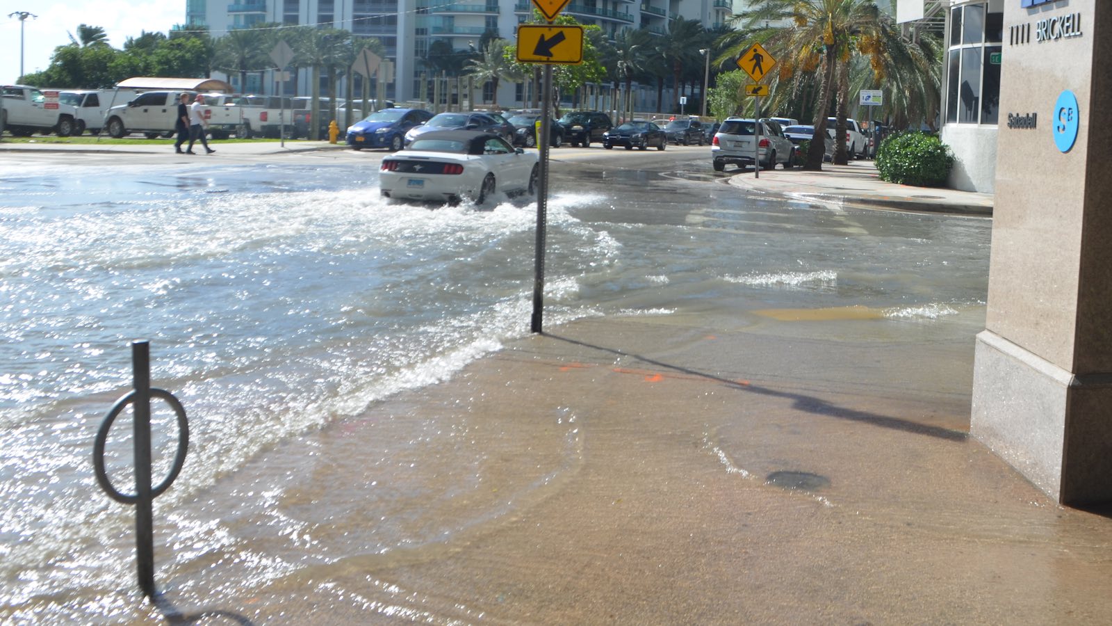
Tides should not be exacerbated by this disturbance toward Miami, one of the areas hardest hit by king tides in recent years. Brian McNoldy, of the University of Miami Rosenstiel School, predicts that the area’s king tides may be relatively subdued this year because of lunar orbital factors.
“During the most rapid downward phase of the lunar nodal cycle – like we’re in right now – we have a bit of a reprieve in the observed rate of sea-level rise, all other things being equal,” McNoldy told a South Florida NBC station. “So, unless we get a strong onshore flow, I don’t think we’ll see much more than the usual boat ramp and dock floods. Getting water onto the streets like in other years is going to be harder in 2021.”


How climate change turns minor tidal flooding into a big deal
Disruptive tidal flooding that now affects the U.S. Gulf and Atlantic coastlines three to six days per year will strike as often as 80 to 180 days a year by the 2040s, according to a 2018 report from NOAA’s National Ocean Service, “Patterns and Projections of High Tide Flooding along the U.S. Coastline Using A Common Impact Threshold” (see PDF). That report built upon projections of global and regional sea-level rise that were released in a separate NOAA report earlier in 2018 (see PDF).
The first sentence of the earlier report makes no bones about the situation: “Long-term sea level rise driven by global climate change presents clear and highly consequential risks to the United States over the coming decades and centuries.”
Though it’s often called “nuisance” flooding because it poses little threat to life or limb, high-tide flooding is a fast-growing threat to the economies and the built environment of coastal areas, especially along the Gulf and Atlantic shores. In South Florida alone, hundreds of millions of dollars are being spent to combat both long-term sea-level rise and also routine “king tides” that are getting worse.
High-tide flooding is distinct from extreme storm surges related to tropical cyclones and nor’easters, although they can overlap. By definition, high-tide floods happen at predictable points in the tidal cycle, such as the period from late summer into autumn when astronomical tides are at their highest. They can be enhanced by seemingly innocuous weather features, such as strong high pressure offshore that pushes high water toward the coast under sunny skies.
High-tide flooding is now accelerating at 75 percent of the NOAA tide gauge locations along the East and Gulf Coasts, with nearly all other locations rising at a more linear rate (see Figure 3 below). Already, the U.S. annual high-tide flooding frequency is more than twice that in the year 2000 as a result of rising relative sea levels.


In the IPCC Sixth Assessment Report’s Working Group I document, released in August, the panel concluded in section 12.4.6.5: “Observations indicate that episodic coastal flooding is increasing along many coastlines in North America (robust evidence, high agreement), and this episodic coastal flooding will increase in many North American regions under future climate change (high confidence).” Toward Hudson Bay and the Atlantic coast of Canada, the panel noted, the confidence in climate-change impacts on coastal flooding thus far is muted by the rebound effect of shorelines that are still rising in the wake of the massive ice sheets that receded thousands of years ago.


Along parts of the Atlantic coast, especially from the Carolinas to New England, regional factors—including subsidence and the knock-on effects of a weakening Gulf Stream—will increase sea level at a faster pace than the global average. On the U.S. West Coast, the rugged topography will reduce the flooding potential of a given increment of sea-level rise. Still, the NOAA report found that an intermediate-low scenario for global sea-level rise (a total of 19.7” by 2100) would push the average number of high-tide flooding days per year on the west coast of North America up to 13-17 in the 2040s and 67-84 by the 2090s.
Under that intermediate-low scenario, high-tide flooding can be expeced virtually every day by the 2090s along the western U.S. Gulf Coast, and on two out of three days along the northeast U.S. Atlantic coast. The report notes: “By definition, ‘every other day’ high-tide flooding would bring to fruition the saying championed by NOAA’s (late) Margaret Davidson: “Today’s flood will become tomorrow’s high tide.”


Website visitors can comment on “Eye on the Storm” posts. Comments are generally open for 30 days from date posted. Sign up to receive email announcements of new postings here. Twitter: @DrJeffMasters and @bhensonweather
Source link