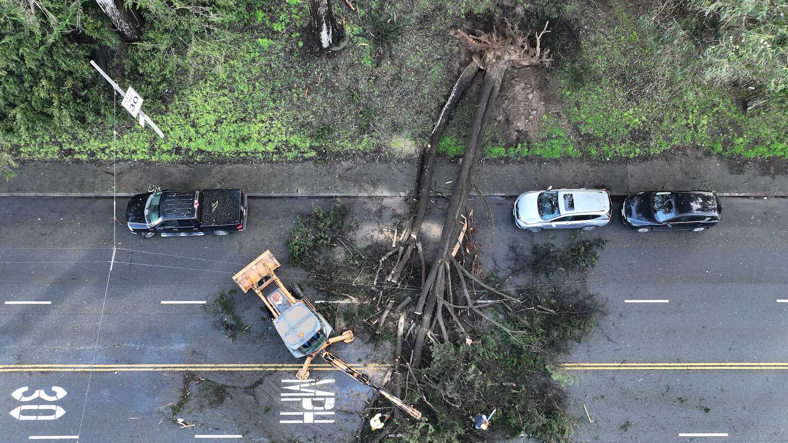
California’s infamous drought-to-deluge-to-drought climate has just swung hard toward the wet end of the spectrum. Three weeks of relentless storms brought San Francisco some of its heaviest rains in more than a century. Floodwaters inundated large areas, tens of thousands of Californians lost power, and countless trees were toppled across the state as gale-force winds blew atop saturated soils.
Despite the widespread havoc they produced, the storms were hugely helpful in restoring California’s water supply after a punishing three-year drought, one whose hydrological and ecological impacts were made worse by a warming climate.
The rainstorms were produced as a series of atmospheric rivers – channels of water vapor several miles deep and hundreds of miles long – plowed into California from the west. Each one pulled in a fetch of deep moisture from the subtropical Pacific, thousands of miles away, then concentrated that moisture into bands that ran below the upper-level jet stream and parallel to low-level cold fronts.
The vigorous jet-stream disturbances that kicked off each atmospheric river also generated several intense surface lows over the North Pacific, including one that qualified as a “bomb cyclone” (and that one ranked among the strongest surface lows on record at such a low latitude, south of 40 degrees north). Bomb cyclones are storms that deepen by at least 24 mb in pressure in a 24-hour period.
Widespread rains across California were boosted with the arrival of each atmospheric river, and there were few breaks during the three-week parade of storms.
San Francisco’s most intense multiday bouts of rain since the 1800s
While many parts of the Golden State saw moderate to heavy rain, with some torrential downpours in the mix, San Francisco took the hydrologic cake. Rainfall has been measured in downtown San Francisco since 1849, making it one of the nation’s longest-running observation points for precipitation. It’s all the more impressive, then, that San Francisco achieved the following, as cataloged by Jan Null of Golden Gate Weather Services:
A massive boost to water storage
Reservoirs far below capacity got a hefty refill from the storm sequence.


A billion-dollar repair job ahead
Repairing damage inflicted by the three-week storm onslaught could run as high as $1 billion, according to initial estimates cited by the Los Angeles Times, which would make it the state’s costliest winter weather event in at least six years. Damage of $1.8 billion (USD 2022) incurred in February 2017 included more than $1 billion for repairs to Oroville Dam, where floodwaters compromised both the main and emergency spillways and triggered a frightening short-fuse evacuation of more than 180,000 people.
Sierra snowpack hits record-high values for mid-January
The recent series of atmospheric rivers produced monumental snows as well as torrential rains. When analyzed across 118 stations, the Sierra Nevada snowpack held 32.7 inches of water as of Jan. 18. That’s 248% of average for the date and a record high for the date in measurements going back to 1970 (the old record for Jan. 18 was 28.4 inches).
Moisture captured in snowpack can be even more valuable than the rain flowing into reservoirs, as snowfall eliminates the risk of immediate flooding from rainfall runoff in favor of what’s typically a more gradual springtime melt-off (although an unusually warm late-season storm with rain falling atop a deep snowpack can have dangerous flooding consequences).


Is the drought over?
According to the U.S. Drought Monitor, more than a third of California was covered by extreme to exceptional drought (D3-D4 on Figure 3) during most of the period from late 2020 to late 2022. As the latest storms arrived, the D3-D4 drought extent plunged from 36% of the state on Dec. 27 to just 0.32% by Jan. 10. By Jan. 17, all of the state’s D3-D4 drought areas were gone.


Despite this fantastic first half of the water year, it would be premature to declare that the state’s drought is over. For one thing, longtime Western weather watchers are aware that the second half of a water year is every bit as important as the first.
“As you know, we’ve seen this scenario before,” tweeted California writer Ed Joyce. “Prodigious start to the winter after drought, then the spigot goes dry and we’re hoping for a ‘Miracle March’.”
The latest 7-day precipitation forecast from the National Weather Service calls for no precipitation for most of California, with a few isolated regions receiving less than a half inch. Long-range computer forecasts favor a continued drier-than-average period for the state into early February.
Whether it’s a wet or a dry pattern, reservoirs can’t simply close their gates and retain every drop of potential storage. On the dry side, environmental laws mandate a certain minimum flow in some rivers to support endangered aquatic life, which can require a certain amount of release from reservoirs. Conversely, if reservoirs were to fill to their actual capacity too soon in a big water year, then they’d be unable to help mitigate flooding when the next big rain arrives.
In the broader sense, any drought relief in California is temporary. The rainy season itself has gotten shorter since the 1960s, as the onset of autumn/winter rains shifts later in the calendar year. On top of this, our human-warmed atmosphere allows meteorological drought (a simple lack of rain or snow) to suck more moisture out of reservoirs, rivers, and soils, exacerbating what’s known as hydrologic and agricultural drought.
By the same token, a warming atmosphere fosters more evaporation from the ocean, helping pump more moisture into rainmaking systems. The upshot: An already variable climate could experience even more “weather whiplash” in rainy seasons that are projected to grow shorter but more intense.
We’ll have more on the water-drought situation in California and the Southwest in forthcoming posts.
Jeff Masters contributed to this post. Website visitors can comment on “Eye on the Storm” posts (see below). Please read our Comments Policy prior to posting. (See all EOTS posts here. Sign up to receive notices of new postings here.)
Source link