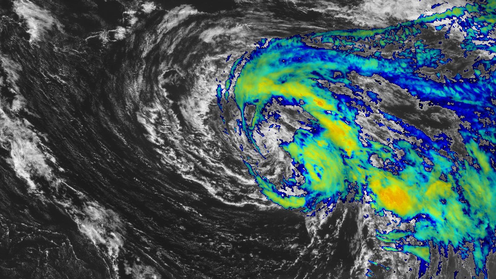
Subtropical Storm Don formed on Friday morning in the waters of remote subtropical Atlantic, and poses no threat to any land areas for at least the next five days. At 11 a.m. EDT Friday, Don was located about 1,170 miles west of the Azores Islands, headed north-northwest at 7 mph. Maximum sustained winds had decreased to 45 mph, down from 50 mph six hours previously, and satellite loops showed that heavy thunderstorm activity associated with Don had decreased through the morning.
Though only moderate wind shear of 10-20 knots is affecting Don, the storm is over chilly waters of 25-26 degrees Celsius (77-79°F) and has dry air spilling into the west side of its circulation. These factors may be enough to reduce Don to a post-tropical cyclone over the weekend. If Don does survive past the weekend, a looping track that will take the storm to the south over warmer waters may allow the storm to intensify. The long-term forecasts from the GFS and European models do not predict that Don will ever affect any land areas, but the Azores Islands should keep an eye on the storm in case it ends up coming their way.
A fast pace for named storm formation in 2023
Don is the fifth tropical or subtropical storm of the year, following a belatedly recognized subtropical storm from January, plus Tropical Storms Arlene, Bret, and Cindy. The average date of formation of the Atlantic’s fifth storm (1991-2020) is August 22. The record-earliest date is July 1 (Elsa in 2021). Second place is held by Edouard of 2020 (July 6).
None of the five 2023 Atlantic storms have reached hurricane strength, though Bret and the January 16-17 unnamed subtropical storm came close, peaking with 70 mph winds. Both storms made landfall; the unnamed subtropical storm hit the northeast coast of Nova Scotia on January 17 with 50 mph winds, while Bret passed over St. Vincent in the Lesser Antilles Islands on June 22 with 65 mph winds. Neither storm caused loss of loss or serious damage.
This season’s Atlantic accumulated cyclone energy (ACE) stands at 9.4, which is above the average of 6.0 for the date, according to the Colorado State Real-Time TC Activity page.
Calvin, now a major hurricane in the Eastern Pacific, could affect Hawaii next week
Hurricane Calvin vaulted to category 3 strength on Thursday night about 1,000 miles southwest of Cabo San Lucas, Mexico, making it the first major hurricane of the Eastern Pacific season. Calvin became a tropical storm on July 12, about a week later than usual for the basin’s third named storm of a season, and rapidly intensified after becoming a hurricane early Thursday.
As of 11 a.m. EDT Friday, Calvin’s top sustained winds were 120 mph. Calvin had an expanding core and a well-structured circulation, and wind shear will remain light around the hurricane for the next day or two. As it cruises steadily west-northwestward over the remote Northeast Pacific, the hurricane could strengthen a bit more before encountering progressively cooler waters this weekend and gradually weakening. Wind shear will also increase by Sunday and Monday, pushing increasingly dry air into the storm. Even so, it is possible Calvin will still be a tropical storm as it approaches the Hawaiian Islands around Wednesday.
In stark contrast to the Atlantic, all three of this year’s Eastern Pacific named systems have attained hurricane strength, and seasonal outlooks have been calling for a busier-than-average East Pacific season. Overall, however, the season got off to a slow start. The first named storm, Hurricane Adrian, was the second latest to arrive for any year in any East Pacific season during the satellite era (1970-present), as it did not develop until June 27. As of July 14, this season’s East Pacific accumulated cyclone energy (ACE) stood at 16.2, well below the average of 24.0 for the date.
Part 2 of our three-part series on U.S. flood risk, originally scheduled for today, will be delayed by breaking weather events. The Part 1, How fast are the seas rising?, was published on Wednesday.
Website visitors can comment on “Eye on the Storm” posts (see comments policy below). Sign up to receive notices of new postings here.
Source link


