|
|
| Mesoscale Discussion 988 | |
| < Previous MD Next MD > | |

|
|
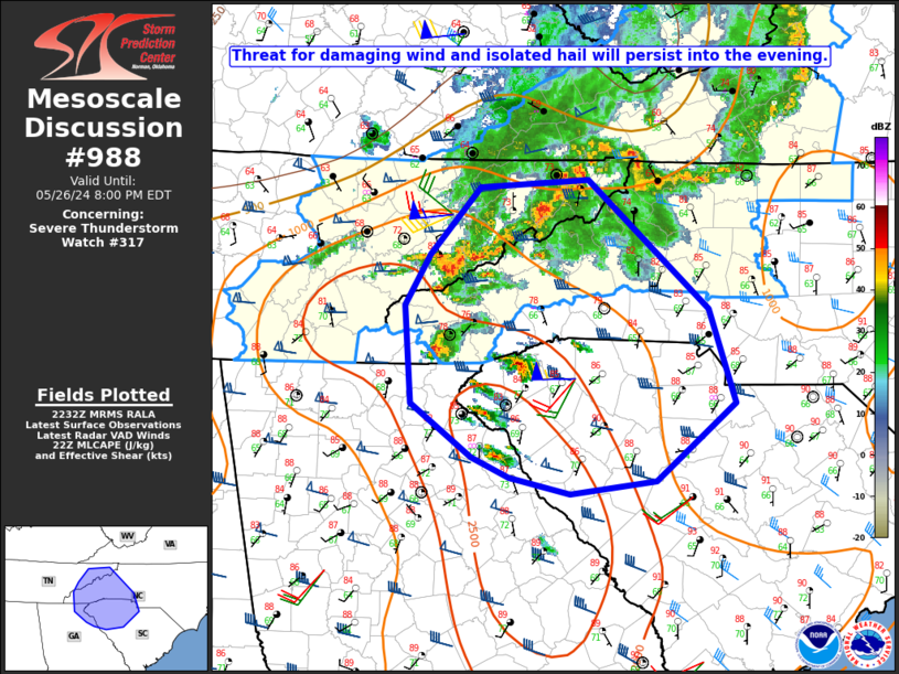
Mesoscale Discussion 0988 NWS Storm Prediction Center Norman OK 0535 PM CDT Sun May 26 2024 Areas affected...Eastern TN...western NC...northeast GA...upstate SC Concerning...Severe Thunderstorm Watch 317... Valid 262235Z - 270000Z The severe weather threat for Severe Thunderstorm Watch 317 continues. SUMMARY...Some threat for damaging wind and hail will persist into the evening. New watch issuance is expected shortly. DISCUSSION...A few supercells have developed from southwest NC into upstate SC, within a moderately unstable environment. The GSP VWP depicts rather strong mid/upper-level flow, and 40+ kt of effective shear, which is sufficient to maintain supercells. While midlevel lapse rates are not particularly strong, the moderate instability and favorable storm mode will support a hail threat with the strongest cells. The supercell storm mode could also support a brief tornado threat, even though low-level shear/SRH is not particularly strong. Steep low-level lapse rates resulting from earlier strong diurnal heating will support damaging-wind potential, especially if any sort of clustering or modest upscale growth of ongoing convection can occur. With the threat expected to extend southward of WW 317, new watch issuance is expected shortly. ..Dean/Smith.. 05/26/2024 ...Please see www.spc.noaa.gov for graphic product... ATTN...WFO...RNK...CAE...GSP...MRX...FFC... LAT...LON 36378312 36448208 35418093 34688068 34078144 33968227 34098284 34258320 34688378 35448384 35858360 36378312 |
|
|
Top/All Mesoscale Discussions/Forecast Products/Home |
|


