|
|
| Mesoscale Discussion 953 | |
| < Previous MD | |

|
|
   Mesoscale Discussion 0953
   NWS Storm Prediction Center Norman OK
   0222 PM CDT Sat May 25 2024

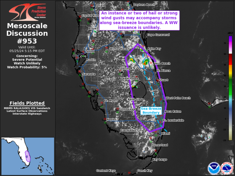
   Areas affected...easter portions of the Florida Peninsula

   Concerning...Severe potential...Watch unlikely

   Valid 251922Z - 252115Z

   Probability of Watch Issuance...5 percent

   SUMMARY...A couple of strong wind gusts or an instance of large hail
   may accompany the stronger storms, particularly those that can
   remain near sea-breeze boundaries. The severe threat should remain
   isolated and a WW issuance is not expected.

   DISCUSSION...Multiple pulse-cellular thunderstorms have developed
   due to localized convergence along sea-breeze boundaries over the
   past few hours. Along the sea-breeze boundary, locally stronger
   deep-layer shear exists (per 19Z mesoanalysis). As such, any storm
   that can anchor to the sea-breeze for a longer period of time will
   be capable of becoming transient supercellular, perhaps accompanied
   with the risk of strong wind gusts or an instances or two of hail.
   Nonetheless, the localized and brief nature of the severe threat
   along the sea-breeze boundary precludes a WW issuance.

   ..Squitieri/Bunting.. 05/25/2024

   ...Please see www.spc.noaa.gov for graphic product...

   ATTN...WFO...MFL...MLB...TBW...

   LAT...LON   28208086 27768034 26628002 25998012 25878050 26228090
               27058107 27598117 27848123 28208086
|
|
|
Top/All Mesoscale Discussions/Forecast Products/Home |
|


