|
|
| Mesoscale Discussion 948 | |
| < Previous MD | |

|
|
   Mesoscale Discussion 0948
   NWS Storm Prediction Center Norman OK
   1039 AM CDT Sat May 25 2024

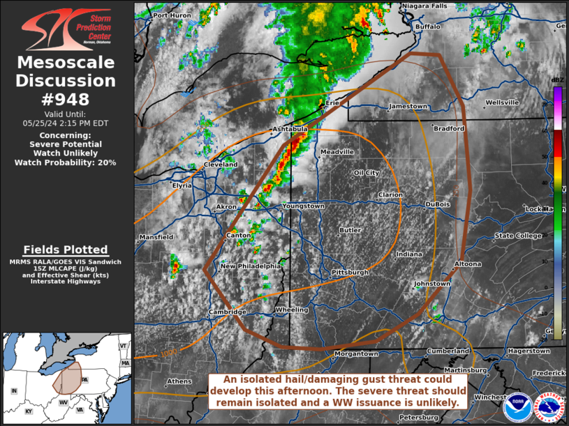
   Areas affected...portions of eastern Ohio into western Pennsylvania
   and far southwest New York

   Concerning...Severe potential...Watch unlikely

   Valid 251539Z - 251815Z

   Probability of Watch Issuance...20 percent

   SUMMARY...Thunderstorms should increase in coverage and intensity
   through the afternoon. Damaging gusts and some hail may accompany
   the strongest storms. The severe threat should be isolated and a WW
   issuance is not currently anticipated.

   DISCUSSION...Thunderstorms are gradually increasing in coverage and
   intensity ahead of a surface trough over eastern OH, with agitated
   CU becoming apparent ahead of the storms. Strong diurnal heating and
   modest warm-air/moisture advection amid modest lapse rates is
   boosting MLCAPE to 1500 J/kg via tall, thin vertical profiles (per
   latest RAP forecast soundings). These forecast soundings also depict
   small low-level hodographs, but with mid-level elongation. As such,
   stronger multicell clusters and line segments that can become
   established may contain hail (with a couple bouts of severe hail
   possible). Damaging gusts may also occur with the stronger storm
   cores. The severe threat should remain isolated though, so a WW
   issuance is not expected.

   ..Squitieri/Bunting.. 05/25/2024

   ...Please see www.spc.noaa.gov for graphic product...

   ATTN...WFO...BUF...CTP...PBZ...CLE...

   LAT...LON   40498164 41748061 42667893 42657854 42137822 41297814
               40597828 40077885 39797939 39718011 39748061 39918109
               40498164
|
|
|
Top/All Mesoscale Discussions/Forecast Products/Home |
|


