| Mesoscale Discussion 932 | |
| < Previous MD | |

|
|
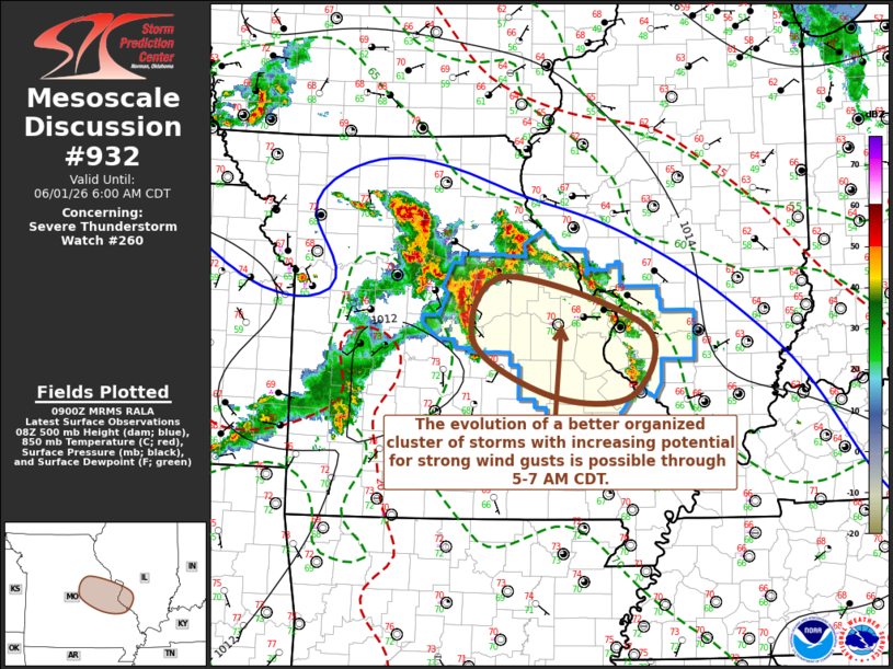
Mesoscale Discussion 0932 NWS Storm Prediction Center Norman OK 0402 AM CDT Mon Jun 01 2026 Areas affected...parts of central/east central Missouri Concerning...Severe Thunderstorm Watch 260... Valid 010902Z - 011100Z The severe weather threat for Severe Thunderstorm Watch 260 continues. SUMMARY...It is possible that a developing cluster of thunderstorms could organize with increasing potential to produce strong wind gusts near and west-southwest of the St. Louis Metro through 5-7 AM CDT. DISCUSSION...New thunderstorm development is underway near the Jefferson City vicinity and will continue to merge with stronger convection now developing southeast of Columbia. This is where forcing for ascent aided by low-level warm advection has become focused, near the nose of a remnant southwesterly nocturnal boundary-layer jet, which may continue to veer to a more westerly component before weakening after daybreak. Before this occurs, continuing inflow of seasonably moist boundary layer air with sizable potential instability (from where it is currently maximized across the Lake of the Ozarks through I-44 corridor) could support substantive further upscale growth, in the presence of weak to modest northwesterly shear. This appears near the periphery of stronger inhibition associated with mid-level ridging, where the evolution of an organizing cluster with increasing potential to produce strong wind gusts might not be out of the question, particularly near and to the southwest of Greater St. Louis. ..Kerr.. 06/01/2026 ...Please see www.spc.noaa.gov for graphic product... ATTN...WFO...PAH...LSX...SGF... LAT...LON 39099172 38568978 37828998 37829108 38399213 39099172 |
|
|
Top/All Mesoscale Discussions/Forecast Products/Home |
|
Source link