|
|
| Mesoscale Discussion 917 | |
| < Previous MD | |

|
|
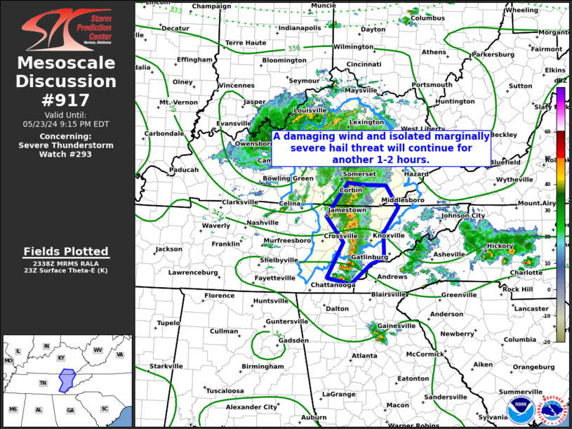
Mesoscale Discussion 0917 NWS Storm Prediction Center Norman OK 0641 PM CDT Thu May 23 2024 Areas affected...Portions of middle/eastern Tennessee and Kentucky Concerning...Severe Thunderstorm Watch 293... Valid 232341Z - 240115Z The severe weather threat for Severe Thunderstorm Watch 293 continues. SUMMARY...A locally damaging wind and marginally severe hail threat will continue for another 1 to 2 hours across portions middle and eastern TN, and KY. DISCUSSION...A cluster of thunderstorms associated with an MCV, along with an embedded bowing segment now moving into Campbell County, will continue to pose a severe damaging wind threat over the next couple of hours. After-which, the system will begin to move into a less favorable thermodynamic environment downstream. In addition to damaging winds, any of the more discrete updrafts within 30-35 kt of deep effective layer shear could become briefly organized and produce marginally severe hail up to 1.25" in diameter. However, poor mid-level lapse rates should keep this threat fairly isolated. A watch extension east of the cluster may be necessary. ..Barnes.. 05/23/2024 ...Please see www.spc.noaa.gov for graphic product... ATTN...WFO...MRX...JKL...OHX... LAT...LON 35268492 35918454 36408493 37018444 36988405 36978357 36568329 36098363 35648363 35518392 35148437 35268492 |
|
|
Top/All Mesoscale Discussions/Forecast Products/Home |
|


