|
|
| Mesoscale Discussion 913 | |
| < Previous MD Next MD > | |

|
|
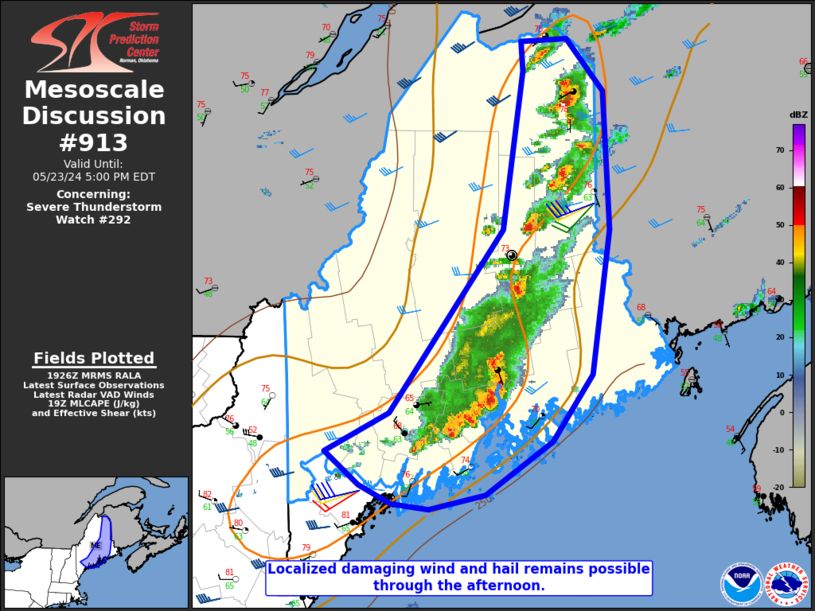
Mesoscale Discussion 0913 NWS Storm Prediction Center Norman OK 0229 PM CDT Thu May 23 2024 Areas affected...Parts of southern/eastern ME Concerning...Severe Thunderstorm Watch 292... Valid 231929Z - 232100Z The severe weather threat for Severe Thunderstorm Watch 292 continues. SUMMARY...Some threat for hail and damaging wind will spread eastward through the afternoon. DISCUSSION...A line of strong to potentially severe thunderstorms is ongoing from southern into northeast Maine this afternoon. The immediate downstream environment remains somewhat favorable for organized convection, with MLCAPE approaching 1000 J/kg and modestly favorable deep-layer shear (as noted on the 17Z/18Z CAR/GYX modified soundings and regional VWPs), and some threat for hail and damaging wind will continue into late afternoon. With cooler onshore flow noted over the Downeast Maine vicinity, some weakening will be possible with time as storms move into this region. However, sufficient elevated buoyancy may still support some threat for isolated marginal hail and/or a strong/damaging gust before storms move offshore. Isolated storm redevelopment also remains possible into southern ME behind the outflow, though at this time any severe threat with this redevelopment is currently expected to remain marginal and isolated. ..Dean.. 05/23/2024 ...Please see www.spc.noaa.gov for graphic product... ATTN...WFO...CAR...GYX... LAT...LON 44466996 45846876 47016855 47236857 47266808 46866769 45846764 44756782 44256824 43856895 43756954 43796993 43927026 44177063 44466996 |
|
|
Top/All Mesoscale Discussions/Forecast Products/Home |
|


