|
|
| Mesoscale Discussion 908 | |
| < Previous MD | |

|
|
   Mesoscale Discussion 0908
   NWS Storm Prediction Center Norman OK
   0911 AM CDT Thu May 23 2024

   Areas affected...Southern New England

   Concerning...Severe potential...Watch unlikely

   Valid 231411Z - 231615Z

   Probability of Watch Issuance...20 percent

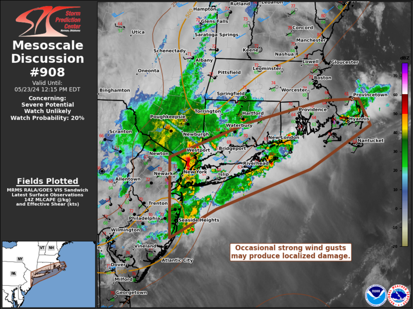
   SUMMARY...Storms associated with an MCV will be capable of wind
   damage. A watch is not currently expected, but convective trends
   will be monitored.

   DISCUSSION...Convection associated with an MCV has produced
   occasional wind damage in eastern Pennsylvania into far southeastern
   New York and parts of the NYC metro. Large hail was also reported
   with a stronger cell in Westchester County. VAD data from local
   radars/profilers do not suggest a strong rear-inflow jet with the
   primary linear segment moving across Long Island. Temperatures and
   dewpoints ahead of this activity are cooler/drier than in northern
   New Jersey/NYC metro. However, forcing from the MCV may allow
   convection to continue roughly along the southern New England coast
   this morning. Weak lapse rates and buoyancy should keep the threat
   marginal, but occasional strong wind gusts capable of wind damage
   are possible. A watch is not expected, but trends will continue to
   be monitored this morning.

   ..Wendt/Hart.. 05/23/2024

   ...Please see www.spc.noaa.gov for graphic product...

   ATTN...WFO...BOX...OKX...PHI...

   LAT...LON   41067426 41667248 42027082 42047002 41596977 40877113
               40207321 39707424 41067426
|
|
|
Top/All Mesoscale Discussions/Forecast Products/Home |
|


