|
|
| Mesoscale Discussion 896 | |
| < Previous MD Next MD > | |

|
|
   Mesoscale Discussion 0896
   NWS Storm Prediction Center Norman OK
   0318 PM CDT Wed May 22 2024

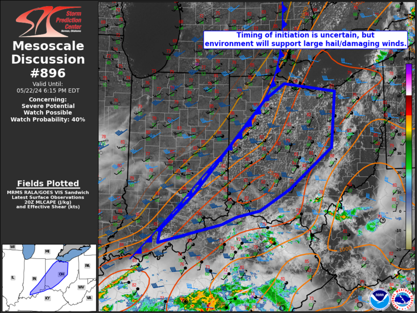
   Areas affected...Southern Indiana into north-central Ohio

   Concerning...Severe potential...Watch possible

   Valid 222018Z - 222215Z

   Probability of Watch Issuance...40 percent

   SUMMARY...Damaging winds and large hail are possible with storms
   that develop along the cold front. Timing of development and storm
   coverage are not certain. A watch is possible this afternoon as
   convective trends warrant.

   DISCUSSION...Heating behind earlier convection associated with an
   MCV has allowed the airmass ahead of the cold front to destabilize.
   Cumulus along the front have become more vertically developed,
   particularly in southeastern Indiana. Winds are quite veered in the
   vicinity of the front and convergence is weak. Some modest mid-level
   ascent from the Upper Midwest shortwave trough may be needed to
   initiate thunderstorms later this afternoon. Other than timing,
   storm coverage is somewhat uncertain as well. Storms that do develop
   will be capable of damaging wind gusts and large hail. A watch is
   possible this afternoon, but timing and spatial extent are not
   clear.

   ..Wendt/Hart.. 05/22/2024

   ...Please see www.spc.noaa.gov for graphic product...

   ATTN...WFO...PBZ...RLX...CLE...ILN...LMK...IWX...IND...

   LAT...LON   38768456 38608497 38208666 38478660 39258571 41218381
               41558327 41388189 40208200 39348314 38898394 38768456
|
|
|
Top/All Mesoscale Discussions/Forecast Products/Home |
|


