|
|
| Mesoscale Discussion 884 | |
| < Previous MD | |

|
|
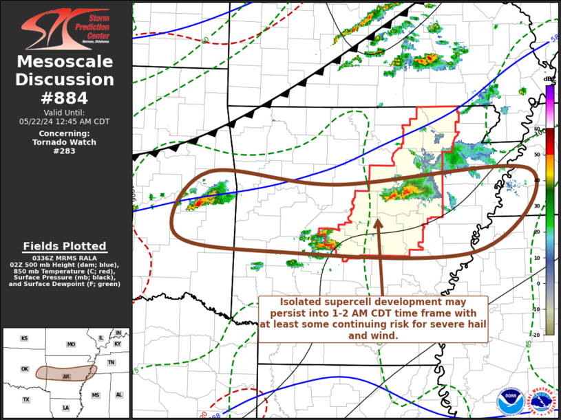
Mesoscale Discussion 0884 NWS Storm Prediction Center Norman OK 1039 PM CDT Tue May 21 2024 Areas affected...east central Oklahoma into central Arkansas Concerning...Tornado Watch 283... Valid 220339Z - 220545Z The severe weather threat for Tornado Watch 283 continues. SUMMARY...Isolated supercell thunderstorm development persists and may continue to spread eastward across and east the Mississippi River through 06-07Z. These may pose a risk for severe hail and locally strong gusts. The potential for tornadoes may now be low enough that a new severe weather watch does not appear needed, but trends will continue to be monitored. DISCUSSION...Ahead of a cold front advancing southeastward across the Ozark Plateau, isolated supercell development is being maintained near the southern periphery of broad mid-level troughing still slowly progressing to the east of the southern Rockies. Forcing for ascent is being aided by weak low-level warm advection near the nose of an increasingly suppressed plume of elevated mixed-layer air, where steep lapse rates are contributing to CAPE up to around 3000 J/kg. Deep-layer mean flow on the order of 40-50 kt remains strongly sheared as it has taken on an increasingly westerly component in the wake of the primary short wave trough shifting through the Upper Midwest. It is possible pre-frontal low-level moistening and destabilization could support the continued eastward spread of ongoing storms into/through portions of the Mid South by 06-07Z. ..Kerr.. 05/22/2024 ...Please see www.spc.noaa.gov for graphic product... ATTN...WFO...MEG...LZK...TSA... LAT...LON 35599490 35449278 35628960 34529050 34549385 34769543 35599490 |
|
|
Top/All Mesoscale Discussions/Forecast Products/Home |
|


