|
|
| Mesoscale Discussion 870 | |
| < Previous MD Next MD > | |

|
|
   Mesoscale Discussion 0870
   NWS Storm Prediction Center Norman OK
   1208 PM CDT Tue May 21 2024

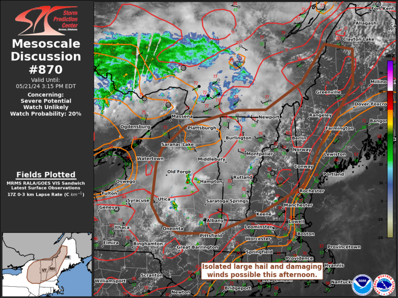
   Areas affected...Adirondacks into Parts of northern New England

   Concerning...Severe potential...Watch unlikely

   Valid 211708Z - 211915Z

   Probability of Watch Issuance...20 percent

   SUMMARY...Damaging winds and isolated marginally severe hail may
   occur this afternoon. Clustering of storms may lead to locally
   greater wind damage potential. A watch is not expected.

   DISCUSSION...Morning observed soundings from CAR/GYX showed
   mid-level lapse rates approaching 7 C/km. With an approaching
   MCV/shortwave from Great Lakes region convection last evening, some
   increase in storm coverage is expected to occur this afternoon.
   Effective shear will only be modest (25-30 kts), but a few more
   organized storms/clusters appear possible. Damaging winds and
   marginally severe hail will be the primary risks with this activity.
   Should storms cluster, locally greater potential for damaging winds
   would exist especially where low-level lapse rates have steepened.

   ..Wendt/Guyer.. 05/21/2024

   ...Please see www.spc.noaa.gov for graphic product...

   ATTN...WFO...CAR...GYX...BOX...BTV...ALY...BGM...BUF...

   LAT...LON   43917528 44287511 44797443 45157281 45177194 45757081
               46597008 46466919 45706922 44267036 43497080 42917205
               42407362 42457370 42437458 42697513 43057539 43917528
|
|
|
Top/All Mesoscale Discussions/Forecast Products/Home |
|


