|
|
| Mesoscale Discussion 864 | |
| < Previous MD | |

|
|
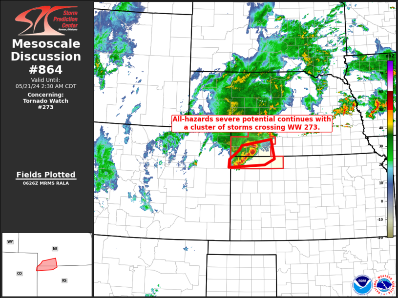
Mesoscale Discussion 0864 NWS Storm Prediction Center Norman OK 0129 AM CDT Tue May 21 2024 Areas affected...southwestern Nebraska into northwestern Kansas Concerning...Tornado Watch 273... Valid 210629Z - 210730Z The severe weather threat for Tornado Watch 273 continues. SUMMARY...A cluster of intense storms continues moving eastward across southwestern Nebraska and adjacent northwestern Kansas. All-hazards severe risk is evident. DISCUSSION...A well-organized, broadly rotating storm is currently observed crossing the Hayes/Hitchcock County vicinity in Nebraska, with trailing storms extending southwestward to Cheyenne County Kansas. The storms are ongoing just north of the conglomerate surface front/outflow lying west-southwest to east-northeast across northwestern Kansas and into central and southeastern Nebraska. As such, this region is on the northern gradient of surface-based instability, and thus capable of producing all-hazards severe weather -- given favorably strong/sheared background flow. This convection should maintain intensity as it shifts eastward toward -- and eventually into -- WW 274, aided by the observed 60-kt low-level jet. ..Goss.. 05/21/2024 ...Please see www.spc.noaa.gov for graphic product... ATTN...WFO...GID...LBF...GLD... LAT...LON 39610212 39900210 40190168 40390153 40600017 39910002 39700047 39610212 |
|
|
Top/All Mesoscale Discussions/Forecast Products/Home |
|


