| Mesoscale Discussion 860 | |
| < Previous MD | |

|
|
Mesoscale Discussion 0860
NWS Storm Prediction Center Norman OK
0753 AM CDT Tue May 26 2026
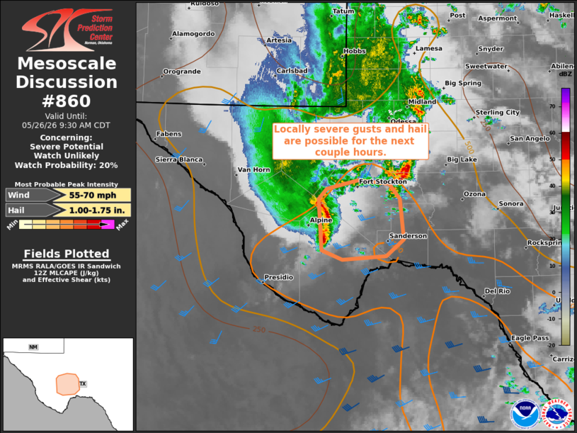
Areas affected...Parts of the Texas Trans Pecos
Concerning...Severe potential...Watch unlikely
Valid 261253Z - 261430Z
Probability of Watch Issuance...20 percent
SUMMARY...Locally severe wind gusts and hail are possible with
storms as they track eastward over the next couple hours. A watch is
not expected for this activity.
DISCUSSION...A cluster of storms has emerged over the TX Trans-Pecos
region, with recent organization of a small cold pool. As these
storms track eastward along the northern periphery of a weakly
unstable air mass, around 30 kt of line-normal effective shear and
increasingly moist inflow may support continued eastward progression
with an accompanying risk of locally severe wind gusts and isolated
large hail.
..Weinman/Smith.. 05/26/2026
...Please see www.spc.noaa.gov for graphic product...
ATTN...WFO...MAF...
LAT...LON 30000345 30710350 30860337 30970287 30930236 30710220
30160213 29920242 29870312 30000345
MOST PROBABLE PEAK WIND GUST...55-70 MPH
MOST PROBABLE PEAK HAIL SIZE...1.00-1.75 IN
|
|
|
Top/All Mesoscale Discussions/Forecast Products/Home |
|
Source link